|
Click here to read the previous part of the trip.
Day 22 â Wednesday 14 July 2021 â Mount Isa
Weather: minimum of 7.5ÂșC and fine
I wake early and read till 7:00 am when I listen to the news. I then read the paper till 8:00 am when I get up. I have breakfast and then fill my water containers and water tank. We leave at 8:30 am and head to BCF and then to a lookout where there are murals on a water tank (see previous day). Here Ron and Donna give me a birthday present as today is my birthday. It is a small camp oven, very nice of them but not necessary.
 |
| Panoramic photograph from the lookout |
We then go to the information centre but the mine tours are all full for today. We have morning tea here and then head to the Underground Hospital. In World War II they built a small hospital underground in some specially dug mines in case Mount Isa was bombed by the Japanese. I have no idea why they thought Mount Isa would be a potential target, not a great deal to hit apart from the smelter and a long way from the ocean.
 | 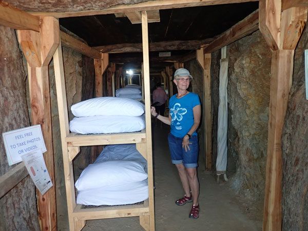 |
| The tent house | Donna and the bunks in the underground hospital |
Anyway, it makes a very interesting place to visit. The tour costs $12 for seniors and you get to look at the museum (in an old building), a tent house (accommodation made for people) and a guided tour of the Underground Hospital which was built in 1942 or 1943. The hospital is in an E shape built into new mine shafts drilled into the side of a small hill, with three exits. There are beds and cots in the hospital as well as some medical equipment and supplies.
The tent house is a renovated version of ones built by Mt Isa Mines from 1932 to 1952. They consist of a tent with a more permanent corrugated iron roof over the top of the tent. A total of 179 were built, the last used in 1960.
 |  |
| Baby basinets in the underground hospital | The escape chute from the hospital |
The museum is also quite interesting, with lots of old medical equipment like x-ray machines, operating equipment and nursing uniforms. All in all, the three parts of the museum are very interesting places to visit. We left here at 12:05 pm and went to Lake Moondarra which is on the northern side of Mount Isa. We arrive there at 12:25 pm and have lunch on the lake edge.
We leave at 1:05 pm and drive by the waterâs edge to the dam wall. This only takes 10 minutes. We walk across the dam and then we drive back to the picnic areas near the dam. Here we sit on the grass and have a cuppa and read. It is a beautiful day, although it is fairly windy. We leave at 3:30 pm and go back into town. We try to buy some butane bottles for our stoves but they are hard to find. Bunnings, K-Mart and Coles have none. We get back to the caravan park at 4:25 pm. I get another carton of beer as I cannot find any other ones I like.
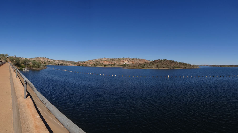 |
| Lake Moondarra and the dam wall |
I wash my NSW State of Origin shirt and dry it in the clothes dryer. We have showers and at 6:00 pm we walk into town. We go to the Buff Club, it takes 30 minutes to walk the 2.0 kilometres. Here we have dinner (chicken parmigiana - $25) and then watch the State of Origin. Unfortunately Queensland beats NSW 20-18, but we win the series 2-1. We walk back and are in bed at 10:40 pm.
Weather: Fine, maximum of 28ÂșC
Arrived: Mount Isa Time: Distance: 55.0 kilometres
Day 23 â Thursday 15 July 2021 â Mount Isa to Lawn Hill
Weather: minimum of 12.5ÂșC and fine
A warm night. I wake at 6:00 am but then fall back to sleep till 6:45 am. I read the newspaper on-line till 7:30 am and then get up. We have breakfast and leave at 8:35 am. We go to Autobarn where I get one can of butane and then SupaCheap Auto where I got another one and one for Ron. Then we go to Woolies for things like bread etc that need to be fresher. We leave town at 9:40 am.
 | 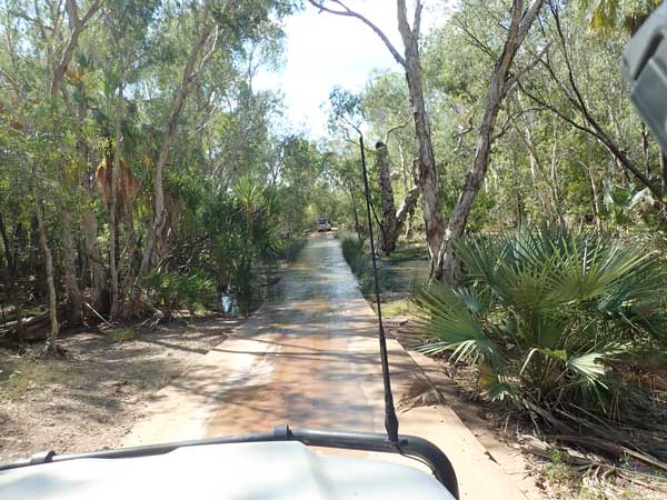 |
| The World War II road north of Mt Isa | Crossing the Gregory River |
We head north on the Barkly Highway. At 10:20 am we stop at a rest area which is a World War II historic site. The old road built during the war is visible here parallel to the current highway and is, remarkably, in fairly good condition considering it is nearly 80 years old. We have travelled 59 kilometres and it is 27â°C. We have some chocolate birthday cake. We leave at 10:45 am.
 |
| Panoramic photograph from the top of the hill at Riversleigh |
We then take the Thornton Yelvertoft Road and at 11:45 am we stop to cut some firewood, we have travelled 168 kilometres this morning. We leave at 12:10 pm and then turn right onto the Gregory Downs Camooweal Road. It is dirt shortly after this intersection but in very good condition. At 12:45 pm we stop at the Thornton River for lunch. We have travelled 210 kilometres today and it is a very hot 31â°C. We leave at 1:12 pm take the Riversleigh Road and soon cross OâShannesy River and then the Gregory River. Riversleigh Road is pretty rough in spots and most caravans avoid it. It is not that bad though.
At 2:28 pm we stop at the Riversleigh World Heritage Area. This is place where there are fossils in the rocks. There is a shelter shed with sculptures of some of the animals that lived here millions of years ago. On the walk we see fossils of birds, crocodiles and more. However, there are no real interpretation signs near the fossils, so sometimes you don't know what you are looking at. It is about one kilometre around the hill, with good views from the top. It is even hotter now, 33â°C. We leave at 3:05 pm.
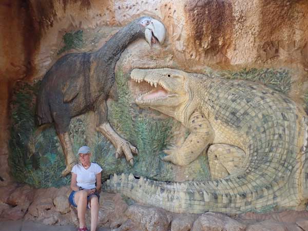 |  |
| Donna in the shelter with the sculptures of the animals that lived at Riversleigh | A lizard I see on the walk |
We arrive at Adels Grove Camping Area at 3:37 pm. When we were planning this trip we had many bad reports of Adels as it was now under new, indigenous management. In addition, their website would not take bookings and no-one answered the phone or emails. Later, when it was closer to our leaving date, the reports got much better. As there is no alternative to Adels (Lawn Hill NP only has very limited numbers of camping sites and all were booked months ago, well before we looked).
 | 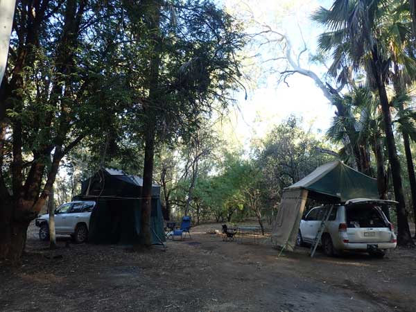 |
| Some of the bone fossils at Riversleigh | Our campsite at Adels Grove |
I book in for three nights ($40 for a night) and Ron for four. We head for the Grove camping area and at 4:00 pm we find a nice spot. We are not right next to Lawn Hill Creek but not too far away. We have a lot of shade but also enough sun for us to move our solar panels around. We set up and then go to the creek to have a swim. It is so nice, cool, but refreshing. We are back at 5:10 pm and start a fire.
I make a damper in my new camp oven which we have as entrĂ©e. I make a madras chicken curry with rice. It is still very warm, in the high 20s. At 9:15 pm I go to the bar area as there is some Telstra mobile coverage here. This comes from a private repeater, so is not all that strong. I check emails etc and read some of the Sydney Morning Herald. I go to bed at 9:40 pm and it is still 22â°C.
Weather: Fine, maximum of 33ÂșC
Arrived: Adel Grove, Lawn Hill Time: 3:37 pm Distance: 326 kilometres
Day 24 â Friday 16 July 2021 â Adels Grove, Lawn Hill
Weather: minimum of17.5ÂșC and fine
Another very warm night, sheet only till 6:00 am. I get up at 7:50 am. For some unknown reason, the ABC Radio news on FM was 7:03 am, not 7:00 am. It is the same for the next three mornings. I think it must be coming via the internet and then rebroadcast locally, perhaps by Adels Grove. We have breakfast and pack up, leaving our tables and chairs to reserve our site. We leave at 9:10 am.
 |
| Panoramic photograph looking over Indari Falls |
It is just over 10 kilometres to Lawn Hill NP and is all tar to the boundary of the NP. We arrive at 9:27 am and head off on the Indari Falls walk. The return walk is 4.5 kilometres. We come back via the loop which goes past the Middle Gorge and Duwadarri Waterhole. There are great views on the track, especially on the return walk. We have a swim at the falls (also on Lawn Hill Creek), again, very refreshing. We are back at the cars at 12:35 pm.
 |
| Panoramic photograph from the top of the hill on the return walk |
Back at Adels we stop at the office and book canoes for Sunday at 1:00 pm. The cost is $50 for a double, all that is available. We are told that there are new canoes and kayaks coming in a day or two, but we heard that said when we booked in yesterday (none arrive while we are there!). We are back at the campsite at 1:03 pm. We have lunch and set up camp again. I put up my hammock and read. At 3:15 pm I have a cuppa and then head to the creek for a swim. The water is 22â°C. I am back at the camp by 3:45 pm and have a cuppa with some more birthday cake.
 | 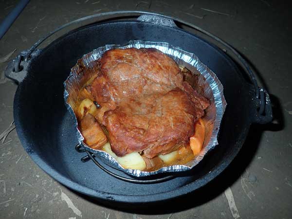 |
| My hammock at our campsite | My roast pork |
At 4:30 pm I start the fire as we are having roasts for dinner. At 5:00 pm we have drinks and nibblies. At 6:00 pm Ron puts on beef and 10 minutes later I put on a flat pork with smoky BBQ sauce. At 7:00 pm they are both cooked to perfection (with vegies of course). We have with a nice Taylors sparkling wine. Tonight I finished the last of the Coopers Pale Ale cans I purchased in Sydney and now have to drink Tooheys Extra Dry.
We have a port and then Ron and I go to the bar area again to use the mobile coverage. We watch the end of the NRL on the TV as we check emails and read the paper. I go to bed at 10:50 pm.
Weather: Fine, maximum of 29ÂșC
Arrived: N/A Time: N/A Distance: 20.9 kilometres
Day 25 â Saturday 17 July 2021 â Adels Grove, Lawn Hill
Weather: minimum of 15..4ÂșC and fine
Another warm night, but cooler than yesterday. I wake very early at 5:10 am and get up at 8:00 am. I have breakfast and we leave at 9:25 am. We are at Lawn Hill at 9:39 am. There is not much parking today.
We do the Island Stack walk which is north of the parking area. Again, this has great views along the Lawn Hill Gorge. We come back via the Wild Dog Dreaming. There are etchings and paintings here. We also go to the Lower Gorge Lookout. It is 6.7 kilometres in total. Today was much cooler, only 25â°C, as there is a southerly wind. We leave at 1:05 pm and head back to Adels, arriving at 1:20 pm.
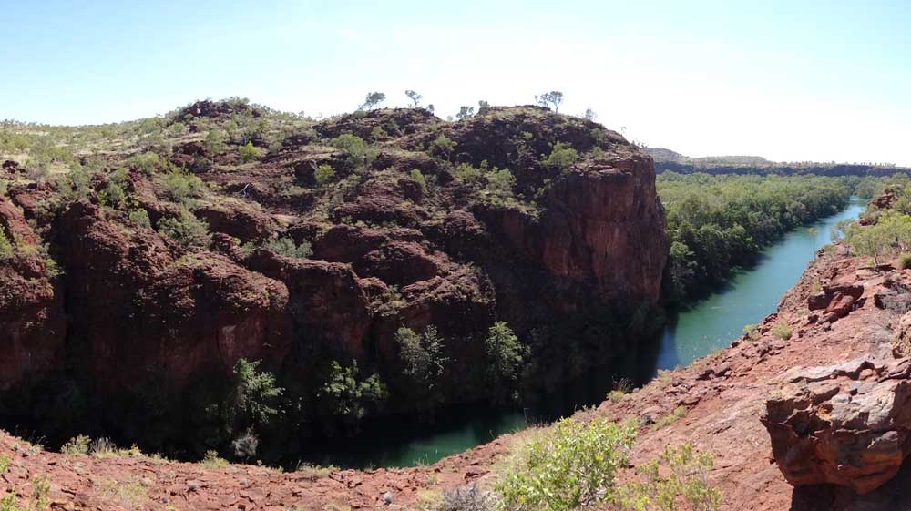 |
| Panoramic photograph of the main gorge at Lawn Hill |
I set up my camp again and also put out my solar blanket as I only have 12.2 volts in my battery. I have lunch, lay in my hammock (one of the best things I purchased for camping), have a cuppa and then at 3:30 pm go for another swim. This is such a relaxing place to be.
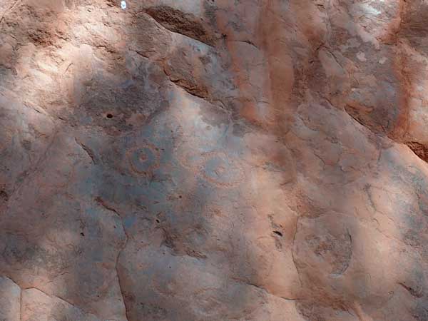 | 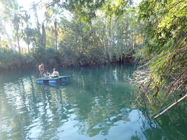 |
| Aboriginal engravings at Wild Dog Dreaming | Part of the swimming area at Adels Grove |
I go for a shower after the swim. There are old amenities near us which could do with a thorough clean. The water pressure is low, but the water is hot. I also wash some shorts, socks and undies and hang up on a line at our camp.
At 5:00 pm we have drinks. I reheat some pork ribs that I cooked at home and vacuumed sealed. Very nice, perhaps better than when I cooked them. I have with some rice. We go to the bar to get mobile coverage but it is very poor and soon give up. In bed by 10:00 pm.
Weather: Fine, maximum of 25ÂșC
Arrived: N/A Time: N/A Distance: 20.9 kilometres
Day 26 â Sunday 18 July 2021 â Adels Grove, Lawn Hill
Weather: minimum of 10.2ÂșC and fine
I wake at 5:00 am and then sleep a little till 7:00 am and then a bit more. I have been sleeping pretty good on this trip compared to at home where I often lay awake for hours in the very early hours of the morning. I read from 8:00 am and get up at 8:30 am. It is still only 11â°C, so much cooler than the past week or so. I have breakfast, put the solar blanket out, and then put the hammock up and read my latest book.
At 10:40 am I have morning tea and move the blanket. We pack up, have lunch and then leave at 12:13 pm for Lawn Hill NP. We arrive there at 12:30 pm and go to the canoe hire area. I end up getting a single kayak, there was no mention of this being available when I booked. There is also a triple canoe, but most are doubles.
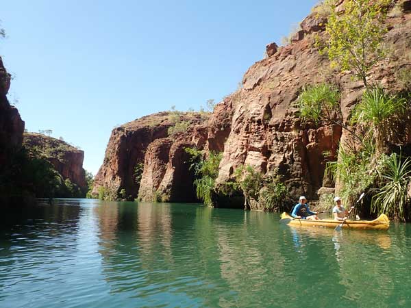 |  |
| Paddling on the Lower Gorge | Going through the Lower Gorge |
We paddle to Indari Falls which takes an easy 35 minutes. It is really spectacular as you go through the main gorge. Even though the river is flowing, it is not hard to paddle against it. At Indari Falls we haul them out and carry them the very short distance to the Upper Gorge.
We paddle to near the end of this section of the waterway. We see a small freshwater crocodile near the end and also a turtle. It was one hour to the end from when we started. We have the canoes for two hours, so need to be back before 3:00 pm.
 |  |
| The waterway on the Upper Gorge | The freshwater crocodile on the Upper Gorge |
We have a swim back at the falls after bringing the canoes from the Upper Gorge and then paddle back. It is a fair bit quicker on the return trip as we have the wind and current with us. We are back by 2:55 pm, a 6.1 kilometre paddle. We go back to Adels Grove and setup camp again.
I transfer 10 litres of water from a container to my main water tank and then fill this with local water which is good. I then listen to the NRL on my radio. I am again using the ABC via the FM station. It is 3 minutes and 8 seconds behind real time! It is a bit warmer today, 28â°C, but nice due to the wind.
I download my photos from my camera and drone. I have not done this for quite a while. I head off for a shower at 4:50 pm. The water is a bit warmer but less cold pressure than yesterday. Back at camp I start the fire and we have drinks and nibblies. I listen to more NRL, this time Souths versus the Bulldogs at 6:15 pm. Souths win 32-24 but it is not impressive as the Bulldogs are coming last and Souths are third.
I cook a rosemary lamb steak for dinner and have with a pasta dish. After the NRL I go to the bar again (it is closed every time we have been there) but my internet device is flat so I cannot read the paper. I go back and read my book at the fire. I go to bed at 9:30 pm.
Weather: Fine, maximum of 28ÂșC
Arrived: N/A Time: N/A Distance: 20.9 kilometres
Day 27 â Monday 19 July 2021 â Adels Grove to Gregory Downs
Weather: minimum of 12.0ÂșC and fine
A bit warmer than yesterday but still coolish. I wake early but then sleep on and off till 6:50 am. I listen to the news at 7:03 am and then read till 7:35 am. I have breakfast, clean up inside the car a bit (dust etc) and then clean my feet which are filthy. While I am leaving today, Ron and Donna are staying another night. We might meet at the Gregory River tomorrow if I decide to stay there two nights. I pack up and leave at 9:15 am but stop near the office so I can get some mobile coverage. I leave here at 9:25 am.
Before I turn right onto the Gregory to Lawn Hill Road, a dozen small pigs run across the road. This road is a pretty good dirt road. The road is mostly dirt, but there are some tar sections, one of six kilometres and a 17 kilometre section from the turn-off to Century Mine (an old zinc mine now being used to reprocess the tailings). This section is, however, in poor condition in places .
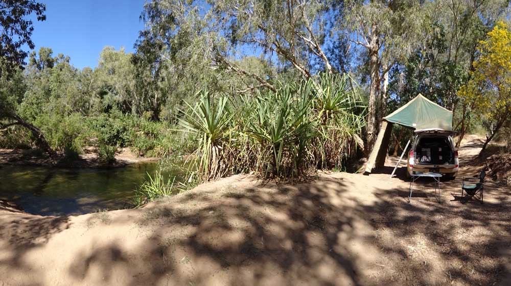 |
| A panoramic photograph of my campsite at Gregory River |
At 10:10 am I stop to cut some timber. I leave five minutes later and at 10:50 am I am at the Gregory River. I have a look around and end up camping on the southern side of the road near the end of the track. I am right above the water in a nice spot. Later two camper trailers come in and camp nearby. There are two girls from Adels (Kyra and Shan) who come and look at camping here but camp a bit north right on the lower river bank/bed.
Once I am here, I set up camp and have a cuppa and read till lunch time. There is good internet here (Telstra). After lunch I walk to the Gregory Downs Hotel to have a look. It is a very nice old Aussie pub. It is two kilometres there and back. I put out the solar blanket and have a swim. The water is 22â°C and very clean. There is a great pool a short walk upstream.
 | 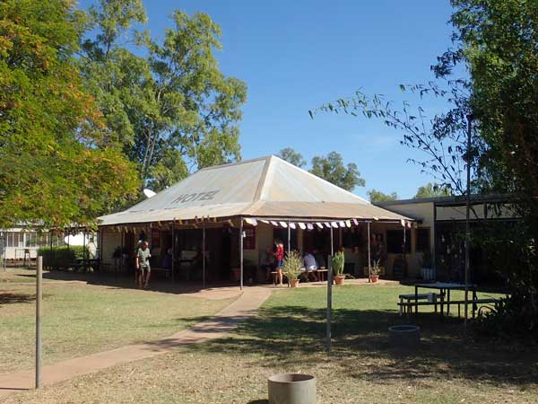 |
| The old bridge over the Gregory River | Gregory Downs Hotel |
I have afternoon tea while trying to book a camping spot at Karumba, Cobbold Gorge and Undarra Lava Tubes. The websites are hopeless, with not enough information for me to figure out if I need a camping site or a caravan site. I end up phoning and leaving messages as none answer their phone. I end up booking Karumba (a bargain $12 per night) for next Thursday and Friday nights.
I have another swim at 4:05 pm and at 4:25 pm I walk to the pub and have a couple of beers ($6 each). I phone Mum while here, she is good and finally settling into her aged care place. I also phone my youngest sister. I am back at 6:10 pm. A couple more vehicles came in during the afternoon and set up here. I cook sausages on my grill on my firepit and have them with pasta from last night. I go to bed at 9:30 pm.
Weather: Fine, maximum of 25ÂșC
Arrived: Gregory Downs Time: 10:50 am Distance: 88.3 kilometres
Day 28 â Tuesday 20 July 2021 â Gregory Downs
Weather: minimum of 10.2ÂșC and fine
Once more I wake early but then sleep off and on till 7:00 am. I read the SMH till 7:45 am. I get up at 8:00 am after changing the bed sheets since I want to wash them in a few days at Karumba. It is windy but clear and still cool. All the vehicles near me are gone by 9:00 am. Ron and Donna are on their way and I tell them via SMS where I am camped.
I book Cobbold Gorge via phone when they finally answer their phone (They did not return my message). I have had to book for 25 to 27 July, and a tour on 26 July. I book Undarra via the web site as they still do not answer their phone. I have booked there for 27 to 29 July and a tour on 27 July. This is all a day later than I had planned as Cobbold did not have space on 24 July.
I walk up to the end of the track I am on and find that the VW Kombi that is parked in the middle of the track is actually at the end. I talk to the wife for a bit. When I got back two caravans have taken the spots where I thought Ron could fit. Not to worry, there is another spot in front of me that is okay. Ron arrives at 10:35 am and sets up in that spot. I have a cuppa and read till lunch.
 | 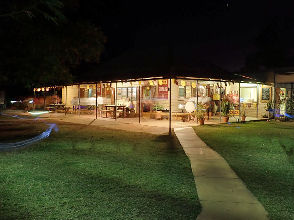 |
| A drone shot of the Gregory River looking north, hotel is top right | The Gregory Downs Hotel at night |
After lunch we walk to the pub and decide to eat dinner here. We donât book as there are heaps of tables. Back at the camp Ron and I go for a swim and float down the river from our camp to the bridge. I have already done this yesterday. It is very shallow in spots and our feet bash on the bottom a lot of times. It is quite good fun. We do this a couple of times.
Back at the camp I have a cuppa and then fly my drone to get some photographs. Then I read my book. At 5:00 pm we walk to the pub again and have dinner. I have lamb cutlets and mash ($26) and three beers (Crown Lager, first time I have had in 15 years I reckon). We are back about 7:45 pm. We go to bed at 10:00 pm. Today marks four weeks on the road!
Weather: Fine, maximum of 26ÂșC
Arrived: N/A Time: N/A Distance: 0 kilometres
Day 29 â Wednesday 21 July 2021 â Gregory Downs to Leichhardt Falls
Weather: minimum of 9.7ÂșC and fine
A little cooler than recent nights, once more I wake early but then get some sleep on and off till 7:00 am. I listen to the news, read the paper and get up at 8:00 am. I have breakfast and pack up. On the way out I stop opposite the pub to dispose of rubbish and use the toilets (there are none at the river). I say goodbye to Ron and Donna here as they are heading into the Northern Territory and I am staying in Queensland. I leave town at 9:20 am.
There are lots of dead kangaroos along the side of the road and some wedge-tailed eagles feeding on them. I arrive in Burketown at 10:35 am which is the only town of any sort for hundreds of kilometres. It is 121 kilometres to here and it is a nice warm 24â°C. I go to the bakery and purchase a loaf of white bread (only type available) and a glazed donut twist ($7 total). I then go to the local park for morning tea, it is a very nice park.
While here Ron and Donna come into town and go to the fuel station and small supermarket. After I finish my cuppa and twist, I head there too. I only put 20.1 litres into the car as my computer says I could just make it to Normanton with what I had left in the tank, but better to be safe than sorry. I do not fill up as the diesel is $1.965 per litre compared to $1.539 at Karumba.
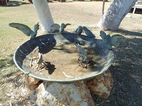 |  |
| A very interesting bird bath at Burketown, pity it does not work | The Burketown Bore, so colourful |
I go into the supermarket next door, it is very small and lots of empty shelves. I get some biscuits, butter and curry. I say goodbye again to Ron and Donna and go to the information centre, some stuff of interest and then to the Burketown Bore. The water here comes out of the ground at 68â°C but there are no pools to swim in. It is very colourful, presumably the salts have coloured the sand.
I leave town at 11:40 am and take the Nardoo Burketown Road to the south-east. This is the road to Normanton, the next town, which is 225 kilometres away. At 12:30 pm I stop at Woodbine Creek to cut some timber (189 km). It is not the best stuff, but okay. I am back on the road 10 minutes later. At 12:45 pm I arrive at Leichhardt Falls.
 |
| A panoramic photograph of the Leichhardt River |
I look around the western side of the river first, it is quite arid and windy here. I cross the river above the waterfall (which is dry of course) and go down a track on the eastern side. The track I go down heads to a spot overlooking the river. Other vehicles have been down here but at the end when I go to turn around, I get badly bogged in very soft sand.
Shit! I cannot get out so I drop my tyre pressures down to 16 psi and try again. I use traction control, the crawl setting and everything I can think of. I move a little but still cannot get out. I use my shovel to remove sand from around the tyres etc, but still no luck. I have forgotten my sand tracks, so that is not much help. I have now been at this for over 40 minutes without much benefit and I am very hot and sweaty.
I have a look around see that there are three small trees ahead of me. I pull out my winch cable and hook it around the trees. I start winching and driving out and move a bit before I pull the trees over! Well, that was a failure. Behind these trees is a small sand gully and at the bottom there is a large dead tree that is buried at both ends in the sand at the sides.
I put a tree protector around the log and using a winch extender, I can just reach the tree with the winch fully out. I try again and I succeed and getting out onto harder sand. I pull the cable back in and then turn to get back onto the track. I stop there and go back and get the winch extension. As I head out another car is coming in, so I stop and tell them not to go past where they are. It has taken me well over an hour to get out.
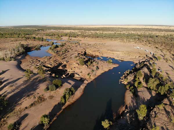 |  |
| A drone shot of Leichhardt River looking towards the Falls | Another drone shot of Leichhardt River looking north |
I head back over to the western side, exhausted. At 2:10 pm I pull up at the first spot I went to and have lunch. I then pull hundreds of prickles out of my clothing, they are everywhere. I then rest and later put all the rescue gear back away in its bag. I rest some more in the shade of a tree. I am right on the edge of the gorge.
 |
| A panoramic photograph of my campsite at the Leichhardt Falls |
On the eastern side of the river near where I got bogged, there are thousands of corellas in the trees making a huge racket. They are also ripping leaves and small branches off the trees and the ground is littered with them. They periodically take off and circle around before going to another tree and repeating this over and over again. The Leichhardt River is not flowing and there are some pools of water in the riverbed.
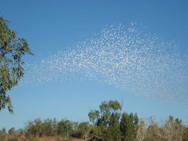 |  |
| The huge flock of corellas | My campsite at night |
At 3:20 pm I have a shower, it is the most refreshing one I have had on this trip, washing all the sand and sweat and dirt off. After this I feel a lot better. I have a cuppa and then walk to the falls and get back at 5:05 pm. I start the fire and make a damper. I cook it a little too hot and burn the bottom a little. I have it with madras curry chicken sweet potato.
At 7:00 pm the corellas take off and fly to the north a bit. At 8:30 pm they go quiet. I go to bed soon after, exhausted from the attempts to get unbogged.
Weather: Fine, maximum of 26ÂșC
Arrived: Leichhardt Falls Time: 12:45 pm Distance: 199 kilometres
Day 30 â Thursday 22 July 2021 â Leichhardt Falls to Karumba Point
Weather: minimum of 11.4ÂșC and fine
The corellas move off at 4:05 am but are again quiet by 4:20 am. I go back to sleep till 6:30 am when they come back en mass. Later they mostly go away and are quiet by 8:00 am. I get up at 7:50 am (no mobile phone coverage here) and then fly my drone while there is no wind. I have breakfast and pack up.
I leave at 9:17 am and at 10:00 am stop to cut timber. This is much better stuff than what I collected yesterday. I have travelled 47 kilometres this morning on a good tar road. I have only seen one car since leaving Leichhardt Falls. There are again lots of dead kangaroos on the roadside and many wedge-tailed eagles feeding on them.
 | 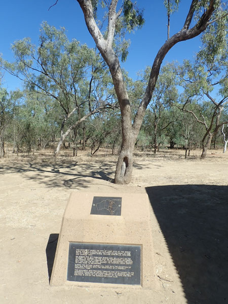 |
| One of the blazed trees at Burke and Wills Camp 119 | Another blazed tree, with a plaque |
I leave at 10:10 am and at 11:12 am I arrive at Burke and Wills Camp 119, 121 kilometres travelled today. This was the last camp on their attempt to get to the Gulf of Carpentaria in February 1861. I stop in the carpark and have morning tea and then walk the short distance to the actual camp site. Here there are quite a few blazed trees which they marked to designate the site. A very historic site indeed. I leave at 11:38 pm.
I arrive in Normanton at 12:10 pm. I have travelled 160 kilometres this morning. I go to the information centre which is in the old Burns Philp store, however it is not open (it is closed for lunch) which is a bit disappointing considering it is the height of the tourist season. It is also not open on Saturdays or Sundays at all! I then go to the Purple Pub and have a very nice hamburger and chips for $12 and a XXXX Gold $5.80.
 |  |
| The Purple Pub | The old Burns Philp store, now a (not much) information centre |
After lunch I go to Kris the Croc, a huge replica of a crocodile killed by a crocodile hunter called Kris. If this is really actual size, it is frightening. I leave town at 12:55 pm and the information centre is still not open. I arrive in Karumba at 1:45 pm. I go to the fuel station and take 111.9 litres at $1.539 (compared to $1.96 at Burketown). I have averaged 13.4 l/100 km since Mount Isa.
I then go to the Barra Centre (about barramundi) and have a quick look. I do not do the tour as I am not that interested in them ($65). Tours are at 9:30 am and 2:00 pm, so I have missed the afternoon one anyway. I will come back tomorrow to look at the free part.
 | 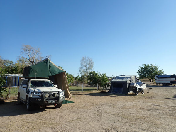 |
| A model of the huge crocodile said to have been shot by Kris | My camping spot at Ronnies |
At 2:30 pm I book into the caravan park (after going to the wrong one first). I am in the Karumba Point Service Station, also called Ronnies. This is small but quite nice. It is also cheap, $24 for two nights for unpowered site. I am very happy with this. I set up and then put some washing on ($4) and read for a while. I then do some work on what I will do on Saturday night after I leave here (Archer Creek I think) and then after Undara Lava Tubes.
 | 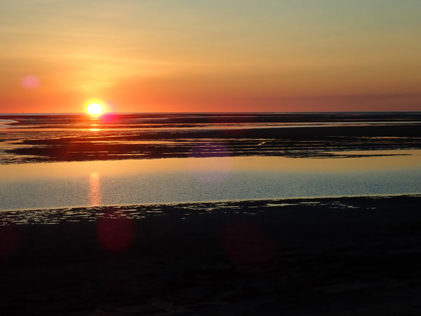 |
| The beer garden at the Karumba Point Hotel | Sunset from the hotel's beer garden |
I have a shower in the very clean donga type showers. These are the best I have seen, individual units. I take the washing off the line, even though it is not yet fully dry. At 5:35 pm I walk to the Karumba Point Hotel to watch the sunset over the water. I was going to have dinner, but the queue was huge and never got any smaller. I have three beers ($6.30 max, first two were cheaper in happy hour). The sunset was nothing special. While here I talk to a couple from Talbingo who know a few ex-NPWS people I worked with.
I am back at camp at 7:40 pm. I have another beer and go to bed at 9:30 pm. It is a warm 22â°C.
Weather: Fine, maximum of 29ÂșC
Arrived: Karumba Point Time: 1:45 pm Distance: 231 kilometres
Day 31 â Friday 23 July 2021 â Karumba Point
Weather: minimum of 16.1ÂșC and fine
Quite a warm night and in the morning there is a heavy dew, even under the awning. I wake early as normal and then get some more sleep. I read the SMH from 6:50 am and get up from 8:00 am. I put the washing back on the clothes line to finish drying. I have breakfast and try to put some more washing into the machines, but they are all full.
Later I put a load on and remove the sheets from the line as they are dry now. I have a cuppa and at 11:35 am I leave and go back to the Barra Centre. As I mentioned, the tours are expensive and even feeding the fish is $28. I just do the free self-guided tour of the information centre. At 12:20 pm I go to the shops and buy some food items, fruit, veg, ($52), meat from the butchers ($17) then I get 1 kg of green Endeavour prawns for $22. These are local but frozen.
I get back to the caravan park at 1:05 pm and have lunch. I collect my washing off the line. I defrost 12 prawns and then peel them as I intend to have for dinner. The bloke next door to me is Dave George, who was a Senior Field Officer for NPWS at Mudgee. Imagine meeting someone from the same organisation as I worked for 37 years. I do not know him, but we know many people in common. He is an axe collector and has been collecting axes on the trip and reselling them to collectors in the USA.
I have a cuppa, read my book and then work out the possible route after Innot Hot Springs (Dave has given me a few places to visit in that area). I have a shower and have drinks with Dave. I then cook green curry prawns with onion, capsicum and rice. I listen to the NRL on the ABC and do some more work on my itinerary up to 11 August. I go to bed at 9:00 pm and read for a while. Again, it is a warm 22â°C.
Weather: Fine, maximum of 28ÂșC
Arrived: N/A Time: N/A Distance: 20.2 kilometres
Day 32 â Saturday 24 July 2021 â Karumba Point to Gilbert River
Weather: minimum of 20.4ÂșC and foggy
It is very warm overnight, the hottest this trip. When I get up it is foggy and a very heavy dew. I wake at 6:15 am and read the paper from 6:45 am. I get up at 7:30 am. I have breakfast and pack up. I leave at 8:40 am. At 9:30 am I arrive at Normanton. The information centre is closed!
 |  |
| The Normanton Railway Station | The Gulflander train |
I then go to the caravan park to see if I can use the artesian spa. For strange reasons, only people staying there can use. You would think they would appreciate extra money from âblow-insâ. I go to the bakery, but this is closed. Virtually everything in the town is closed too. Saturdays in Queensland!
From here I drive to the train station and have a look at the Gulflander train. The station and train are both quite interesting. The train still runs on certain days between here and Croydon and also does some shorter trips. I should have thought about this before and arranged my days so I could go on it. The train is a motor rail with one carriage. It is more like a tram than a train. It is quite famous.
I leave Normanton at 9:45 am. At 10:25 am I stop for morning tea in a rest area, 128 kilometres travelled for the day. The rest area is right next to the railway line. I leave at 10:35 am and take the Gulf Developmental Road out to the east.
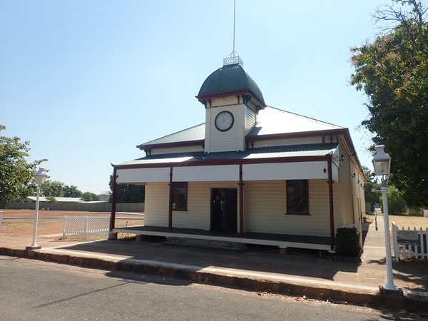 |  |
| The Croydon Courthouse | The old Croydon Police Station |
At 11:40 am I arrive in Croydon which is where the Gulflander goes to. This is a really interesting town. I go to the information centre and get a map. I then drive to the pub and do the historic walk. I buy some bread and wraps at the small shop. I go back to the pub and have a BLT and chips ($14) and a beer ($5.80). The BLT was very good. I leave at 12:55 pm.
 |  |
| The Bank of New South Wales at Croydon | The Croydon Hotel |
My plan today was to go to Little River but when I arrive there at 1:30 pm I find that there is only a section of old road that crosses the river. If you had a caravan, perhaps it would be okay, but no good to me. I continue on. At 1:45 pm I arrive at Gilbert River. This is a large free camping area located on the south-western side of the river the western side of the road. There are quite a few vehicles there, all large caravans or motorhomes.
I have a look around and see that there is a track off to the north from near the start of the camping area that leads towards the river. I go down this and discover a small area just above the river bank. This is a really nice spot with room for two or three rooftops overlooking the river. I set up camp here. The river is quite wide, about 250 metres across. However, as you would expect, it is basically totally dry, with a sandy bed, although there are a few small stretches of water on my side.
 |  |
| A drone shot of the Gilbert River, my campsite centre right | A drone shot of the Gilbert River looking east |
I fly my drone to get some photographs of the river and camp site. I then I call Mum to see how she is going locked down in her aged care place (all is good!). Souths are playing New Zealand Warriors this afternoon so I sit overlooking the river and listen to the match on ABC radio. I even get a mention when I send a photo of me in my new Souths Indigenous shirt to them. Souths kill NZ 60 to 22.
While I listen I peel some prawns for dinner and get everything ready for my meal. After the football I walk to the main part of the camping area, there are about eight vehicles camped here. I have beer and nibblies from 5:30 pm and then get a call from Geoff from my dive club. I listen to more NRL and read. Later I cook coconut creamy prawns and have them with rice. Excellent meal!
 |
| A panoramic photograph of the Gilbert River from the bridge |
My friend Kevin Green who used to run a dive operation in Espiritu Santo in Vanuatu is in Cairns today and we have decided we will try to catch up sometime in the coming weeks as he too is travelling around Queensland camping.
I start a fire and listen to the other NRL matches. While here there is some shooting to the north-east on the other side of the river. It is a warmish night. I go to bed at 9:30 pm after the NRL finishes and read till 10:00 pm.
Weather: Fine, maximum of 30ÂșC
Arrived: Gilbert River Time: 1:45 pmcDistance: 303 kilometres
Day 33 â Sunday 25 July 2021 â Gilbert River to Cobbold Gorge
Weather: minimum of 14.1ÂșC and fine
A cooler night than I have had recently. I wake at 5:45 am and listen to the 6:00 am ABC news before getting a touch more sleep. I read the SMH from 6:45 am (good internet coverage) and get up at 7:30 am. I never listen to the ABC radio on Sunday mornings as I detest âMaccaâ who is on from 5:00 am till 10:00 am. I would rather have my eyes poked out than listen to him for more than a few seconds!
I get up at 7:30 am and have breakfast by the river. At 8:45 am I go for a walk to the bridge and then down onto the sandy bed of the river. I walk to the west and eventually go back to my campsite. I discover that a noise I have been hearing during the night is a pump which is sucking water from the sand and sending to a property which has an orchard on the northern side of the river. I get back at 9:15 am having walked 1.7 km all up.
I pack up and at 9:40 am I leave, dropping off my rubbish in the bins at the camping area. At 10:15 am I arrive at the Cumberland Chimney. This is an old brick chimney from a mining operation. There is also a very nice camping and picnic area on a small dam. The dam has a bird watching platform with binoculars, two tables under cover and toilets and garbage bins. There are ducks, cranes, cormorants and more on the dam. I should have camped here, although where I did last night was quite nice too. While here I have morning tea.
 | 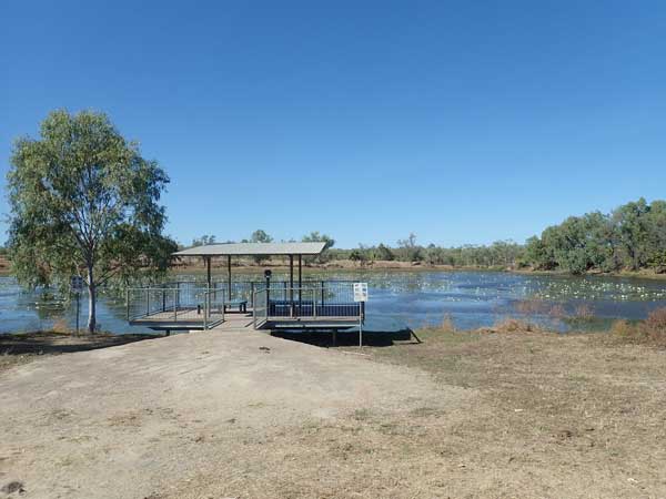 |
| The Cumberland Chimney | The wetland at The Chimney |
I leave at 10:45 am and at 11:05 am I arrive at Georgetown, a very small town. The road here is mostly single lane with some sections of two lanes. I have passed lots of cars today. I go to the information centre but this is not great.
I leave at 11:15 am and head south on the Forsayth Road. This is a dirt road and in parts a bit windy as it climbs over some small hills. On the southern side of these hills a dickhead in a Toyota 79 series goes past at about 80 or more km/h. This is way too fast for this road as it is very rocky. As expected, a lot of rocks are flung up and a couple hit me. One hits the windscreen on the passenger side, causing two large starbursts which soon have cracks extending out in four directions. Damn! Stupid local idiot, obviously does not care about anyone else.
At 11:45 am I arrive at Forsayth (117 km today) and try to repair the cracks with a windscreen repair kit. I think I have successfully done it as the crack and stars are almost invisible. However, as it turns out it fails and by the end of the trip I have four huge cracks, two going halfway across the windscreen and the other two going to the bottom of the screen.
 |  |
| The Goldfields Hotel at Forsayth | Train track at Forsayth |
I finish at 12:35 pm and then go over to the Goldfields Hotel for a beer. I have a Goldfields Lager which is not too bad. I then go back to the park where I tried to fix the windscreen and have lunch while looking at the collection of railway items here. I leave at 1:10 pm and travel via N Head Road and Cobb Road to Cobbold Gorge, arriving there at 2:00 pm. It is 46 kilometres from Forsayth.
Cobbold Gorge is a privately owned tourist attraction on a property called Robin Hood Station. It was set up in 1994 and the camping and accommodation section was established after the 2000 Sydney Olympics when they purchased accommodation units from the games. I have booked in here for two nights (done back in Gregory River - $15 per adult per night). I have also booked a tour, the only way you can see the gorge. This cost $100. Note prices are higher now.
 |  |
| A track points lever at Forsayth | My campsite at Cobbold Gorge |
I book in and then go to the unpowered camping site on the bottom section. This is a very nice camping area, with lots of trees, firepits and seats. I find myself a spot under some trees and set up. At 2:15 pm I set up my hammock and read with a cup of tea. I then go for a swim in the resortâs pool. I later prepare more prawns for dinner and have a shower.
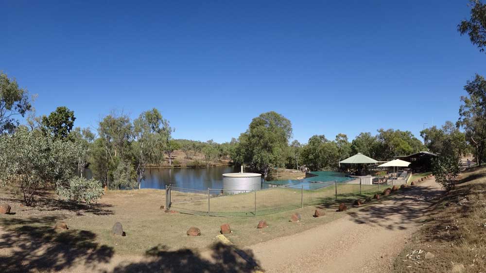 |
| A panoramic photograph of the Cobbold Gorge Resort |
At 5:00 pm I have drinks with some neighbours around their fire. Later I cook honey king prawns with rice and some garlic bread. After dinner a few more drinks and I go to bed at 9:15 pm.
Weather: Fine, maximum of 28ÂșC
Arrived: Cobbold Gorge Time: 2:00 pm Distance: 163 kilometres
Click here to read the next part of the trip.
| 
 v6.00.307 © 2003-2005