|
Click here to read the previous part of the trip.
Day 71 – Wednesday 1 September 2021 – Charlotte Plains to Eulo
Weather: minimum of 10.1ºC and fine
This is the warmest night for over a week. I wake at 6:30 am and get up at 7:20 am. I have another spa in the big tub and am back at 8:00 am. I have breakfast and pack up. I top up my water tank from my containers. I leave at 10:20 am after one last spa. This time I go out the short route and am on the highway in under 10 minutes.
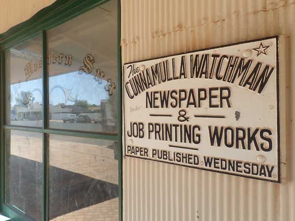 | 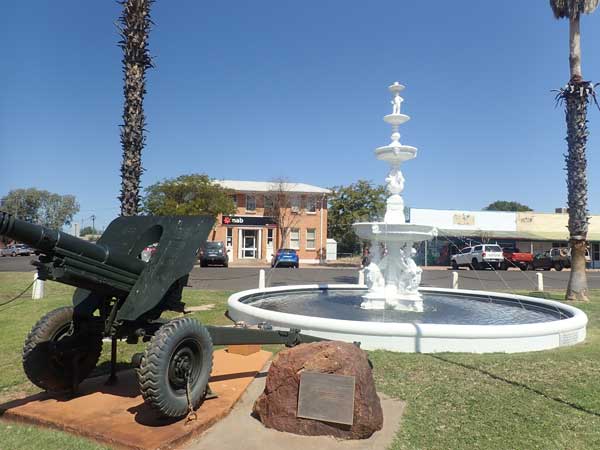 |
| The Cunnamulla Watchman, now closed | The Cunnamulla War Memorial |
I arrive back in Cunnamulla (third time for the trip) at 11:00 am. I go to refuel but the unstaffed station I go to will not work with a credit card. I then head to the BP out near the train station which is the cheapest in town apart from the first one I tried. I take 42.3 litres at $1.52 for a total of $64.36. I have averaged 12.9 l/100m km since Charleville. I ring my ex-wife to see how our dog Veto is going. She is good (she had hurt her leg a few weeks back).
I go a pub and buy some beer (XXXX Gold again) and wine ($63). I then go back into the centre of town and have morning tea and fill my water containers opposite the information centre. I then go for a walk around town, looking at the historic buildings. There are some nice pubs and buildings. I am back at the car at 12:25 pm. I go to the bakery and get a pie and then go to the Club Boutique Hotel for a beer. I sit outside and have my beer and eat the pie, both were good.
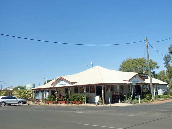 |  |
| The Club Boutique Hotel in Cunnamulla | Having a beer in front of the pub |
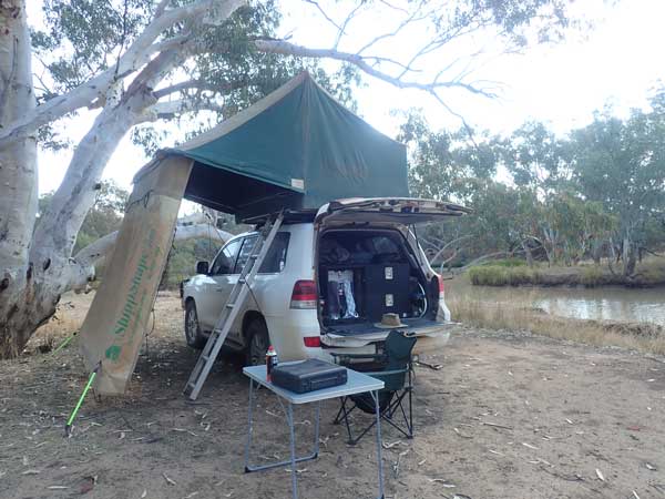
After lunch I go to the IGA which is not the best I have ever seen. I buy $25 worth of things. I leave town at 1:15 pm and arrive at Eulo at 2:15 pm. I head down to nearly the same spot Ron, Donna and I camped almost 10 weeks ago. This is on the Paroo River. I set up camp and then go on-line get a permit to enter into South Australia which opened up to Queensland (except Brisbane and south-east) a few days ago. I will probably cross into there on Sunday 5 September.
I have a cuppa and read the paper (good internet here). It is hot and there is no wind at all. I later go for a walk to both ends of the track I am on. While walking, I collect some fire wood (better to use local than the stuff I have already cut).
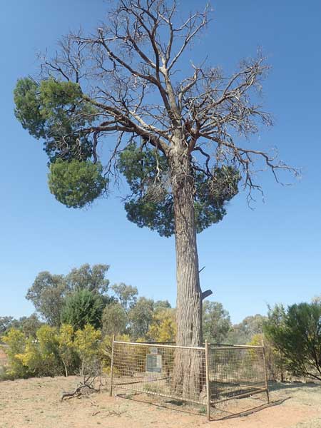 |  |
The Robber's Tree in Cunnamulla. In 1880 Joseph Wells robbed the
Queensland National Bank. He was caught trying to hide in this tree.
He later was executed, the last person executed in
Queensland for robbery under arms. | My campsite beside the Paroo River, Eulo |
I am back at 5:00 pm and I heat water for a shower using the heat exchanger. It takes a while as the engine has cooled, but I have a nice shower. After this I pull apart the chicken I purchased in Charleville and make curry chicken and rice using it. There is still enough for two lunches which I put in a plastic bag.
I put a fire on and there are a few mosquitos about. I hear a noise from the car and find a mouse in my rubbish bag. It escapes into the car! I put out a mouse trap and catch it within 15 minutes. I think it must have got in last night. I send an old work colleague a message and am shocked to find that she is in a relationship now with another ex-colleague. They even plan to move to Tasmania. Considering they can only have met up over Facebook less than 10 weeks ago and could not have met in person considering Covid lockdowns (he lives out of Sydney), I am flabbergasted.
There are too many bugs (and I am in shock), so I go to bed at 9:00 pm. It is still 21ºC.
Weather: Fine, maximum of 31ºC
Arrived: Eulo Time: 2:15 pm Distance: 127 kilometres
Day 72 – Thursday 2 September 2021 – Eulo to Yowah
Weather: minimum of 14.8ºC and fine
A very warm night, over two weeks since it has been that warm. I wake at 6:15 am, read the SMH and listen to the ABC Radio news. I get up at 7:45 am. It looks like it is going rain from Friday night to Sunday morning, starting further west. I decide that I will come back to Eulo on Friday I think and stay in the caravan park which is part of the hotel.
I have breakfast and leave the campsite at 8:50 am. I go up to town and use the toilet (very good setup with water) and check out the hotel/caravan park. I see that if I camp in the back left I can be near a high shelter and perhaps even back right to it. This will let me use the table under it even if it is raining and also get access to the rear of my car as well as the rooftop tent.
I swap a book at the book exchange opposite the hotel and then try to get some bread at the shop but there is none. I leave at 9:10 am. I head west on the Bulloo Developmental Road (here also called the Adventure Way) and 18 kilometres out of town I turn north onto the Eulo Toompine Road. The road is tar and mostly one lane. At 9:50 am I arrive at Alroy Station where there is a camping area as well as artesian spas. This is 63 km from Eulo.
I stop here and have a look at the camping area. It looks really good and there is a very large covered area with tables and kitchen facilities. I now think I may stay here Friday night as if it is raining then I will be able to camp very close to this and be protected (there is only one caravan here and way over the other side).
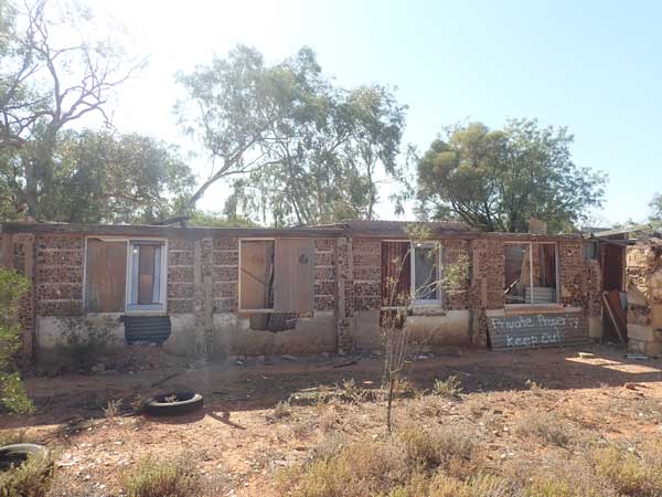 | 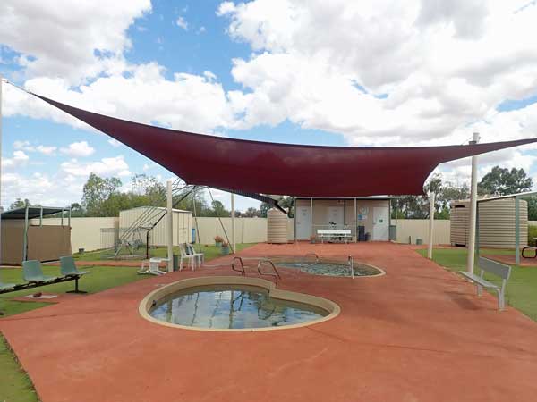 |
| This house is made of opal | The Yowah spa |
I continue on and a bit further on I take the turn to Yowah. This is an opal mining town which also has two artesian baths. I arrive in Yowah at 10:20 am, 31 km from Alroy. I go to the free camping area and have a look. Okay, but not the best. I have morning tea in the day use area opposite. After this I head to the Artesian Waters Caravan Park after first looking at the town artesian spa pool. Very nice!
I book into the caravan park, only $10 per person for unpowered site. I also pay for the two course roast dinner held every Thursday night (hence why I am here tonight) to raise money for the Royal Flying Doctor Service. I get a very nice spot and set up camp. There are free washing machines so I put my dirty washing in, mostly my sheets.
At 11:45 am I walk to the town spa where it costs $3 for a visit or $5 for the day. I pay for a day (honesty box) and have a very nice spa. The spas are like small home swimming pools. The water is about 37ºC. I have a spa and then a cold shower to cool down. An excellent setup.
I get back to the car at 12:40 pm and the washing is done so I hang it on the line. I then have lunch. I read and soon the washing is dry. At 2:20 pm I go for a walk around town. I follow the bore drain and then past the free camping area to the end. Then back to the school which has closed down. From here I walk back to my car, 3.5 km. I am back at 3:10 pm. I have a cuppa and speak to a friend about the people from work who have met up. He is as shocked as me.
At 3:55 pm I walk back to the spa and have another very nice hot spa. The water is a little cooler at 35ºC. I get back at 4:50 pm. After a shower I go to dinner at 5:35 pm. The dinner is held in an undercover section next to the caravan park reception/shop. There are a lot of people here, I am not sure how many. I sit at a table with some people I talked to earlier.
 | 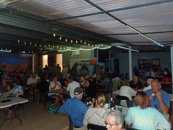 |
| The Yowah duck race | The dinner at the caravan park |
Dinner is a choice of beef or chicken with vegies. Dessert is a choice of two, I had apple crumble, It was all very nice. After dinner, they have the duck races. When you arrive, you can purchase ducks for (I think) $1 each ($2?). They give you a number which corresponds to a duck. The same duck can be sold more than once, in this case I think probably three or four times.
The ducks are small yellow plastic ducks children play with in the bath. They are all placed in a small pool where the artesian water comes out of the pipe and then they race down the drain to a finish line about 15 metres away. Great fun. Prizes are various things made/donated by the community. All the money raised also goes to the RFDS. They have purchased an ambulance and filled it with all the equipment required. This is on display.
The night finishes about 8:00 pm, so I go to the spa in the caravan park. These are large metal baths (single and doubles) in private rooms with an open view to the sky. I have a nice 37ºC spa. I spend little over an hour in there. Excellent!
I go to bed at 9:15 pm and it is still 25ºC.
Weather: Fine (cloudy from 3:00 pm), maximum of 31ºC
Arrived: Yowah Time: 10:20 am Distance: 95 kilometres
Day 73 – Friday 3 September 2021 – Yowah to Alroy Station
Weather: minimum of 19.3ºC and fine
Last night was the hottest night since 24 July at Karumba when it was just over 20ºC. I am awake at 6:30 am as has become almost normal. I read the paper, listen to the news and get up at 8:00 am. I have breakfast and pack up. At 9:35 am I leave the caravan park and head out to the opal fossicking area. I have a walk around and talk to some of the people I met at dinner last night.
 |  |
| The Yowah "Museum" | Inside the museum |
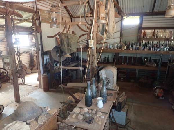
At 10:20 am I arrive at the town spa and have a very hot 40ºC spa. This is 5ºC warmer than yesterday afternoon. I leave at 11:05 am and go to the "museum". This is really an opal sales place but has some interesting things here. The opals are nice, but some cost $5,000. I leave town at 11:20 am.
I arrive at Alroy Station (36 km) at 11:48 am. It is 27ºC and I park near the camp kitchen and sit in there and read. There is internet coverage here too. At 12:35 am I decide to have lunch and then I set up camp a short distance from the kitchen. At 1:35 pm I go to the artesian spa area which is only 50 metres away. This consists of two very large baths that you fill with water as needed. I have a 39ºC spa, spending only 20 minutes in there.
 |  |
| A drone shot of a small section of the Alroy Station camping area | My campsite at Alroy Station |
I don't empty it and leave the water to cool. I read my Kindle and have a cuppa. At 2:25 pm I go for a walk to the other end of the camping area and then along the Yowah Creek. There is a lot of water in the creek. I walk 2.7 km. I have another cuppa and finish a Jack Reacher novel on the Kindle. At 4:20 pm I walk to the main road and back not all that far. I then have another spa, adding hot water to the existing water to get 37ºC.
I get out at 5:10 pm and then fly the drone as the wind has dropped a bit, although it is still somewhat windy. So far there is no rain although there has been high overcast since 11:30 am. There is still only the one caravan here and that was here yesterday morning too. I have drinks at 5:30 pm and start a fire in the wood stove.
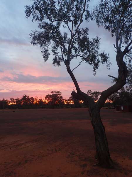 |  |
| A great sunset | The fuel stove that I used to cook my steak on and to keep me |
Soon after this the owner, Mary, comes and collects the $10 camping fee (per person). She also gives me some firewood and a sticker. We have a good chat too. I cook a Scotch fillet steak with sweet potato slices on my cast iron fillet on the stove. The steak was really good. At 7:20 pm I go to the spa again and spend half an hour in there, still 37ºC. I go in again at 9:05 pm.
There has been a lot of cloud since 8:00 pm, but there are patches of clear sky too. I go to bed at 10:15 pm.
Weather: Fine (cloudy from 11:30 am), maximum of 29ºC
Arrived: Yowah Time: 11:48 am Distance: 36 kilometres
Day 74 – Saturday 4 September 2021 – Alroy Station to Eulo
Weather: minimum of 20.3ºC and cloudy
Another warm night, even warmer than last night. I wake at 6:40 am and read the SMH and listen to the news. I get up at 8:00 am and cook a bacon sandwich for breakfast. It starts raining lightly at 8:30 am so I pack up and move the car to the camp kitchen.
The rain stops at 9:30 am, it has not been heavy. I check the internet and Thargomindah (to the west) has had only 0.8 mm since 6:00 am. I go to the spa when it stops raining, only 15 minutes as it is hotter. It is light to the north where the rain is coming from and the radar is not showing any rain here or to the west. I decide to cut my hair as it is a few weeks since I have done it. I should also mention that I have not cut my beard since a few weeks before I left home back in June.
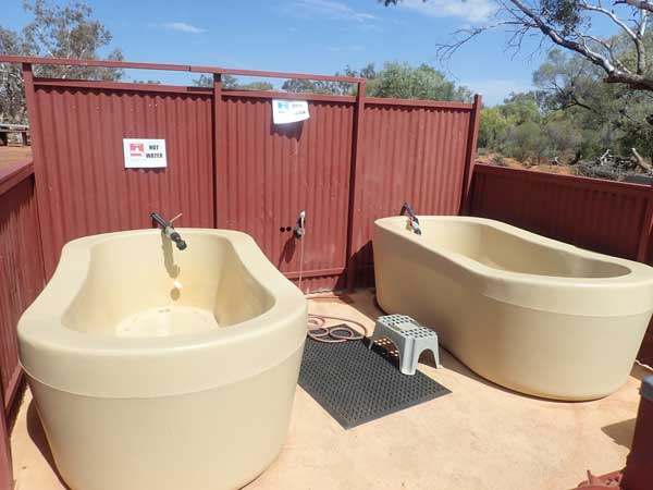 |  |
| The spas at Alroy Station | The camp kitchen |
I keep reading the SMH (today is Saturday of course) and at 10:30 am I have morning tea. It rains a tiny bit at 10:15 am and then again at 10:45 am, a bit heavier. At 11:35 am Thargomindah has only had 1.2 mm. There is more rain at 11:45 am and it eases at 12:05 pm so five minutes later I leave. At 1:00 pm as I approach Eulo, I stop to move a tortoise off the road and at 1:05 pm I arrive at the caravan park behind the Euloa Queen Hotel. It is 62 kilometres to here and it is still raining, and a cool 18ºC
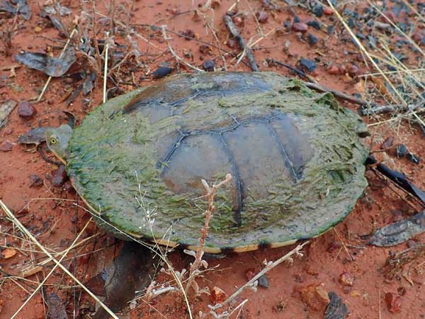 |  |
| The tortise I rescued from the road | My campsite at the Eulo Queen Hotel |
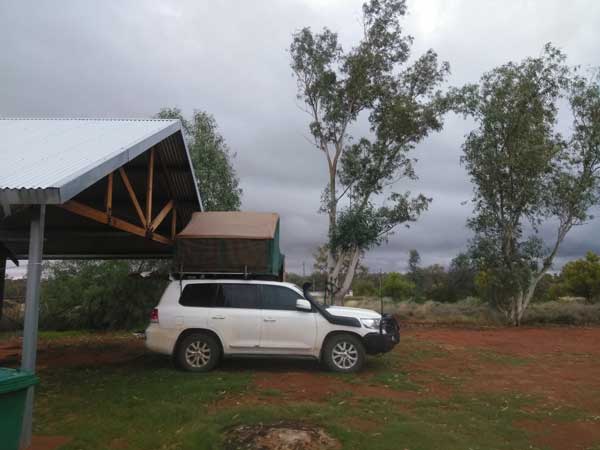
I book in, only $5 a person for an unpowered site. I get the spot I want, right next to the large covered area. I walk to the shop and buy a very nice sour dough loaf and a camembert cheese, total $12. I then make lunch under the shed using the loaf, very nice. I then read my new book, the one I picked up here two days ago. I ring my Mum as I might not get the chance in the coming days due to limited phone access.
At 2:10 pm it starts to rain again and then stops at 3:30 pm. My guess is about 4 to 5 mm has fallen here. Only 1.8 mm has fallen at Thargo. At 4:20 pm I have a shower and then heat up massaman beef curry and rice from a few days ago. At 6:45 pm I go to the pub to watch the NRL. Souths are playing Saints and win 20 to 16. Souths really fielded a second grade side as the last round is next week and Souths have to play Penrith who are coming second (Souths are third). Souths will finish in the same position no matter the results.
 |  |
| The Eulo Queen Hotel | Watching the NRL in the Eulo Queen Hotel |
I have a great time there, the publican Col is very funny. My biggest night out for the whole trip I think. I am in bed by 9:35 pm. It is a cold 10ºC and cool wind, but rain has not really fallen since I went to the pub.
Weather: Raining, maximum of 18ºC
Arrived: Eulo Time: 1:05 pm Distance: 62 kilometres
Day 75 – Sunday 5 September 2021 – Eulo to Thargomindah
Weather: minimum of 10.4ºC and fine
A cool night but no more rain and the sun is out when I wake, but some very high cloud. There is some south-east wind. I wake at 6:15 am and after a while I read the SMH. I listen to the news and read some more and at 7:40 am I get up and have breakfast.
While I eat, I check the Queensland and South Australian Government road websites for road conditions and find that all the roads in and out of Innamincka are currently closed. The Queensland roads are all open, well at least the ones I want to go on. I find that there was 17 mm on Friday night at the Moomba gas field to the west of Innamincka and 6.2 mm at Thargomindah. I reckon more fell here yesterday than at Thargomindah.
I figure that by the time I get to Innamincka, the main roads should be open as that will be three days since the rain fell. My second battery has dropped voltage to under 12 volts as it has had hardly any input in the past 40 hours. I put the solar on for the first time in over 24 hours. I fill the water tank from my container and then fill the containers. Nice water here.
I leave the caravan park at 10:00 am and swap a book on the way out of town. It is sunny with little cloud. I am still on the Bulloo Developmental Road (Adventure Way). The road is a good tar road, mostly single lane. I stop at 11:00 am at a rest area for morning tea. I have travelled 76 km. It is a cool 16ºC. I leave about 10 minutes later and at 11:50 am I arrive in Thargomindah, 132 km from Eulo.
I go to the fuel station, the main one with the shop. The other one is in front of the Toyota dealer and "closed". However, I later meet a couple who filled their vehicle there and then discover it is closed. They are looking for someone to pay! Anyway, I take 46.4 litres at $1.67 for a total of $77.44. This is an average of 11.6 l/100km.
 |  |
| The Thargomindah bore buildings | Part of the Thargomindah Hydro display |
I then go to the Foodworks supermarket. This is pretty good and I buy a few things, mostly a 24 pack of Coke Zero cans and some tandoori chicken. Lucky I went now as it closes at noon and it is actually 12:11 pm! It does open later, perhaps 4:00 pm for a short while. It is Sunday of course and this is Queensland!
I then go to the Information Centre and for $12.50 I get a key that lets me into a bunch of buildings on a self-guided tour. I first head to the old Hydro Power Station which was the first built in Australia and only the third in the World. This used the pressure of the water coming from the hot artesian bore to turn a wheel and create electricity. There is a video, hologram and a working recreation of the hydro station. Really well done, although I did have a problem with some things starting as I think I entered too soon after someone else who had also started the show.
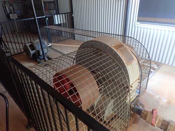 | 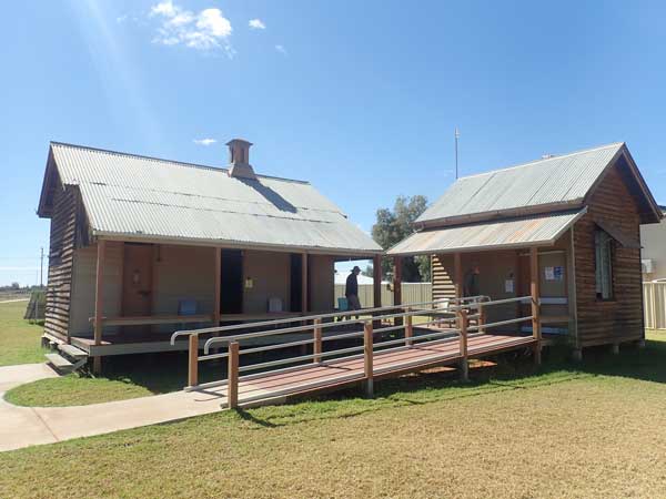 |
| A replica of the Thargomindah hydro power machine | The old Thargomindah Police station and gaol |
 |  |
| The old Thargomindah Hospital | Inside the hospital |
After this I have lunch at the power station. I then go to the old jail. There are cells that you can enter but the sound recordings are not working. At 1:55 pm I go to the old hospital. This is a very nice old building with original furniture and equipment inside. There are also many video screens with actors reading and playing parts of real people, doctors, nurses etc. It ended up a bit boring as there are too many screens. Despite this, it is very well done.
 |  |
| A drone shot of my campsite at Thargomindah | My campsite |
I drop the key into the box they have for this purpose and then head to find a camping spot. It is windy and it takes me a while to find a spot I like. I end up on the eastern side of the Bulloo River and the northern side of the road. I am a few hundred metres from the road and am the only person here. There are other people camped back towards town in spots where you are apparently not supposed to camp and where I camped in 2010.
I set up camp at 2:50 pm. I then go for a walk back towards town and then along the river to the south on a nice concrete path. This goes to Pelican Point which is where the caravan park is located. I walk back via the caravan park and the Bulloo River Hotel. I stop here and have a beer ($7). I meet an English couple in the pub who I spoke to at Yowah.
 |  |
| The Bulloo River Hotel at Thargomindah | A beer in the hotel |
I walk back via the Cobb and Co Crossing, the old causeway across the river. Here I find a nice spot to camp, the access is via the eastern side over the first bridge. Too late to move now. I get back to camp at 4:40 pm and then collect some firewood. At 5:15 pm I start the fire and have drinks. It is cold! I have massaman beef curry and rice from a few days ago. I go to bed at 9:45 pm and sleep at 10:15 pm.
Weather: Fine, maximum of 17ºC
Arrived: Thargomindah Time: 11:50 pm Distance: 141 kilometres
Day 76 – Monday 6 September 2021 – Thargomindah to Innamincka
Weather: minimum of 3.1ºC and fine
Well, back to the cold nights! I sleep great and awake at 6:00 am. I lay awake till just before 7:00 am when I read the newspaper and then listen to the news. I get up at 7:55 am and have breakfast. It is sunny but very cold with a southerly wind. I leave at 9:30 am.
I go via the supermarket as I forgot a couple of things (sausages) and the toilet. I leave town at 9:45 am. The road to the SA border is still shown as being shut but the publican and others say that it is now all tar and open. When I was here last time two years ago there was still some dirt. I only pass one vehicle in the next 100 kilometres.
I see three more vehicles before I get to the Noccundra turn-off (125 km) where I stop at 11:10 am for morning tea. I have been to Noccundra twice now, including early in this trip. There has been a lot of cattle on the road as well as one horse. It is still very cool, 17ºC.
I leave at 11:20 am. Again the road is tar and mostly single lane. I only see a total of eight vehicles in the first 200 kilometres. At the intersection with the Innamincka Road, I turn left. This is where the Bulloo DR ends (it is also called Bundeena Road from Thargo).
 |  |
| The signs at the Noccundra turn | Cooper Creek |
At 12:25 pm I stop on the western side of Cooper Creek. This is 221 km from Thargomindah. I stopped here in 2010 and 2019 for lunch as well. There is a fair bit of water in the river (and it is a river really). I have lunch and fight flies which are everywhere. I leave at 12:45 pm.
Twenty kilometres on I come across an upturned car on the side of the road. The Nissan X-Trail has Police tape around it so I know straight away I am not going to find anything terrible. I stop for a look. All the airbags have gone off but apart from it being upsidedown, there is not a great deal of damage. I would assume the people inside were okay. I find a bungee cord that matches two I have, so I take it with me.
 | 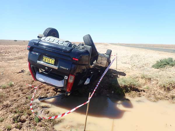 |
| The skid marks leading to the crash | The Nissan X-Trail |
At 1:30 pm I stop at Chalky Creek, 286 km from Thargomindah. Here I cut some timber, gidgee. I leave 15 minutes later. This section of the road is also tar and mostly two lanes. The road is now tar all the way almost to Innamincka, only the last kilometre or so is untarred and this is being worked on. I cross over into South Australia and arrive in Innamincka at 2:40 pm (Queensland time - same for the rest of the day). I have travelled 370 kilometres today.
I go straight to the Innamincka Trading Post (fuel station and shop) which is next to the Innamincka Hotel. I take 46.9 litres at $1.90 for a total of $89.07. I have averaged 12.4 l/100 km. It is still cool, 20ºC, but sunny. I then go to the NPWS office but there is no-one there and no information at all about the roads into Coongie Lakes or Walkers Crossing. To be honest, all four times I have been here, it has never been open, nor has there ever been any information available about parks or roads.
I see an Aboriginal woman outside and she tells me both roads are closed for at least two weeks due to the rain. Bugger, one of these days I will get to them, maybe the fifth time will be lucky.
 |  |
| Innamincka Hotel | A Coopers Pale Ale inside the Innamincka Hotel |
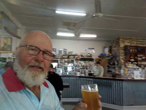
I go to the ITP who confirm that the roads are closed. I pay for a night's camping on the common ($10) and then go to the pub for a beer. A Coopers Pale Ale is a very expensive $10 a schooner. I also discover that you have to wear a mask in shops and hotels in South Australia. I then have a hot shower in the public showers opposite the ITP and pub. This costs $2 for three minutes. Nice, but only one hook to hang things on and no curtain so water bounces everywhere, including onto your towel and clothes.
At 3:25 pm I find a spot on the common, right down the south end and away from the spot I stayed at in 2019. I am right on the Cooper Creek, a nice spot. There are plenty of vehicles all over the common. I set up camp. There are plenty of flies and I have to put my fly hood on. I have a cuppa and revise my trip. I had planned to go to Coongie Lakes for two nights, then travel via Walkers Crossing to the Birdsville Track and then down to Marree.
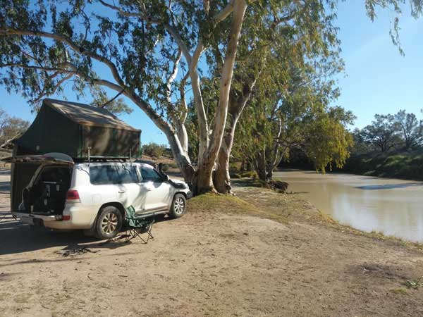 | 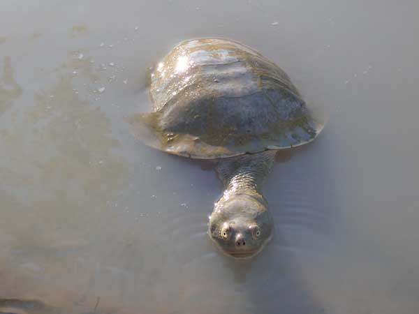 |
| My campsite on the Cooper Creek at Innamincka | One of many turtles in the Cooper Creek |
I decide to head down the Strezlecki Track to Mount Hopeless, Arkaroola, then Gammon Ranges NP. After this I will go to the Flinders Ranges NP. While doing this, I see heaps of turtles in the water, at least six. It is impossible to imagine that Burke and Wills died here in 1861 from starvation. There are corellas nesting in the tree next to me and fish galore in the water.
At 5:10 pm I put my fire on and cook pork ribs in my small camp oven. I also make a rice dish to go with them. The ribs were expensive, $10, but worth it. I have port and chocolate after dinner to finish off the meal. The wind drops after sunset and it ends up quite nice. I go to bed at 9:40 pm.
Weather: Fine, maximum of 20ºC
Arrived: Innamincka Time: 2:40 pm Distance: 373 kilometres
Day 77 – Tuesday 7 September 2021 – Innamincka to Yerila Creek, Mount Hopeless
Weather: minimum of 9.4ºC and fine
All times till further notice are South Australian time.
I wake at 2:40 am and am awake for over two hours. Nothing I do helps me fall back to sleep. I finally go back to sleep and wake again at 6:00 am. At 6:40 am I read the SMH and at 7:00 am I try to listen to the ABC news but it is very faint. The wind comes back as soon as the sun rises. I get up at 8:00 am, very tired still. I check the roads and find that the Cordello Downs Road to the north is now open. I have a slow breakfast and pack up.
At 9:45 am I leave. I decide to go via the Old Strezlecki Track. This is shown here as 15 Mile Track. I take a wrong turn at one spot but realise after only a half kilometre or so. The road is pretty awful, far worse that when I travelled along it in 2003. After I have gone about 20 kilometres I am regretting coming this way.
 |  |
| The Old Strezlecki Track, aka 15 Mile Track | One of the very wet sections of the track |
The first one third has lots of water but is okay. The next one third is dry but rough but the last one third is the real problem. It is wet and rough. On this part I have to make numerous detours off the track onto surrounding flat land. I have a lot of worries that I might get bogged, although there are plenty of decent trees that I could use to winch myself out.
As it turns out, I have no problems and get through without any worries at all. At 11:08 am I arrive at the Strezlecki Track. I have covered 47.4 km, an average of 34 km/h and a fuel consumption of 16.7 l/100 km. I have morning tea here and then leave at 11:15 am. The road is dirt but in very good condition. There are a few large trucks around as the Moomba Gas and Oil Field is on this road. There are also quite a few vehicles.
 |  |
| Strezlecki Creek at Strezlecki Crossing. The tree in the middle is at far right in the photo from 2010 | The Strezlecki Crossing in 2010 |
At 1:02 pm I arrive at Strezlecki Creek, 135 kilometres from where I had morning tea (average 75 km/h, 11.7 l/100km). Back in 2010 we camped here on the way back from Central Australia. I stop here to have a look and also have lunch. Wow, it has changed a lot. Back then there was lots of water still in the waterway from the floods early in the year. Now there is no water and it is not as nice a spot as the banks where we camped are very overgrown with weeds. I leave at 1:18 pm.
At 1:58 pm I arrive at Montecollina Bore. This is 46 kilometres from Strezlecki Creek. In 2010 we stopped here for quite a while as there was a hot artesian bore putting out water into a small dam. I had heard that it was now capped and sure enough, it is not flowing. This is very sad, as it was one of the highlights of the trip along the Strezlecki Track.
 |  |
The Montecollina Bore, totally dry. The artesian water used to
came out the pipe and into the small pool then the large pool. | The Montecollina Bore in 2010 |
 | 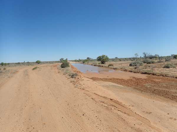 |
| The Strezlecki Track south of Montecollina Bore. | The wet section of Mount Hopeless Track |
So far to here I have had two sections of tar road, both about seven kilometres long. These were not there in 2010. There have been some muddy bits so far, but mostly I have been sitting on 80 to 90 km/h. I have only passed one car since the creek and that was here.
At 2:15 pm I briefly stop at the Art Baker Rest Area as there are nice views to the south. Further on I take the Mount Hopeless Road which leads to the south to the Flinders Ranges and Arkaroola. This road has quite a lot of wet sections, at least five, that I have to avoid. After that the road is better (dirt still). At Yerila Creek I stop to look for a campsite. At 2:55 pm after 10 minutes looking, I find a nice camping spot on the west side of the creek and to the north of the road. There is less wind here and it is a nice spot. I set up camp and also put out my fly tent as there are lots of flies.
 | 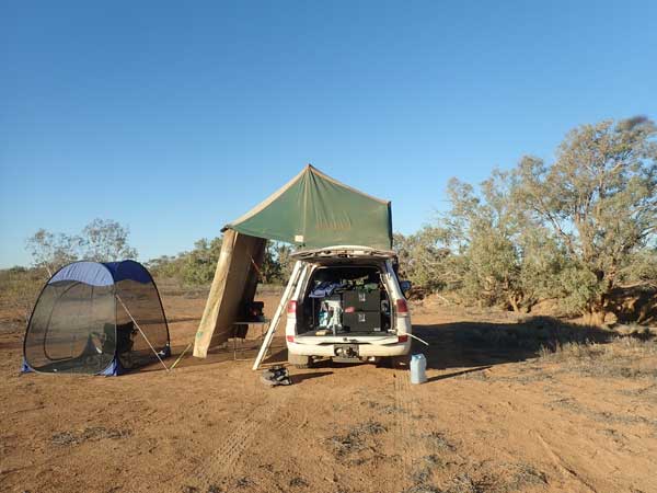 |
| Flies galore, Yerila Creek | My campsite at Yerila Creek |
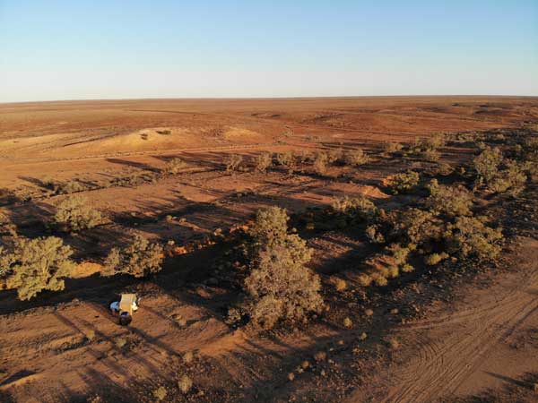 | 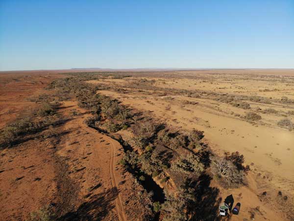 |
| A drone shot looking to the south-east | Looking to the south-west, I think the hills north of Arkaroola are in the middle |
I heat water for a shower and then have a very nice wash. I sit in the tent reading. There are lots of camping spots here and there is no-one else around. I have a cuppa and then later go for a walk to the south along the creek. It goes a long way. I walk back, 2.2 km all up. A car goes past, the second since I have been here. After lunch I have travelled 120 kilometres and only seen two vehicles.
Back at the camp, I fly my drone as the wind has dropped a lot. I have drinks in the fly tent at 5:45 pm. The wind totally drops after dark and the flies disappear. I start a fire and cook some sausages for dinner and tomorrow's lunch. I make fried rice to go with it. I have a nice fire with two large bits of timber I found. I go to bed at 9:45 pm, it is a cool 13ºC
Weather: Fine, maximum of 22ºC
Arrived: Yerila Creek Time: 2:55 pm Distance: 287 kilometres
Day 78 – Wednesday 8 September 2021 – Yerila Creek to Arkaroola
Weather: minimum of 8.0ºC and fine
I have a very good sleep, unlike the night before. I wake at 5:45 am and listen to the 6:00 am news. Later I start a new book. I get up at 7:15 am and fly the drone again. However, I have problems as it is beeping at me and the throttles are not centred. I have no idea why this has happened. I fix it and fly again but a bird tries to attack it. Luckily it was only a swallow. You certainly have to be careful in the outback as this is not the first time the drone has been swooped, mostly by hawks. There is little wind but the flies come back at 7:45 am.
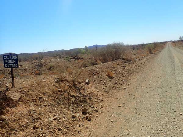 |  |
| The Mount Hopeless Track south of Yerila Creek | The view towards Arkaroola from Mt Hopeless Track. The stick on right is a very old telephone line pole. |
I have breakfast in the fly tent and then read in there till 8:30 am. I then pack up and leave at 9:10 am. The road is pretty good at first, I sit on about 75 km/h. I see a few budgies but only one vehicle. At 10:30 am I stop for morning tea at Mulga Creek Well. This is 84 km away. There are no flies. There is an emu here with 8 chicks, very nice. There is also a nice view of the hills to the south-east.
I leave at 10:45 am. This section of road is much rougher, very rocky. I arrive at Arkaroola Road at 11:43 am. This is 48 km from the well, so I have averaged only 49 km/h. I have seen no other vehicles. The Arkaroola Road is very good dirt. I pass a few places that I will stop at in a couple of days when I leave. I stop at Station Lookout at 12:13 pm and at 12:25 pm I arrive at Arkaroola, 163 km for today. I book in for two nights, $50. I look for a spot and find one on the creek. The best ones along the creek are nearly all taken. I set up my chair and table to take the spot.
 |  |
| The Pinnacles at Arkaroola | The Bolla Bollana Copper Smelter ruins |
Arkaroola is a privately owned conservation area which has camping and accommodation. More about this later.
It is fine but only 22ºC. I phone my ex and find out that our dog, Veto fell down her stairs. She is okay, but it looks like she has cataracts in one eye. I already suspected this. I have lunch and then head off for a drive. At 1:40 pm I am at The Pinnacles. There are very nice views from here. In fact, I will walk here in two days time. I then go via Bolla Bollana Springs, nothing here to see, then to the ruins of the Bolla Bollana copper smelters. I get here at 2:02 pm. There is some interesting stuff to see here.
 | 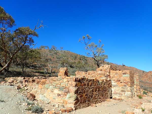 |
| More of the Bolla Bollana Copper Smelter ruins | The Wheal Turner Copper Mine ruins |
From here I go to Wheal Turner Mine. This is four wheel drive only and slow going. I average 23.3 l/100 km for the 17.2 km which takes just over an hour. This is an old copper mine. There are bits of copper ore everywhere. There are the remains of some buildings, but it is probably not worth the hour I spent to get here. I head back at 3:27 pm.
 | 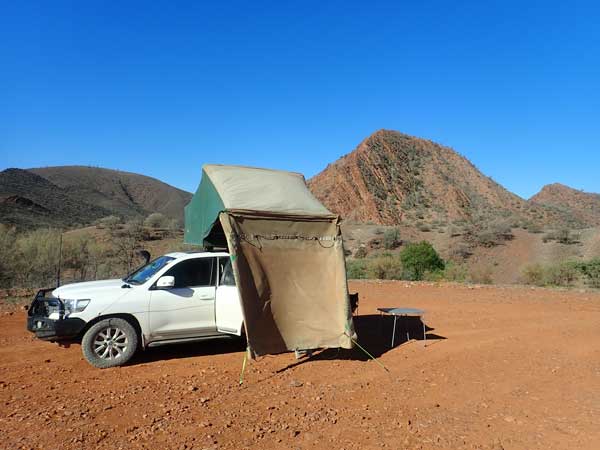 |
| The Wheal Turner Track, pretty rough | My campsite at Arkaroola |
I get back at 4:25 pm and decide to move from the creek. I end up at the main plateau camping area but away from other vehicles. This is near to the toilets and showers. I set up camp at 4:35 pm. I then walk to the showers and after I mix up a damper. I put a fire on in my firepit. I put the damper on at 6:15 pm and it is ready at 6:40 pm. I did not have enough coals on the bottom at first. I have it with a CuppaSoup. Very nice!
I read for a bit, it is cold. I go to bed at 9:15 pm.
Weather: Fine, maximum of 22ºC
Arrived: Arkaroola Time: 12:25 pm Distance: 217 kilometres
Day 79 – Thursday 9 September 2021 – Arkaroola
Weather: minimum of ??ºC and fine
I wake at 4:00 am and apart from perhaps a few minutes, I do not sleep again. I listen to the radio news on the hour and later read the SMH. I get up at 7:50 am. The flies are bad. I have breakfast and then partially pack up. I head to the reception and pay $45 for a key ($50 deposit) to enable me to do the Echo Camp Backtrack. This is very hard four wheel driving.
 |  |
| The arrow and date at Echo Creek Historic Site | The emu and chicks |
I leave at 9:15 am and at 9:30 am I arrive at Arkaroola Waterhole. This is only 5.8 km away. The waterhole is dry but is fairly spectacular. I leave at 9:42 am and at 10:00 am I arrive at Echo Camp Historic Site. This is 11.1 km from the campsite. I have averaged 20.0 l/100 km to here. It is warmer today at 24ºC. There is an arrow pointer made from stones here that was built in 1898. There is also a grave and a cairn to prospectors. I leave at 10:07 am.
I see another emu, this one has 8 chicks. At 10:27 am I arrive at Echo Creek Waterhole. This is only 2.6 km from the Echo Camp, but had a very steep descent to it. I later discover that I should not have come down here as the girl who gave me the key said there was one section that was closed due to a rock slide. I never saw any slide, but it was a difficult but not too bad section of track. I get down and back up it easily. I have morning tea while I am here. The creek is dry but there are lots of birds around. I leave here at 10:38 am.
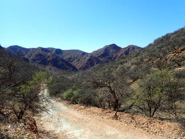 | 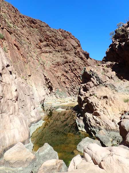 |
| The rough track down into Barrarrana Gorge | Barrarrana Gorge |
 | 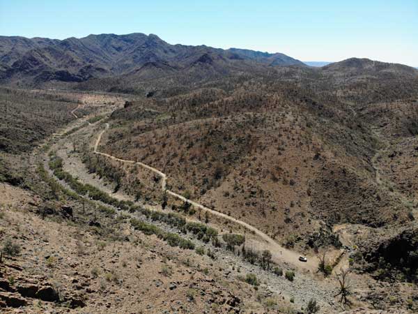 |
| A drone shot of the Barrarrana Gorge | The track into Barrarrana Gorge |
At 11:13 am I arrive at Barrarrana Gorge. This is 5.5 km and low range all the way from Echo Creek Waterhole. I average 27.2 l/100 km and 9.4 km/h. This is a very nice gorge with a bit of water. I fly my drone to get some photographs. I leave at 11:35 am and at 11:55 am I stop at what I think is the Lake Frome Lookout. This is 1.6 km from the gorge and I average 53.0 l/100 km (!!!) and 4.8 km/h. I leave 5 minutes later.
 |
| The view from the first lookout |
Eight hundred metres on I stop at the real Lake Frome Lookout which has great views. It is a very steep descent from here to the exit gate which I reach at 12:15 pm. Despite descending, I average 45.2 l/100 km and only 6.4 km/h. This is the gate at the other end of the track. I use the key to open it and go through and at 12:22 pm I arrive at the Paralena Hot Springs Road. I turn left towards the north.
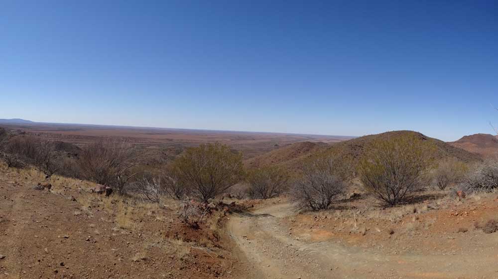 |
| The view from the Lake Frome Lookout |
At 12:50 pm I arrive at Paralana Hot Springs. This is 36.6 km to here from the campsite. I go for a walk to find the springs. Well, I never really found any springs. There are only very old signs and none pointing to the springs. The only thing I found was the stream and in one spot it was a bit warm. The springs are said to be radioactive. I have lunch and then leave at 1:25 pm.
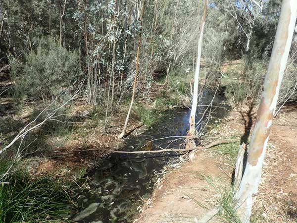 |  |
| Paralena Hot Springs, pretty uninspiring | The ruins at Livelys Mine |
At 2:18 pm I arrive at Stubbs Waterhole which is on the Arkaroola Creek and not far from Barrarana Gorge that I visited this morning. There is some water in here. I talk to a young couple in an 80 series LandCruiser who passed my camp yesterday morning. I leave at 2:40 pm and at 2:55 pm I arrive at Livelys Gold Mine which was dug in 1946. There is a hut and some mine shafts. I leave at 3:02 pm and after dropping the key back at reception and getting my deposit back, I am back at camp at 3:25 pm. I have travelled 71 kilometres today.
I have a cuppa and then walk to the reception to look at merchandise (did not buy anything). I then go to the rock display, lots of various types of rocks. Of course, Arkaroola was set up by Reg Sprigg, a geologist who studied under Sir Douglas Mawson (of Antarctica fame). Sprigg was the first to drive across the Simpson Desert. He did this with his wife and two children in a Nissan Patrol in 1962. Click here to read about a book review of their adventures. Hence the rock display and the names of places on the property and the geological signs all over the place.
 | 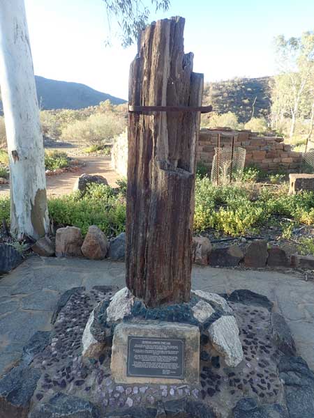 |
| The mine shaft at Livelys Mine | A petrified tree near the reception |
I go back to my camp and then have a shower. After this I start a fire and at 5:50 pm I have drinks. I cook the remaining pork spare ribs in the small camp oven. Again, great with some fried rice. The wind drops at sunset. I go to bed at 9:35 pm.
Weather: Fine, maximum of 28ºC
Arrived: Arkaroola Time: 3:25 pm Distance: 71 kilometres
Day 80 – Friday 10 September 2021 – Arkaroola to Italowie Gap, Gamon Ranges NP
Weather: minimum of 1.5ºC and fine
A very cold night. I wake at 2:00 am and am awake for 75 minutes, I then sleep fitfully till 6:30 am. I read the SMH and then listen to the ABC Radio news. I read till 7:50 am when I get up. It has warmed up to 13ºC. I make a bacon sandwich for breakfast as I have lots of time, I am not going far today.
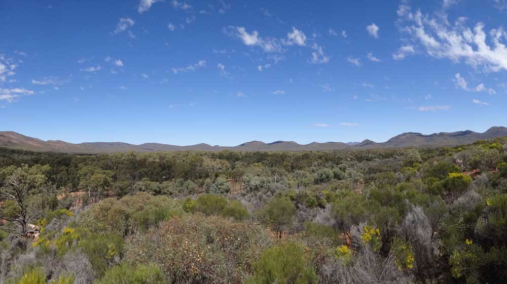 |
| A panoramic photograph on the Mawson Track |
I pack up and then at 9:00 am I go on a walk which is called Mawson Spriggina as it is the combination of the two walks. This is 8.7 kilometres. It goes past a formation known as Sitting Bull (looks like the famed Red Indian) to The Pinnacles. It then comes back the southern side of the road, past an observatory. It is a very nice walk with great views, but it is hot, 27ºC. I am back from the walk at 11:10 am.
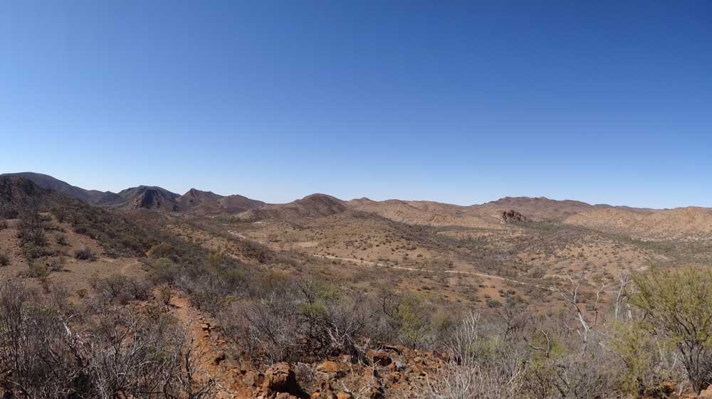 |
| A panoramic photograph on the Spriggina Track |
I leave at 11:20 am and head back the way I came in two days ago, the only way out. I go to the Weetootle Camping Area in Gammon Ranges NP. I am not camping here but I want to check it out. There is also a day use area and I there as well. I arrive there at 12:05 pm (35 km). In the picnic area there is a table and chairs in the shade. I do the short walk, only 400 metres each way. Lots of interpretation signs about the plants make it very interesting. I have lunch after the walk at the table. I leave at 12:50 pm.
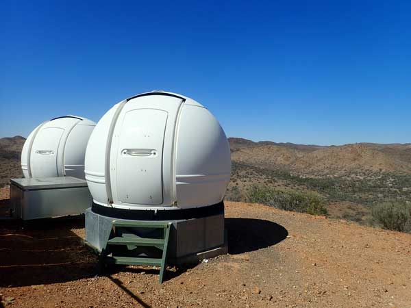 |  |
| One of the observatories at Arkaroola | There are a few of these sculptures around here |
I continue along the Arkaroola Road and then turn right at the intersection with Mount Hopeless and Gammon Ranges Roads. This is where I turned two days ago. At 1:20 pm I arrive at Italowie Gap Camping Area in the national park. This is 58 kilometres from Arkaroola.
I booked this site a few days ago (as well as ones in Flinders Ranges NP) and I find a spot. I don't think I actually had to pick a spot, but I go around a few times and find a nice one with some shade (there is not much at all). I find one with a table and chairs, all have firepits. I set up my fly tent in the shade but I leave my car elsewhere in shade. I move it later to this site once it cools down a bit.
 |  |
| A drone shot looking towards Italowie Gap | The Italowie Gap Camping Area |
I have a cuppa and sit in the fly tent and read from 2:00 pm. At 3:00 pm I walk to the road and collect some firewood on the way back. I get back at 3:25 pm. At 4:00 pm I start a fire in the firepit as I am cooking a roast for dinner. I fly the drone and then heat some water for a shower. After the shower I go back into the fly tent as there are still heaps around.
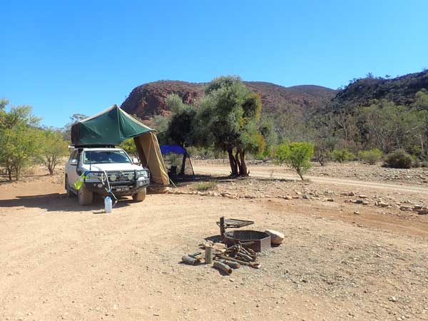 | 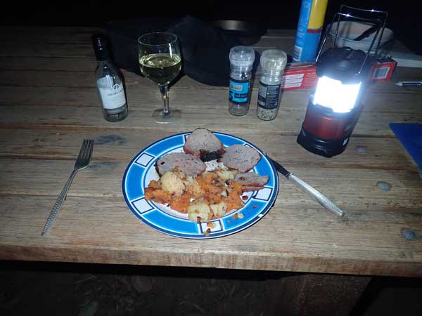 |
| My campsite at Italowie Gap | Roast beef dinner! |
I put the roast beef on at 5:30 pm. I have vegies on as well. The wind is strong again, first from the south-west and then the north-west. Fifteen minutes later it is calm! Weird indeed. The roast is cooked by 6:30 pm and is excellent.
I listen to Manly play Melbourne on the ABC. Melbourne wins 40 to 12, making me think they are the team Souths has most to worry about in the finals. How wrong I will turn out to be! Today was the hottest day I have had for weeks, and it is a warmish evening. I go to bed at 9:45 pm.
Weather: Fine, maximum of 29ºC
Arrived: Italowie Gap Time: 1:05 pm Distance: 62 kilometres
Day 81 – Saturday 11 September 2021 – Italowie Gap to Parachilna Gorge
Weather: minimum of 8.1ºC and fine
A warmer night but by 7:45 am when I get up it is over 20ºC. Today is 20 years since the 911 attacks on New York and the Pentagon. I cannot believe it is that long, I clearly remember watching live the second plane crash into the World Trade Centre. Such a sad night, I stayed up till the early hours of the morning watching it all unfold.
When I get up the flies are again bad so I eat breakfast in the fly tent. It is also windy again. I pack up and leave at 9:00 am as I am not sure where I will go today. I follow the Gammon Ranges Road to the west and have a look at Copley. A bit of a dump really but the pub looks nice. There is nowhere to stay so I go onto to Leigh Creek. I arrive there at 10:35 am, 91 km from Italowie.
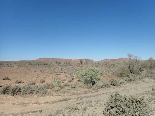 |  |
| The Gammon Ranges from near Copley | Copley Hotel |
If Copley is a dump, then Leigh Creek is also but on a bigger scale. It is a mining town solely built it appears to support the Leigh Creek coal mine which has now closed down (2016 I think). As such, most of the houses are empty and the shopping centre is in disrepair, with really only the Foodland IGA supermarket open. There does not appear to be a pub or a club, so my plan to stay here and possibly watch Souths play on TV tonight is not possible.
I look for a park so I can have morning tea but the one I find only has one table and it is in the sun (and it is hot). I have a cuppa and then go to the supermarket. I buy a few things, there is not a great range of items at all. I spend $66. I then go to the fuel station (which I went to in 2019) and fill up. I take 100.5 litres at $1.689 for a total of $169.81. I have averaged 13.9 l/100 km since Innamincka, 739 kilometres away.
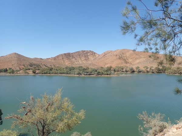 | 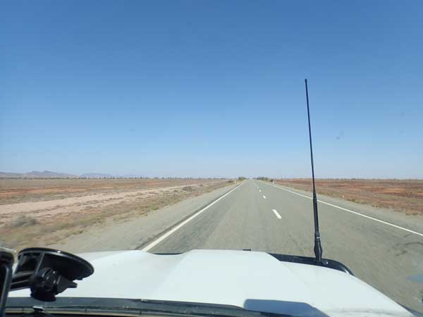 |
| Aroona Dam | The highway as I approach Parachilna |
I leave town at 11:30 am and a few kilometres south I turn off to Aroona Dam. This was built as the water supply for the mine and town. It is extremely windy and 30ºC when I arrive so I find some shade and park. I fill up my water tank from my containers and then fill the containers from the tap here. I read the SMH and also download the whole issue so I can read it later (it is Saturday so it is big and I may not have phone coverage later). I have lunch.
Two women arrive in two campers. I speak to them as they have come from Flinders Ranges. They tell me that the spots I propose to camp at in the coming three nights (Parachilna Gorge, Trezona and Aroona) are all good spots. I go down to below the dam wall and cut some timber for my fires in the coming days as I cannot cut any once in the national park. I leave at 1:35 pm and it is a very hot 34ºC, possibly the hottest day I have had on the trip.
 | 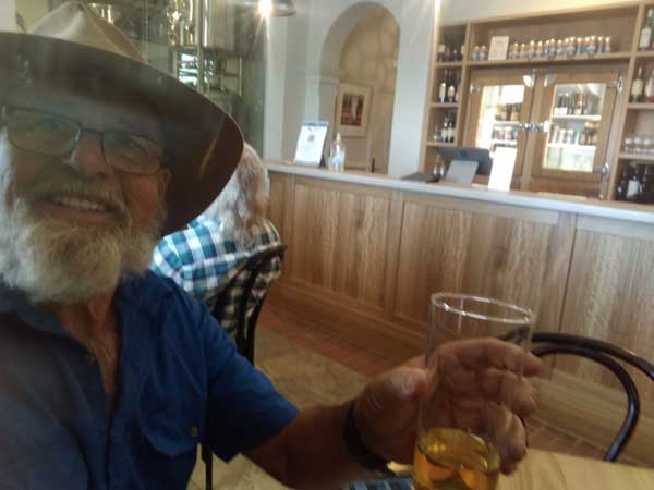 |
| The Parachilna Hotel | Having a beer inside |
I head south on the Outback Highway. I arrive in Parachilna at 2:18 pm, 173 km from where I camped last night. The only thing here really is the hotel. However, at first it looks closed as the doors are all shut and there are no signs at all that indicate it is open. I even try a few doors without luck. Then I see someone come out another door and I realise it is open. I go in and order a beer. This is a mid-strength pale ale and is the best beer of its type I have ever tasted, albeit a bit expensive at $9. They are having this brewed for them and are in the process of setting up a brewery here. I want to buy a six-pack but they do not have this beer, so I get one of lager for $25.
It is still 32ºC when I leave at 3:05 pm. I take the Parachilna Gorge Road to the east. It is 13.5 km to where I decide to camp. There are hundreds of possible camping spots in the gorge, anywhere along the road by Oratunga Creek which has gouged out the gorge. I go off the road down to the banks of the river and find a spot just below the original road which has old stone retaining walls. There are huge river red gums and it is a great spot. There are dozens of cars over the few kilometres of the gorge and more come in later (possibly from Port Augusta).
 |  |
| Parachilna Gorge | Parachilna Gorge |
I have a cuppa after setting up camp and then read the SMH. At 4:10 pm I have a hot shower. Around this time at least 80 motorbikes go past, heading east. They sound like old Australia Post postie bikes. I have read about rallies being held for them. I later find out that it is the Apex Outback Postie Bike Ride which is held each year about this time through the Flinders Ranges. It is very windy till after dark so I do not light a fire till 6:30 pm.
I cook some rice and then Mongolian lamb that I purchased a long time ago. This is very nice and I have lots left over for coming meals and lunches. At 7:20 pm I listen to Souths play Penrith in the last round of the competition. Remember this is SA so the time here is 30 minutes after NSW and Queensland. I have to switch between about five different ABC stations to listen to the game, but mostly 702 in Sydney. It is a great game and Souths win 16 to 10. I go to bed at 11:30 pm, very happy about the win and Souths prospects for the finals.
Weather: Fine, maximum of 34ºC
Arrived: Parachilna Gorge Time: 3:25 pm Distance: 186 kilometres
Click here to read the next part of the trip
| 
 v6.00.307 © 2003-2005