|
Over the October Long Weekend in 2008, Kelly and I decided to go four wheel driving as we had not been for a trip in NSW for over a year. A few of our friends from the St George Scuba Club also decided to come along. The plan was to visit Abercrombie River National Park which is south of Oberon, west of the Blue Mountains.
ROUTE MAP
 |
| A map of our route in Google Earth - note route to and from Sydney not shown |
GPS TRACKS
You can download the Google Earth track of this trip by clicking here and looking at it in Google Earth.
You can download the OziExplorer track of this trip by clicking here and looking at it in OziExplorer.
Saturday 4 October 2008
Kelly and I left home at Kirrawee at 7:05 am and we arrived at our meeting spot at Mittagong just after 8:20 am. We had come via the Princes Highway and the Appin Road. It was raining the whole way and for most of the way from Helensburgh to well after we got onto Appin Road, there was very heavy fog. This kept our speed down to about 60 to 70 kmh for about 15 kilometres.
Ron and Donna (in a new Prado Turbo Diesel towing a camper trailer) had also left Kirrawee at the same time as us but they had come via the M5. They arrived about a minute before us. Heinz was already there (in a 3.4 litre petrol HiLux).
After quick breakfast and the purchase of some bread, we headed out of town towards Wombeyan Caves. It continued raining all the way, although not too heavy. We arrived there at about 10:20 am. It was still raining so we went to the camp kitchen and made morning tea. Robyn and Chicka turned up a few minutes later (LandCruiser 80 series diesel). They had come down the day before and camped at Wombeyan Caves.
After morning tea we left at about 11:10 am. The plan was to go via the bottom end of Blue Mountains National Park and some state forests to join up with the Oberon to Goulburn Road up near the north-eastern access to Abercrombie National Park. We travelled via Langs Fire Trail, then Goker Fire Trail and then Range Fire Trail. On some maps the Range Fire Trail changes name to Mount Fatigue Fire Trail. Along here we stop in the state forest and collect enough fire wood for tonight. We then turned left onto Mount Werrong Road and then left at Cosgrove Road. This is at the start of a recently logged section of state forest.
Just under four kilometres along this road and you come to the Oberon to Goulburn Road. We turn right and a few hundred metres down the road I see an echnidna crossing the road. I have to slow down fairly dramatically to avoid running it over. It is a fairly large one, bigger than the ones we saw in Tasmania in February 2008.
We continue on and just over three kilometres later we turn left into Felled Timber Road. This runs through farming properties. Just over 2.6 kilometres later we turn left onto Brass Walls Fire Trail. This leads through some more properties and 2.5 kilometres on we are in Abercrombie National Park.
The first few hundred metres is quite easy but then we come to the intersection with the Link Fire Trail. This is not signposted but says something like "To Middle Fire Trail". We turn right. It has not been raining now for well over an hour. There are signs saying that this is Dry Weather Access only. However, the tracks do not look wet so we continue on.
As soon as we get onto Link Fire Trail it is very steep. This is second gear low range but presents no problems. A kilometre up this track we stop for lunch. It is just before 2:15 pm. We stop for about 20 minutes and then head off again.
Soon after we drop down into Davey Creek. It is a fairly step climb up out of the creek for about 100 metres. I get up okay but Heinz is having problems. He only has his narrow wheels on and has not much weight in the back. He is losing traction. He drops the air pressures in his tyres and eventually makes it up the hill. There are some other four wheel drives at the top, heading in the opposite direction.
 | 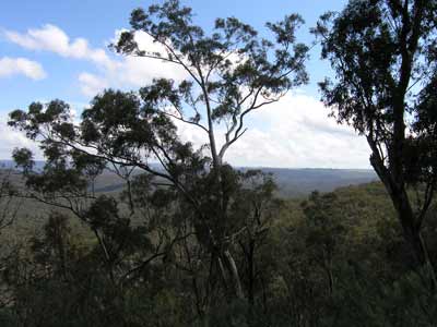 |
| Stopped on one of the tracks in Abercrombie River NP | The view from near the intersection of
Licking Hole Track and Link Fire Trail |
Ron is next. He gets to the same spot as Heinz and stops. He too has traction problems. He has little weight in the rear and on the slope, his trailer does not put much downward pressure on the rear wheels. When he attempts to back down to start again, his trailer heads off on its own mind and he cannot go any further. He has a few more goes, including dropping air pressures, but he cannot get up.
I reverse down the hill to a spot that is a bit level (a drainage hump) and we use three snatch straps linked together to connect his car to mine. We head off and the first few attempts fail (Ron left his handbrake on for one). Finally, we move up a few metres. The next attempt gets us up about 15 metres. I back down to the level spot as I am now losing traction. We take out one strap and go again. This time we get him going and right up to the top.
Chicka comes next and has no problems at all, he does not even spin his wheels. We continue on. It has taken us 45 minutes to cover this 100 metres. A bit further on we come to an intersection. This is Middle Fire Trail. We keep going straight ahead. There are a couple of more trails that we pass. At the intersection with Licking Hole Trail, we turn right. The track here passes out of the national park. A little while later it goes back into the park.
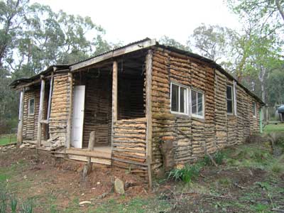 | 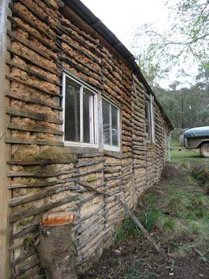 |
| Ledinghams Hut - rear | A wall of Ledinghams Hut |
We pass Long Nose Fire Trail (which I think is blocked at the park's boundary) and 2.8 kilometres from the Licking Hole intersection we turn right onto Ledinghams Fire Trail. This leads 2.2 kilometres to Ledinghams Hut. This is a wattle and daub hut (timber and mud), built probably in the early 1900s as a grazing hut. There are also cattle yards here. The hut is very interesting, although in a poor state of repair (structurally it is okay).
We had thought about camping here but there is no flat land. We stop here for just over 10 minutes. At 3:21 pm we leave. We back track to the main track and turn right. Just under five kilometres along we come to the Retreat River. Here there is a private property. This inholding has its own vegetable garden, solar array and even more interesting, a water powered generator. We cross the river (and see his small foot bridge) and stop next to the water wheel. It is not working but tomorrow when we pass by again it is running.
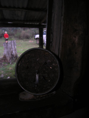 | 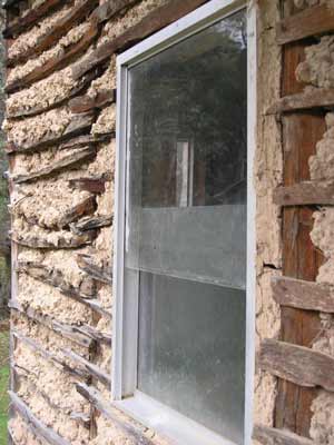 |
| Kelly's artistic shot of a clock inside Ledinghams Hut | A window in Ledinghams Hut |
A couple of hundred metres on we turn left to The Sink Camping Area. It is 500 metres down this track. An interesting thing that we learnt on the way out two days later that there is a steam engine and/or boiler in the area between this track and the main track to the south. Next time I will go looking for it.
A 100 metres before the main camping area there is a track off to the left. This leads to a camping site on the river that is big enough for a half dozen vehicles, although on this day two cars have hogged the whole area. We go onto the main camping area. Here there is a nice camping area, also right on the Retreat River. It is 3:50 pm. There are two cars here. We cannot use the northern end as the ground is sloped (but if you are using a normal tent there is a lot a spots over a small fence). To the south the ground is flatter.
Due to the low fence, we have trouble finding spots where we can put the section of our roof top tent (Robyn and Chicka also have one) and where Ron can put his camper. The site is badly planned, it should have some small bays to reverse into.
Anyway, we finally find spots, with Robyn and Chicka in the corner and we are only a few metres in front of them. You could not do this to someone you did not know. We both need to use some rocks to level the cars a bit as the ground also slopes here, but not badly.
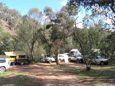 |  |
| The Sink Camping Area | The Retreat River at the Sink Camping Area |
The camping area has good fire pits (at least four here), a pit toilet and a sink. God only knows why it is here. What came first, the sink or The Sink? I have been told that it was put there before the site became a national park. There are also steps down to the river which is quite nice. We are soon set up and having some relaxing drinks. We are all planning to have baked dinners so I start preparing the fire. At 5 pm I get it going but just before 6 pm we have some very heavy rain. Luckily it does not last too long.
The fire is not going great, but we get it going enough to create some embers. We have the three camp ovens on and between us we cook chicken, pork and beef. The rest of the evening is nice weatherwise, although later on there is a lot of lightning around.
During the night we are awoken by very heavy rain.
Sunday 5 October 2008
The rain during the night continues on and off in the morning. As daylight saving started during the night, we have lost an hour's sleep so we all stay in bed till at least 9 am. We get up and have breakfast and finally we are all ready to go at about 10:45 am. Today we are planning on doing a tour of the national park, visiting each of the camping areas.
We head back up to the main trail (Retreat Fire Trail) and then head south. At the top of a hill about 1.7 kilometres from the camp site we come across an old bugger in a red Ford Laser. His name is Bob McMullan (or McMillan). He has come in this morning and he got stuck on one of the drainage humps just around the corner. He tells us that it took him an hour to get his car free, by jacking it up and digging out over the body.
Once he was free he had attempted to go back the way he came in but he could not get up the hill, it was too slippery. He had then decided to go back towards centre of the park and when he saw the flat cleared area at the top of the hill, he decided to set up camp. He had his billy on and advised us that he would stay till the track dried out. He said he had enough food and water for a week. I told hem that we would be leaving at about 10:30 am tomorrow and if he wanted to come with us, we would ensure he got out.
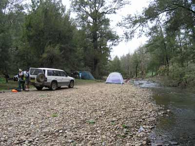
We continued on, turning left at Abercrombie Fire Trail (the track to the right is the main track into the park). The track drops about 150 metres and 3.3 kilometres on we come to the Retreat River again. There is a small camping area on this side off on the left (down a small track). It has a fireplace and would fit two ShippShape type cars or maybe three smaller tents. The river is easily crossed and there are some other spots down a small track off to the right. Just over a kilometre from the river crossing we turn left to The Beach Camping Area. This is on the Abercrombie River and is another 150 metres lower. The camping area is less than a kilometre down this track.
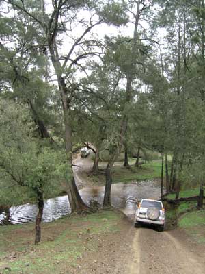 |  |
Crossing the Retreat River - you can camp
down to our left and across the river in front of Ron's car | This is The Beach Camping Area,
but not the main section |
The Beach Camping Area has four distinct sites. The first is a flat area raised up from the river and is the best site if there is any chance of the river rising. It is big enough for up to eight or so tents. The second site is below this one to the north and is on the river flat. It is large enough for four or so tents. The third site is right at the end of the track where it goes onto the river flat. This is the last choice of sites. The final site is around to the left on the river flat. It is big enough for about four tents. There is a toilet here as well as a number of fire places.
The river here is quite nice, with small swimming holes here and there. You will notice that there is a lot of rubbish up on the riverbank, showing how high the river can rise. Be very careful if there is any chance of rain that could make the river rise quickly.
We have morning tea here and then head off at 12:10 pm. Back on the Abercrombie Fire Trail we turn right and head south-east. After three kilometres (from the track intersection) we come to Middle Fire Trail. We turn right here as the Abercrombie Fire Trail sort of transforms into the Middle Fire Trail here and to stay on the Abercrombie Fire Trail you have to turn off.
About 2.9 kilometres on we cross Silent Creek (which can often be dry but today has lots of water). Over the creek we turn to the right and there are some camping spots here. Around the corner we come to the main camping area. This is the largest site in the park, it can handle at least 20 tents. There is a toilet here. and fire places.
 |  |
| This is the main part of Silent Creek Camping Area | Here we are having lunch at Licking Hole Hut
You can camp off to the left of the cars or over the creek past the hut |
We backtrack to near the creek crossing and continue up the hill. Six hundred metres up the track we turn left onto Silent Creek Fire Trail. There are some nice views from this track as we head north-east. The track follows a series of ridges at about 800 metres for 3.5 kilometres before it starts to drop down to Back Creek. We cross the creek and climb back up to 800 metres. We come to the intersection with Quobleigh Fire Trail about 1.5 kilometres along the trail. Here we turn left.
We now start to drop again, this time back to Silent Creek. After crossing the creek the track climbs to almost 950 metres. Again it follows the ridge and presents some fantastic views. The track gradually climbs to 1050 metres and 6.5 kilometres on we turn left onto Middle Fire Trail. We are heading to Licking Hole Camping Area.
This trail also follows the ridge and 3.5 kilometres along we turn right onto Licking Hole Fire Trail. This gradually descends the ridge till 2.5 kilometres on we come to Licking Hole Camping Area. As you come down you will see a track to the left that goes to a good camping area. You can also continue on, cross the creek and a short distance on, turn left at the hut and cattle yards. The hut here is small and worth looking at. While I prepare lunch, Kelly goes off and takes some nice shots of the hut and the stockyards. It is 1:45 pm.
 |  |
| A gate in the stockyards at Licking Hole Hut | A post at Licking Hole Hut |
After lunch, Heinz discovers that he has lost his phone bluetooth device. He figures that it is back a short distance where he stopped and got out of the car to pick up a rachet handle. He heads back with Ron and they soon find it. We cross the other creek and find a large camping area totally devoid of campers (all the others have many - but not full).
We leave at 2:20 pm and climb back up the track to the north on Black Hill Fire Trail (Licking Hole Fire Trail continues where we turned left at the hut). We get back to 1000 metres and 2.4 kilometres along we come to the intersection with Felled Timber and Retreat Fire Trails that we passed yesterday afternoon. The rest of the track is the same as we travelled yesterday. We stop a short distance on as we pass through private property and cut some fallen timber on the side of the road for our fire tonight.
It is 7.4 kilometres back to The Sink Camping Area. As we pass the private inholding, the waterwheel is in the water and generating electricity. We are back at 3:30 pm, having taken four hours and forty minutes to travel the almost 45 kilometres.
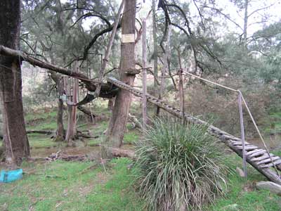 | 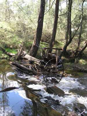 |
| The bridge over the Retreat River at the private property | The waterwheel in action |
We are all a bit dirty so I set up the Twine hot water heater and shower and most have a hot shower. A bit of luxury never goes astray when camping! At 5 pm we have drinks and nibblies and soon the fire is going.
Kelly and I have a barbecue and I then make a large crusty apple pudding in the camp oven which we all have for dessert. We head off to bed at about 11 pm. During the night a thunderstorm comes over and we have very heavy rain, lightning and thunder for more than 30 minutes and it rains on and off for a few more hours.
Monday 6 October 2008
As it is raining again, we all take our time in getting up. The plan was to be packing up by 9 am but we are a bit slower. Robyn and Chicka decide to stay here till their tent dries out. They are going to Yerranderie anyway, so we now only have the three cars. We finally get everything ready about 10:30 am.
We head back out towards Abercrombie Fire Trail and at the top of the hill we see old Bob waiting for us. He has decided to leave so he fits in behind me as we head down the hill. The hill that he had a problem with is right after this and I get a bit ahead of him to give him a chance to build up some speed. He gets to the steepest and slipperiest bit and has a lot of trouble but he finally gets past this section.
We turn right into Abercrombie Fire Trail and from here it is an easy run to the edge of the park and the main road that leads to the track. We are soon in farmland and at the intersection with Arkstone Road. Here Heinz and Ron need to pump their tyres up.
The wind is bitter at this exposed spot but while we wait Kelly and I have a long chat to Bob and find that he does a lot of touring and camping in his Laser. He is going to be away from home for a while and soon he says his goodbyes, he off to explore the other end of Arkstone Road to see if he can get through to the south. A funny old bloke!
We are heading to Oberon and it takes about an hour to get there. We buy some great pies from the bakery and eat them in the main street before we head home via the Blue Mountains. we have a very good run back, getting home at 3:30 pm (after striking some of the heaviest rain I have seen for years at Menai).
A really good weekend. We will definitely go back to Abercrombie National Park again.
| 
 v6.00.307 © 2003-2005