|
For the previous part of this trip, click here.
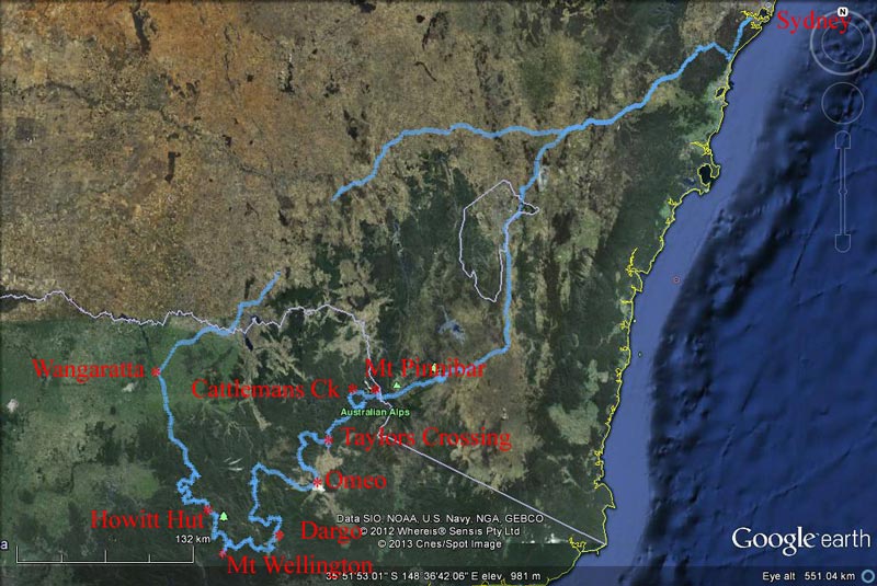 |
| Our route as recorded by our GPS using OziExplorer and uploaded to Google Earth |
Day 4 - Tuesday 25 December 2012 (Christmas Day) - Craigs Hut to Howitts Hut, Alpine National Park
Weather: minimum of 5.2ÂșC and fine
It was very windy during the night, with the trees squeaking as they rubbed together. It was about 6.5ÂșC when we got up at 7:30 am. We will have to get up earlier than the past few mornings as I want to leave relatively early. I want to get to Howitts Hut by shortly after lunchtime so we can set up for tonight's Christmas Dinner (Aussie style). It is not that many kilometres, but it will take us a fair while as the road is extremely steep and rough for most of the way.
After breakfast we leave at 8:50 am, a bit later than planned. We head back towards Mount Stirling for 750 metres till we come to The Monument Track. Last time we did not go this way (we continued past Craigs Hut to Circuit Road) but I wanted to try a different route. It is a very steep descent from here to Circuit Road. We stop at the top of the hill before starting the descent as we want to make some phone calls for Christmas Day. We continue after a 10 minute stop.
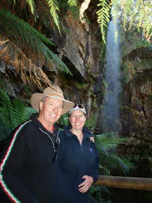 |  |
| Kelly and Michael at Bindaree Falls | Another photo at the falls |
At the intersection with Circuit Road (less than 4 kilometres), we basically cross it and take Bindaree Road which continues to descend to the Howqua River.
We stop at Bindaree Falls which are about 10 kilometres down this track. This is not well signposted as the sign is almost hidden. It is on the left just before you cross a small bridge. We walk the few hundred metres to the falls. They are quite small but interesting. You can walk behind the falls and it is a lot cooler here (if it is a very hot day). It takes 15 minutes to walk up and back, but we are here for 30 minutes. At 10:10 am we continue down this same track. It is now sunny and 15ÂșC.
A bit further down the road at the intersection with Upper Howqua Road, we turn right. A few hundred metres on there is another road that comes off to the left and crosses the Howqua River. This is the Bluff Link Road. It also appears to be called Link Road and in some publications, maybe 16 Mile Road. However, I am pretty sure that the Jeep 16 Mile Road is the name of the road to Bindaree Hut. Originally I planned to take the Bluff Link Road to the south but a check of the Parks Victoria web site back in November showed that it was closed. This was later clarified to be from the Jeep 16 Mile Road intersection (that is, where they meet at the other end). The Upper Howqua Camping Areas are also closed.
We continue to the west and just past the river crossing there is a spot where we have previously seen people camped near the river, but today it looks overgrown. We continue along the track to Bindaree Hut and cross the river. This is right where the hut is located. It is a very small and low hut. There is a very large camping area here, much nicer than where the other people were set up camp in 2007. There is also a toilet here. It is 10:25 am and we stop for morning tea. It is 16 kilometres to here from Craigs Hut.
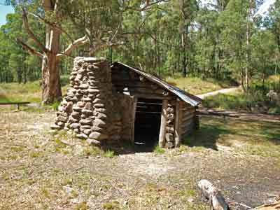 |  |
| Bindaree Hut | Pikes Hut |
At 10:55 am we continue on the 16 Mile Jeep Track as it heads south, basically following the Howqua River. After about 10 kilometres we come to the Pikes Flat Camping Area. This also has a hut called Pikes Flat Hut (probably the worst one we see - made from corrugated iron). This is a very nice camping area and there are a few people camped here with families. It has a toilet and across the river there were more sites, a toilet and a shed, but this now seems to be closed.
We only stop for about five minutes. We keep going and pass the turn off to Ritchies Hut which is about three kilometres further on, just off the main road. In 2007 we missed the track that leads to it as it did not appear to be signposted. As I suspected, the track comes off immediately after you cross a creek that feeds into the river and as you make a sharp left turn. However, you cannot drive there, despite what may be implied elsewhere.
 | 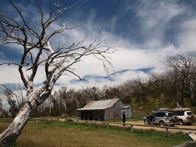 |
| Bluff Road approaching Bluff Hut | Bluff Hut |
We continue along the road as it turns to the east. We soon come to the Bluff Link Road again. This is 11 kilometres from Bindaree Hut and it has taken 50 minutes, including a short stop. At this intersection we turn right and just over 500 metres along we turn left onto a track that is signposted "Bluff Hut 4x4 Only". This is Bluff Track and Bluff Hut is only 2.2 kilometres along this track. It is a fairly steep ascent from here and we get to Bluff Hut at 12:05 pm. There is a very good camping area here as well. It is 1508 metres. The road has been graded only a few weeks before so it is in pretty good condition.
When we last visited in December 2007 Bluff Hut was being totally rebuilt as it burnt down in the 2006-7 bushfires. We stop here to take some photos. We depart at 12:30 pm. About 200 metres further up there is a grassy spot where you could also camp. We stop here for 15 minutes and walk across the grass to the edge of the cliff. This has great views out towards Mount Buller and Mount Stirling.
 |  |
| Bluff Hut | Mount Buller and Mount Stirling from above Bluff Hut |
 |  |
Kelly and Michael with Mt Buller and Mt Stirling
behind - taken above Bluff Hut | Donna looking at the view from above Bluff Hut |
After Bluff Hut we start climbing up towards Lovick Hut. It does not take long to get to the top of the ridge as the first section has also been graded, but as the road is pretty rough for the rest of the distance, the 6 kilometres takes 28 minutes. There are very nice snow gums along this section of the track. The height here is over 1680 metres. The track drops a little before climbing again. This part of the trip is Kelly's favourite, she reckons the snow gums, alpine grass and wildflowers make it look so beautiful.
We come to the intersection with Cairn Creek Track. Lovick Hut is actually about 300 metres to the left from the intersection. Lovicks Hut is located at 1493 metres.
In December 2007 it only consisted of some poles and beams. Again, I had thought at the time that Lovick Hut was burnt down in the 2006-7 bushfires, or perhaps even earlier in the 2003 fires. However, in 2015 I was told it was pulled down by the owner as it was falling apart. Today it has been almost totally rebuilt. It is a nice hut. There is also a camping area across the track behind the trees and a toilet behind the hut. The sites have a great grass cover and are under lots of snow gums. We stop here and have lunch. It is 1:15 pm when we arrive and 1:45 pm when we leave.
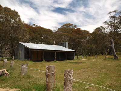 |  |
| Lovicks Hut | Lovicks Hut |
We are a bit behind schedule as Ron and Donna tend to stop longer at places than we do and I have not allowed for this.
After Lovicks we continue on the Bluff Track (I think it is still called that here). Kelly is driving and we continue climbing till we are on the top of the ridge. After 3 kilometres we come to Picture Point. This is a lookout and there are great views to Craigs Hut, Mount Buller and Mount Stirling. We stop here for only a few minutes to take some photographs.
 |
| The view to the north from Picture Point |
After another 2.3 kilometres we come to Brocks Road. Near this intersection there is King Billy No 1 Hut. It is up the walking track that crosses the road here. There is also a camping spot at this intersection (straight opposite where you have come from).
We turn left into King Billy Track and start a steep descent into the valley. It is slow as the track is very rocky. It is mostly high first and second or even low second and third.
During this descent we stop to cut timber for tonight's fire. We need a fair bit for our roast dinners tonight. A few minutes after finishing, we come across a bloke in a LandCruiser who says he has spent the past hour clearing the track a short distance further down. Sure enough, we soon come to a hairpin turn where a huge tree has fallen not just across one part of the track, but the two sections. Poor bugger!
 | 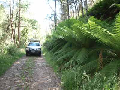 |
| A large mud hole on Bluff Track | King Billy Track along the Macalister River |
We end up following and crossing the Macalister River (twice) for about 2.5 kilometres before climbing back up again. It takes 86 minutes to travel the 14.4 kilometres from Brocks Road down the valley and back to the top of opposite side of the valley.
As you ascend up the many zig-zags, you will notice an area of the hillside that looks like a landslide. This is perhaps 100 to 200 metres across and extends from the top almost to the bottom. It is composed of large rocks that have no soil or growth whatsoever.
 |  |
| The rock scree as you come out of Macalister River Valley | Looking into Macalister River Valley |
Just after the top of the valley we come to a parking area. This is the start of a walking track to Mt Howitt and Gartner Hut. We do not have time to do the six kilometres round walk so we continue on.
Only 1.5 kilometres along we come to an intersection. Off to the left is Zeka Spur Track. Just before this we passed Butcher Country Track to the right. In 2007 we used Zeka Spur Track to access Wonnangatta Valley. Howitt Hut is about 2.5 kilometres down the Howitt Road which is straight ahead.
Before we get there, we stop at Howitt Plain for a few minutes. This large open area has a lot of wildflowers and the clouds are making a very attractive view.
 |  |
| Our camping spot at Howitts Hut | Michael, Ron and Donna at Howitts Hut |
We arrive at Howitts Hut at 4:20 pm. We are about 90 minutes behind my schedule, but all is well. This is a very beautiful spot. As well as the hut, there is a well and nearby a camping area with toilet. The whole area has lots of snow gums and they provide a lot of shade. We have a look at the various sections (in front of the hut, just above it and further up the track). We decide to set up camp right up the top of the camping area.
Tonight we are having a baked dinner for Christmas. As mentioned we have collected a fair bit of timber today as we need some nice coals to cook with. I start the fire straight away in the fire pit.
Before dinner is prepared, we have hot showers. At 5 pm we have drinks and nibblies. At 6:00 pm Ron puts his pork on as it is huge. Later we put the roast turkey roll on. We will share the meat as normal.
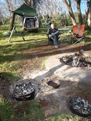 |  |
| The camp ovens cooking our Christmas Dinner | Ron and Kelly toast Christmas |
We are also having left over salads from last night and to follow, Christmas puddings with double cream. Yum!
The fire is a success and we get lots of coals. Our roast cooks in about 45 minutes and by 7:45 pm we are eating a traditional dinner of turkey and pork.
After dinner, we sit around the fire for a while. Later I heat up the puddings in the camp oven and we have them as dessert. We go to bed at 11:15 pm. It is a cool 6ÂșC as we go to bed.
Weather: Fine, max of 15ÂșC Arrived: Howitt Hut, Alpine National Park Time: 4:20 pm Distance: 62 kilometres
Day 5 - Wednesday 26 December 2012 (Boxing Day) - Howitt Hut to McMichaels Hut, Alpine National Park (?)
Weather: minimum of 0.9ÂșC and fine
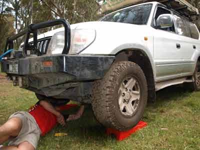
I listen to the ABC Radio news and stay in bed for a while. We do not have far to go, so no need to hurry. I get out of bed at 9 am. Kelly gets up a little later. I cook bacon and eggs for breakfast and then set about repairing the second bash plate that covers the transfer casing. This has always been a problem, right from when the Prado was two years old and I partially ripped it off (the front mounts are very flimsy). Yesterday it seems a rock or two tore it from its mount on one side (the other two connectors have been missing for 11 years). I find some fencing wire and use this to attached the plate back to the chassis.
Back in November when I was entering the waypoints and route for this trip into OziExplorer to upload to our GPS, I checked the Parks Victoria web site for any road/camping area closures. As well as the Bluff Link Road closure, a track called Kelly Lane was also closed. Bummer, as we wanted to go to Kelly Hut and stay there. However, in early December when I again checked, there was no mention of the closure. Hopefully it is open I think as we pack up this morning. In case it is not open, I have an alternate plan prepared.
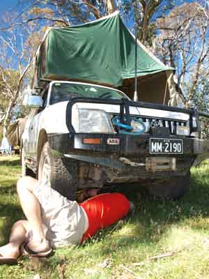 | 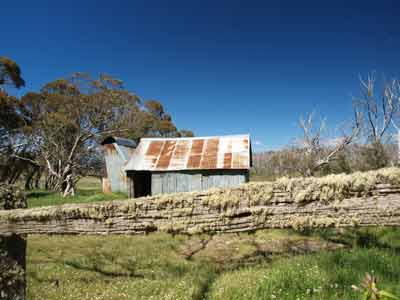 |
| Michael under the Prado repairing the bash plate | Howitts Hut |
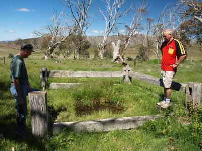 |  |
| Ron and Michael at the well | Michael from inside Howitts Hut |
We pack up and have morning tea. Before we depart, we drive back to the hut and have another look around. The light is much better now so we take some more photos. At 11:00 am we leave. It is sunny and the temperature has rocketed to 11ÂșC.
We head south again on the Howitt Road. This road travels along a plateau at about 1500 metres. Only just down the road is a spot called The Bastards Neck. This is a spot where the road goes along just off one side if a very narrow saddle that connects two plateaus. The road is on the western side of the neck and the ground drops off dramatically to our right.
 | 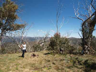 |
| Lichen on the fence in front of Howitts Hut | Kelly at Minogues Lookout |
Six kilometres from Howitts Hut is Minogues Lookout. The road to this is up and back to our right. We drive up the hundred or so metres and find fantastic views (as well as mobile phone coverage). We collect some firewood while here and leave at 11:40 am. Kelly also builds a small cairn.
A further seven kilometres along is the turn off for Bryces Gorge Car Park. This is a few hundred metres off the main road. There is a toilet, some tables and BBQs and a nice camping area. This would be a nice spot to stay for a night or two.
This parking area also gives access to Guys Hut. It is a one kilometre walk to Guys Hut. We do the easy walk (leave at noon and 45 minutes return including 15 minutes at the hut). We were going to do the loop walk from the hut to Conglomerate Falls and then to Pieman Falls and back to the car park, but we could not find the track out the other side of the hut area. The hut is very nice, with lots of original timbers. It was built in 1939.
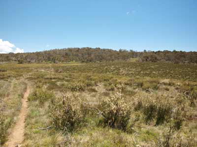 | 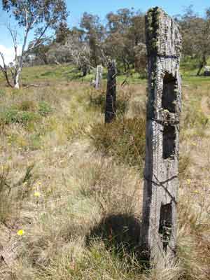 |
| The track to Guys Hut | The fence near Guys Hut |
 |  |
| Guys Hut with brilliant wildflowers out front | Kelly at the entrance to Guys Hut |
We return to near the car park and do the separate walk to Pieman Falls. This is about 1.5 kilometres each way and takes about 50 minutes including time at the falls. It is a very nice walk, we even see trout in the creek.
We have lunch when we get back to the car. We depart at 2:30 pm. It is now 17ÂșC. Only four kilometres along is the turnoff to Dimmick Lookout. It is about one kilometre off the main road and we arrive there at 2:40 pm. There are spectacular views out over the Wonnangatta Valley to the east. The lookout is not fenced, so some care needs to be taken. There is also a small spot where you could camp just before the turning circle. We leave at 2:55 pm.
 | 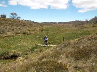 |
| Pieman Falls | Ron and Donna on a bridge on the walking track to the falls |
 | 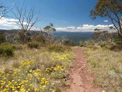 |
| Bryces Gorge Camping Area | Dimmicks Lookout |
The Howitt Road is actually a good dirt road, accessible to two wheel drive vehicles. We make pretty good time and after another seven kilometres we come to what is called the Snowy Range Airstrip. This is quite a good strip, probably only used for emergencies (fire and injury) as well as bringing staff and equipment in for maintenance purposes. There are quite a few buildings here as well.
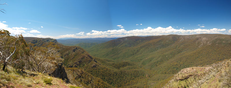 |
| A panoramic photograph from Dimmicks Lookout |
Another seven kilometres down the road we come to Kelly Lane. Sure enough, the road is open. We turn right and soon cross Shaw Creek where we stop to collect water. There is a track that comes off here that leads about 500 metres to a camping area called Holmes Plain. We go and have a look but we decide it is very plain (bad pun). There are no facilities at all. This was only ever a fall back plan anyway.
We continue on and five kilometres we arrive at Kellys Hut. It is 3:45 pm. It is very windy and the camping spot is a bit unprotected. There is a table here, but no toilet. We have a look at the hut. It is a pity you cannot camp right in front of the hut as this would be much more protected. We decide to have a look at the alternative first.
 | 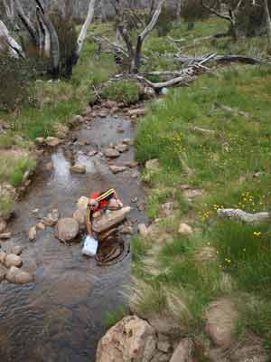 |
| Holmes Plain Camping Area | Collecting water from Shaw Creek |
 |  |
| Kellys Hut | Kelly at the door of Kellys Hut |
Another kilometre down the track is a turn off to McMichaels Hut. This is located closer to the creek and has a lot of trees providing protection. The hut is not as nice, and in fact the people who camped here before us must have been pigs as there are bottles and rubbish everywhere. However, despite this we decide to stay here. It is 4:05 pm.
We set up camp and spend the rest of the afternoon lounging around and reading (as well as picking up the rubbish). There is space for a few vehicles. The hut has a lot of different beer bottles inside, but that is no reason to leave more here (especially VB).
The creek is cold so we have hot showers (10 litres) and then drinks and nibblies. Dinner tonight is Sichuan beef stir fry, so Kelly and I get that ready. We already have a small fire going (so much better camping with a fire, even if we do not need the heat). Dinner was spicy, I loved it, but a bit warm for Kelly.
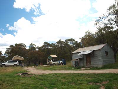 | 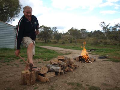 |
| McMichaels Hut | Michael showing the result of his axe work
(note the Aussie safety boots and refreshment) |
It gets cool at 8 pm so we crank the fire up a bit. Kelly and I went for a walk then back to the main road and then down to a creek. I found two number plates in the creek, obviously torn off as cars crossed when the water level was a lot higher than now.
Back at the camp, we play pot shots at a can with a sling-shot and then have some chocolate for dessert. We see six satellites, but the moon is almost full and it blots out most stars. We go to bed at 10:15 pm. Today we only saw two cars.
Weather: Fine, maximum of 17ÂșC Arrived: McMichaels Hut, Alpine National Park (?) Time: 4:05 pm Distance: 38 kilometres
Day 6 - Thursday 27 December 2012 - McMichaels Hut to Millers Hut, Alpine National Park
Weather: minimum of 3.9ÂșC and fine
I am up at 8 am this morning as is Kelly. She decides to go for a swim in the creek. Her comments in our logbook were "Very cold. Feet numb after 30 seconds". I figured this out last night as when I went to get water from the creek it felt very cold to me.
Every morning when we are camping, Ron treats Donna by making her a coffee which she has in bed. I do not do this for Kelly as she would never get out of bed! I need to encourage her to get up by offering the coffee as a bribe. This morning for some reason I do not need to do this and she gets up to freeze herself. Luckily it has warmed up quickly and is now 14ÂșC and sunny.
 |  |
| The pool on the creek just before Tamboritha Road | The small camping area near here |
We have breakfast and head off at 9:05 am. We continue south along Kelly Lane and go past through a couple of creek crossings. The track is very rutted in spots, people have driven on it when it was very muddy. Near the second creek there is a nice camping spot for a couple of vehicles.
At 9:22 we cross a bridge where there are a few good camping spots and a deep hole to swim in. We stop and have a look as there is another camping spot above this and a toilet. It is only a few hundred metres from Tamboritha Road. There was also another nice spot on the creek a few hundred metres before this, you needed to turn left at a T junction.
At 9:30 am we reach Tamboritha Road, six kilometres from McMichaels Hut. Tamboritha Road is a good 2WD road. We turn left and head north-east towards Arbuckle Junction, the intersection of Tamboritha, Howitt and Moroka Roads. Four kilometres along we come to Lost Plain. There is a picnic table and toilet and it looks like a reasonable place to camp.
 |  |
| Kelly and Michael at the viewing spot on Moroka Road | McFarlane Saddle Camping Area |
At Arburkle Junction, we turn right onto Moroka Road (really a continuation of the road we are on). A short distance along here there are really nice views out to the left over the Moroka Valley. We stop for a few minutes. We continue along Moroka Road.
We make good time and at 10:00 am we come to McFarlane Saddle, 19 kilometres from Kelly Lane. This is a camping area which gives access to some walking tracks. It has a toilet and is very nice. There are a couple of cars here, they have set out on one or two day walks. It is 1533 metres high here. We stop and have morning tea. It is sunny and 16ÂșC.
 |  |
| The view as you approach Mt Wellington | Ron ascending Mt Wellington |
 |  |
| Kelly on the summit of Mt Wellington | Kelly and Donna on top of the cairn on Mt Wellington |
We head off again at 10:25 am. Five kilometres along we come to the Moroka Range Track. This is not called the Mount Wellington Track like some books state. We turn right and head towards Mount Wellington. Four kilometres down this track we come to Mount Wellington Track. We turn right into it. This is a steep rocky track and it takes us 22 minutes to travel the four kilometres. On the way we cross the Moroka River, it is not too deep.
We arrive at Mount Wellington at 11:13 am. This is 1644 metres according to our GPS and has 360Âș views. There is a huge rock cairn at the top, must have taken ages to build it. We add another rock or two.
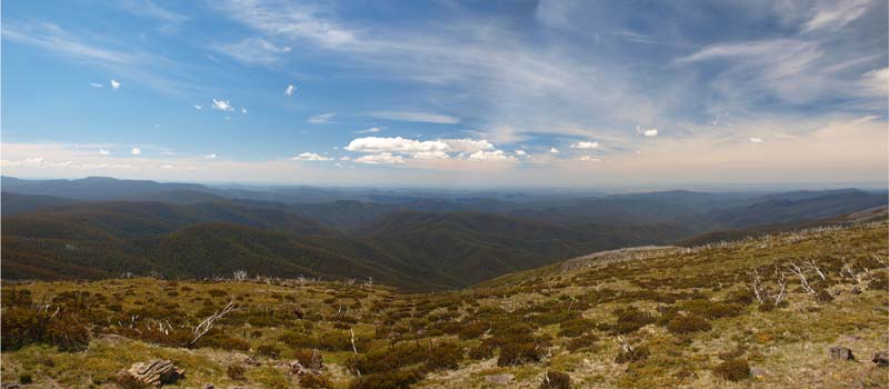 |
| A panoramic photograph to the east from Mt Wellington |
The view from here is again, like many other of the mountains in Victoria, spectacular. From here you can see Lakes Entrance to the east. One of the lakes, Lake Wellington, is at least 75 kilometres away and clearly visible. Moe and Sale to the south-west and south-east are visible and we speak on the UHF to people at Statford, about 55 kilometres away.
After a 37 minute stop, we continue on and arrive at Millers Hut at 12:15 pm, another five kilometres along the track. We have decided that if this is a nice spot, we will probably camp here tonight. It looks quite okay, so we will probably stay.
There is a walk from here that goes to Lake Tali Karng. This is the largest natural lake in the Victorian High Country. We had planned to do part of the walk, as the complete walk includes a descent of over 600 metres to the lake. Of course, you then need to ascend the same distance.
However, we decide to drive out to The Sentinels. This is supposed to be a lookout that looks down onto Tali Karng. This is not only a very rough track, it is quite overgrown. Ron turns around after a while as his Prado is relatively unscarred by branches on its side (well, it was before this track). We keep going and get to the end of the track (four kilometres) after 30 minutes. This shows you how rough it is, about 8 km/h average.
 |  |
| Kelly at The Sentinels looking west | Looking north from The Sentinels |
The Sentinels are (I presume) the series of rocks near the parking area at the end. We decide to walk to them (500 metres) and following the track. Well, this peters out and soon we are "lost". Kelly spots a red bellied black snake about a metre from her and then she sees some pink tape. Someone has used this to mark the track. We refind the track but again, we are lost. We cannot see any more tape and there is no obvious track. We decide to turn around. A bit of a waste of time, the effort in getting here both by vehicle and walking) has not been worth it. There are some nice views to the west and north-west. It took 35 minutes to walk less than 800 metres.
We get back to the car and have lunch (left-over turkey from Christmas dinner with cheese and toasted in a sandwich - yum). At 2:00 pm we head back to Millers Hut. It is low range first and second in many parts. There are also lots of mud puddles, but the bottoms are hard.
At 2:35 pm, we arrive back. It is 1414 metres high here. Millers Hut is very original, but there has been some damage or vandalism to the chimney area. We find some of the slabs for the wall near the chimney being used near the camping area's fireplace. We decide to carry them back to the hut and put them inside. I reckon they would not have lasted long, burnt on the fire.
 |  |
| Our campsite at Millers Hut | Michael repairing the bash plate again at Millers Hut |
There are other cars here when we return, but Ron and Donna have claimed the best spot. It turns out that these cars are only here for lunch and will leave soon. Another couple of cars come in later as well, but they soon leave. The whole area is nicely grassed, but there is only one area that is flat enough for us to set up our roof-top tents. This is straight in front of the hut, about 40 metres away.
We pick out spots and set up. As it is looking like there might be rain, Kelly and I put up our rear awning. I also have to make more repairs to the bash plate that I fixed on Christmas Day as the wire I used to tie it up on one side has slipped and it is hanging down a little. I add another piece and tighten up the first one. We read for the rest of the afternoon (Ron and Donna found the track to the lake but it looks too overgrown).
Just before 5 pm we have showers and then drinks and nibblies. Tonight dinner is lamb loin chops, sausages and pasta. We go to bed relatively early as there is some rain about. Soon after getting into bed, it absolutely pours down, but it only lasts less than 15 minutes.
Weather: Fine, maximum of 14ÂșC Arrived: Millers Hut, Alpine National Park Time: 12:15 pm (first time)Distance: 52 kilometres all up
For the next part of this trip, click here.
| 
 v6.00.307 © 2003-2005