|
Click here for bla first part of this trip
Day 12 â Saturday 20 July 2019 â Birdsville to Mungeranie - All times Queensland times
Weather: Minimum of 3.9ÂșC and fine
I get up at 7:55 am and make some toast to have with my tea for breakfast. We pack up and at 8:55 am we leave the campsite. I go and get some water to fill my containers. As I mentioned earlier, there are plenty of taps along the main road. The one closest to us is blocked by a caravan which has connected his plumbing to it as he is doing his washing! I find one that is not being used and fill up.
I then go to the Burke and Wills Tree which is on the other side of the river and road. Not much to see other than a very old tree (obviously) which has a scar on one side. This was the site of one of the spots where Burke and Wills camped back in 1861 on their ill-feted trip.
 |  |
| The Burke and Wills Tree, note the scar where the camp details were carved | Morning tea on the Birdsville Track |
Stephen and Phil leave while I wait for John to fill his water containers. We head off at 9:55 am and sit on about 90 km/h on the very good gravel road that is Birdsville Track. My nephew Pat (Stephen and Gailâs son) calls me and we discuss the trip. Pat bought my 1999 Toyota Prado earlier in the year. John and I catch up to the others about 10:20 am.
Due to the flooding earlier in the year, the main Birdsville Track is closed at one spot about 75 kilometres south of Birdsville. There is a temporary track around this and it is very rough. At 10:45 am we stop for morning tea at a spot where there is a large cleared area. It is 77 km from town. I take some drone photos while we are here.
 |  |
| Another drone shot of the Birdsville Track, our four vehicles at bottom | Stopped for lunch at Tippipilla Creek |
We leave at 11:25 am and once back on the main track we have better going again. The road varies a lot, I pass two slow caravans and there are more ahead of me. At 1:10 pm we stop at Tippipilla Creek where there is a camping area. Not the greatest spot where the toilets are, but I think you could find a nice spot in amongst the trees. We have lunch here, it is windy again and 23â°C. We have travelled 190 km since Birdsville.
We leave at 1:50 pm. The road is pretty good and there is a spectacular approach through Mungeranie Gap. We arrive at Mungeranie Roadhouse at 3:50 pm after driving 324 km today. I do not need to get fuel but the others do. I pay my $10 camping fee (per person) in the bar and then go to look for a spot. I find an area in the trees near the southern end where we can all fit. John comes over a little later and we make sure we take up spots so the others can also be here.
 |
| A panoramic photograph of Mungeranie Gap |
When John goes to pay and book a table for dinner, he finds out we cannot book a table but we will need to order dinner early so they can plan it. There are plenty of vehicles coming in all the time. Stephen and Phil fill up and come over and we pick out where we will all park and then set up camp. John goes and orders dinner for himself and me at 4:30 pm. I order chicken parmigiana, a bit expensive at $30 (but it is huge and very good). We say we want it about 7:00 pm (South Australian time, that is, 6:30 pm Queensland time).
 |  |
| The Mungeranie Hotel | Old Chevolet Blitz trucks at Mungeranie |
At 4:50 pm I go for a shower, so good, it is luxury to have more than 5 or 10 litres! We start a fire soon after and have some nibblies and drinks. At 6:50 pm (Queensland) we go to the pub after I put Veto to bed. It is packed (there are probably close to 50 cars camped here tonight) and I soon start speaking to some other South Sydney fans. The Rabbits are playing tonight but there is only Optus coverage here (again!) so I cannot watch or even get an update.
All beers are $6 each, so I have Coopers Pale Ale bottles. Later Cheryl and Deb who we saw at Noccundra and Innamincka come in and Cheryl keeps us up to date with Souths (we beat Cowboys 28-18). Dinner does not come till 8:30 pm. It does not help that it is apparently the chefâs first night! As mentioned, the meal was very good.
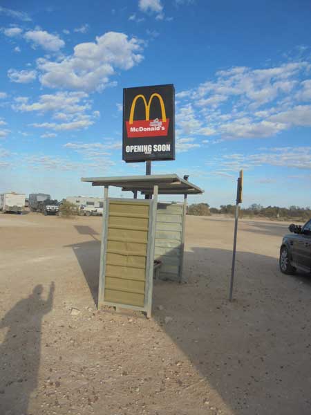 | 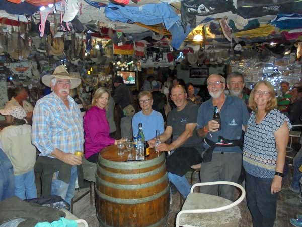 |
| A funny sign at Mungeranie | Inside the Mungeranie Hotel |
I am not sure how many beers we have, but it was certainly the most of the trip. It was a great night, we all enjoyed ourselves a lot. I later buy a nice long sleeve shirt for $70, very similar to the ones they were selling at the BRB but which sold out well before I even looked at the merchandise store. We go to bed at 10:30 pm.
Weather: Fine, maximum of 23ÂșC
Arrived: Mungeranie Roadhouse, Mungeranie Time: 3:50 pm (Queensland)Distance: 324 kilometres
Day 13 â Sunday 21 July 2019 â Mungeranie to Curdimurka (South Australian Times)
Weather: Minimum of 6ÂșC and fine
I get up at 7:10 am and have breakfast. I wash some clothes as I am running low. I hang them up to dry on my tent lines and later inside the car. The flies are very bad, worse than last night. I take some drone photos too. We pack up and leave at 9:15 am.
The road is mostly good and we sit on 80 km/h (for Stephen). At 10:30 am we stop on the southern side of Wannatalkanna Creek for morning tea. We have come 94 km. Once again my snorkel is loose, so I fix it here. A better fix will have to wait till I get home. We leave at 11:30 am.
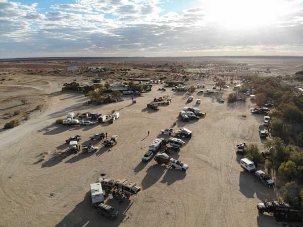 |  |
| A drone shot of Mungeranie looking from above our campsite to the roadhouse/hotel | Our campsite at Mungeranie |
At 12:35 we stop at Lake Harry Ruins. This is 174 km from Mungerannie. We have a look around. While here Stephen notices that he has lost the Anderson plug for his ESC (Electronic Stability Control), hit by a rock. Nothing we can do here. We leave at 12:54 pm. About 1:15 pm as I come out of a small creek, my dashboard says âNo cruise controlâ, âno precrash emergency brakingâ and then âCheck engineâ. What the! After a kilometre or so I find a safe place to stop.
Here I notice that the temperature gauge is showing nothing but my Scangauge is showing a horrendously high engine temperature. I quickly open the bonnet and there is water everywhere. Strangely, I did not have any come out onto the windscreen. I then notice that a hose has come loose. I put it back on and get some water from my tank.
 |  |
| The Lake Harry ruins | Stephen in a car at Lake Harry ruins |
I put it in the water container which is empty. I put more in, it boils. I leave the engine running. By now the others have caught up with me and we put more water in. The temperature on the Scanguage comes down to something like 160â°C, it is normally 80â°C. I turn off the engine for a while and then restart. I do this a couple of times and at the last one the car barely ticks over, but eventually starts. I decide I will not turn off again. The temperature is down to 120â°C, so I drive slowly for a few hundred metres, then top up the water again. If I had my reading glasses on I would have seen a notice near the water container which says how to bleed the system!
The temperature drops to 90â°C so I drive some more and it goes to 111â° to 120â°C and then put more water in. Eventually it is 85â°C so we drive slowly to Marree (we were about 10 km out). Here I get in the fuel line and top up (82.7 litres at $1.97 a litre, average 13.6 litres per hundred kilometres), leaving the engine running. I then buy some coolant and add that to the system. A few slow runs around and out of town and the temperature is back to 82â°C.
I get a pie from the roadhouse too and have that, a weird spaghetti bolognaise one. Nice though. At 2:45 pm we leave and head up the Oodnadatta Track. The temperature is now nearly normal. We stop at the sculpture park (see my 2010 trip report for photos) at 3:30 pm (56 kilometres from Marree) and I put the rest of the coolant in the tank as well as about two more litres of water.
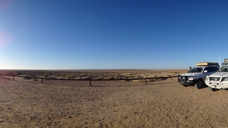 |
| A panoramic photograph from the lookout at Lake Eyre South |
Of course the Oodnadatta Track follows the Old Ghan Railway and we are mostly only a few metres from it. There are bridges, old ruins and thousands of timber sleepers. We leave the sculptures after 15 minutes and by the time we get to Lake Eyre South (minus 4 metres at the lookout) 40 kilometres along, the car is running at 80â°C plus or minus two degrees as it should. Everything seems to be okay.
John and I are a long way ahead of Stephen and Phil, so we are back on the road before they get here. We spend less than 10 minutes here and at 4:33 pm we arrive at Curdimurka Siding. This is 106 kilometres from Marree. This is the site of a fettlersâ cottage for the Ghan Railway and has been partially restored. There is also some track, a water tank and water softener for the steam engines. Until 2008 there was a bi-annual ball here.
 |  |
| The train track at Curdimurka | Curdimurka looking east |
We decide to camp behind the fettlersâ cottage as there is a bit of wind from the south and this protects us. I start a fire as tonight we are all having a roast dinner. I then set up camp. The others arrive about 4:50 pm. Once we have everything setup, we have drinks. I then prepare my pork roast and vegetables. I put them on at 5:45 pm as the meat is a fairly thin piece that you can also cook on a barbecue.
 |  |
| Sunset from the drone at Curdimurka | Our camp ovens are on for a big Curdimurka dinner |
Gail cooks corned beef on the stove and a half pumpkin filled with cream in the camp oven. Cathy cooks something else, I cannot remember what! At 7:10 pm it is all ready. We share all the meals and have a brilliant dinner.
It is very dark as there is no moon up. We see a few shooting stars and satellites. We go to bed just after 10:00 pm. A stressful day that ends up okay.
Weather: Fine, maximum of 19ÂșC
Arrived: Curdimurka Siding, Curdimurka Time: 4:33 pm Distance: 308 kilometres
Day 14 â Monday 22 July 2019 â Curdimurka to William Creek and back to Coward Springs
Weather: Minimum of 2.2ÂșC and fine
I get up at 7:30 am and have breakfast before taking some more drone photos. Our plan is to head to William Creek and if the others can get on a flight over Lake Eyre, then we will stay there tonight. If not, we will probably come back to Coward Springs. The problem is that they did not book a flight four weeks ago and everything is full. They are hoping that there is a cancellation this afternoon or tomorrow morning.
 |  |
A drone shot just after sunrise at Curdimurka - I now
have this as a large canvas print in my living room | The water tank and softening plant at Curdimurka |
We pack up and leave at 9:15 am. It is a short 29 kilometre drive to the Mound Springs. These are small hills that have formed by the artesian waters coming out of the ground naturally and depositing sand etc, sort of how a small volcano forms. Last time I was here the road in was very rough, so I tell Stephen to leave his car and van at the start of the track in. Gail gets in my car and Stephen goes with John. It is 9:45 am.
 |  |
| The Bubbler | Blanche Cup, note the new(ish) timber deck |
Yep, it is very rough, looks like they have not graded it since 2010 when I last visited! We go to The Bubbler first and then Blanche Cup. They are only a few kilometres off the Oodnadatta Track and not far apart. The water is warm and every now and again it âeruptsâ as air comes out with the bigger flow of water. I notice that since 2010, they have built timber decks around the springs. I take some drone photos of both spots and we leave at 10:10 am.
The Oodnadatta Track is a lot rougher and despite sitting on 80 km/h as planned, I get a long way ahead. At 11:00 am I stop to let the others catch up. We are now 77 km from Curdimurka and I have to wait 15 minutes before they arrive. I have a cuppa and Veto has a run. Back on the road the track stays the same and we arrive at William Creek at 11:50 am. This is 38 km from where I stopped, so I have averaged 65 km/h.
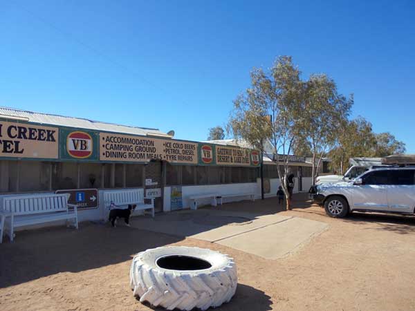 | 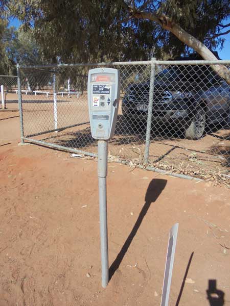 |
| William Creek Hotel | Parking meter at William Creek, ha ha!! |
There are lots of cars here. Stephen and Gail go to check on flights but as expected, none are available till Friday. Phil and Cathy book for next Saturday as they have decided to go to Uluru and then stop here again on the way home. We were going to eat lunch in the pub, but they only seem to have proper meals which are quite expensive. Instead, we make our own lunch. Everyone has a look at the pub, I cannot find the dive club sticker we put on the window in 2010, looks like they have done a cull.
After this, Stephen goes and refuels (his HiLux tank is small) and Phil and Cathy head off further up the track towards Oodnadatta. We leave at 1:05 pm and head back towards Marree. The road seems to be a bit better heading in this direction, but as I am last and following Stephen, it is much slower. We arrive at Coward Springs, 74 kilometres from William Creek at 2:45 pm, averaging only 45 km/h, but a great fuel economy of 9.9 l/100 km.
I go in first before the others arrive (I over took them earlier) and find a good spot for the two cars and a car and van. By now they have arrived so I walk to the gate to meet them. The caretaker has arrived and we pay him out $15 per person. Gail also hands over the Australia Post mailbag which she picked up in the William Creek Hotel. It had a note on it asking if someone could take to Coward Springs!
We set up camp and then I take Veto and go to the spa. This is made out of railway sleepers from the Old Ghan Railway (as are the showers and toilets). The water is about 26â°C, nice but could have been warmer. Some other people come in and we have a good chat.
 | 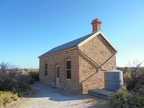 |
| Our campsite at Coward Springs | The drivers cottage at Coward Springs, now a mini-museum |
After the spa (40 minutes), I set up my cabana and sit inside away from the flies while I have a cuppa and read. I later start a fire in the fireplace (an old large LPG cylinder). We are having pizza tonight and Gail makes the dough. Everyone has donated some bits, we have salami, ham, bacon, chicken, pineapple, capsicum, beef, hot sticks, garlic, chilli, herbs and of course cheese.
Once the dough is ready, Gail makes it into pizza bases the right size to fit into my camp oven. I make up two garlic and cheese ones and I cook these as an entrée. What I do is put the camp oven on the direct fire and also have some coals on the top. We share these and then each person makes their own pizza. I put them on aluminium foil and drop them into the oven on a trivet. Each one takes about four to five minutes to cook. Better than any pizza from a shop!
We go to bed about 10:00 pm. The camping area here is pretty full, but there are still some available spots. A fantastic place to spend a night!
Weather: Fine, maximum of 20ÂșC
Arrived: Coward Springs Time: 2:45 pm Distance: 189 kilometres
Day 15 â Tuesday 23 July 2019 â Coward Springs to Farina
Weather: Minimum of 5.0ÂșC and fine
I get up at 8:00 am as we do not have that far to travel and some of that will be on tar roads. I have a sausage sandwich for breakfast, using up the last one I cooked a few days back. Something different! I give myself a haircut and repack my clothes into their containers, some things I will probably not need again this trip. At 8:50 am Veto and I go for a walk and I take some drone photos. We go to the museum and I find the visitor book that Kelly and I signed back in 2010.
I then have a shower, hot water using a donkey boiler. Nice! We leave at 10:05 am and stop at Curdimurka Creek to cut timber. However, Stephen misses the turn off so we tell him to keep going. John and I cut some timber, filling up our containers. This is the first I have cut since before Birdsville. We leave at 10:50 am. The road is good in spots as there is some grading going on.
 | 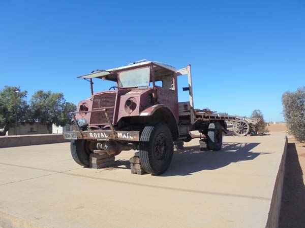 |
| The Marree Hotel | Tom Kruse's mail truck, a Chevy Blitz |
We arrive in Marree at 12:25 pm, having travelled 132 kilometres this morning. We go to the Marree Hotel and order lunch. We all have Marree Burgers (the lot with chips) at $24. Expensive but very good. I wash it down with e Coopers Pale Ale ($8). We have a look around town at the train displays and Tom Kruseâs old mail truck and then the Tom Kruse Museum which is new and is in the hotel. Excellent display.
We head off at 1:45 pm and drive at 80 km/h (the speed limit, no idea why so low) along the now tar road to Farina, an old deserted town. We arrive there (57 kilometres) at 2:35 pm. There has been a bakery operating here the past couple of months using the refurbished underground bakery. There is also a brand new building that will be the bakery and visitor centre, fits in well. However, as luck would have it, the bakery closed for the year yesterday. No idea why they would shut it when there are still plenty of people travelling in the area.
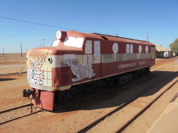 |  |
| One of the later diesel trains used on the Ghan Railway | The post office ruins at Farina |
After a quick look around (I have been here twice before), I move to the camping area. This is on the Farina property and costs $5 per person. I look around and notice that there is now no grass anywhere, last times there were very nice grass spots. We take a while to decide where to camp as the wind is up again. We finally settle on a spot which is a bit more protected and just after 3:00 pm we set up camp. At 4:00 pm I start a fire in the donkey boiler which heats water for the showers. There area also flushing toilets here.
I then help Stephen fix his caravan's Electronic Stability Control. You may recall that the connector got bashed to death a few days back. Stephen purchased another Anderson plug and some solder in Marree. I have a blow torch attachment that goes on a propane cylinder. We use this to heat the metal plug parts and melt the solder into it and stick the wire in. We then crimp it as well. We put it all back together and it works (at least according to the lights).
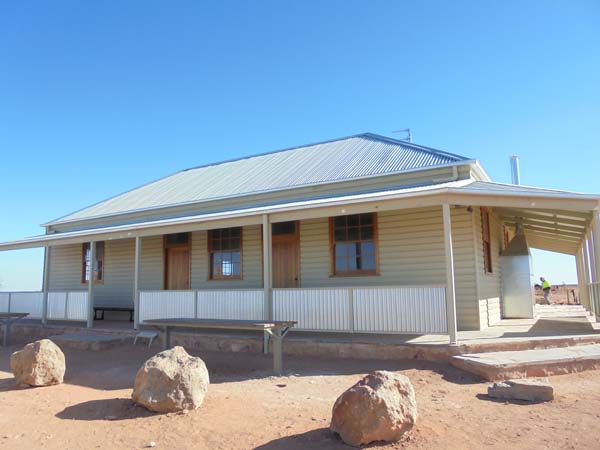 |  |
| The new bakery building | Our campsite at Farina |
During all this I keep adding small bits of wood to the donkey boiler. Gail goes for a shower and reports it is nice and warm. We all end up having showers, it was good.
At 5:10 pm we have drinks and nibblies and at 6:00 pm I start a fire. The wind has now dropped enough so that it is safe to do so. I cook rissoles with canned potatoes. For dessert I make my apple crumbly pudding which takes about an hour to cook. Very nice as normal.
The others go to bed at 9:00 pm but I stay up reading till 9:45 pm when I retire for the night.
Weather: Fine, maximum of 19ÂșC
Arrived: Farina Time: 2:55 pm Distance: 189 kilometres
Day 16 â Wednesday 24 July 2019 â Farina to Hallett
Weather: Minimum of 4.4ÂșC and fine
I get up at 7:10 am and have breakfast and then pack up by 7:50 am. I fly the drone and take photos of the camping area as it was too windy yesterday. From this I realise for the first time that the camping area extends a long way to the east. Next time I will need to have a look up that way.
John and I are separating from Stephen and Gail today as they are heading into the Flinders Ranges and we are going south. At 8:30 am we leave and head down via Lyndhurst and at 9:20 am we stop at Leigh Creek for fuel. This is 67 kilometres from Farina. I take 74.1 litres at $1.745, an average of 13.4 litres per hundred kilometres since I last filled up at Marree 552 kilometres ago.
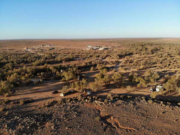 |  |
| Looking back towards the Farina ruins from above the campsite | Our campsite |
Ten minutes later we leave and at 10:30 am we stop at some railway ruins, another fettler cottage, which has a spectacular backdrop of the Flinders Ranges. We have morning tea and at 10:55 am we leave. At 11:35 am we stop at Hawker, the largest town we have seen since Bourke over two weeks ago.
We go to the small supermarket and get fresh bread, yoghurt, cereal and a couple of other things. We leave at 11:50 and continue on our way along Flinders Ranges Way to Quorn where we arrive at 12:35 pm. We have travelled 289 kilometres this morning. We have lunch in a nice park in the main street, opposite some beautiful old hotels.
 | 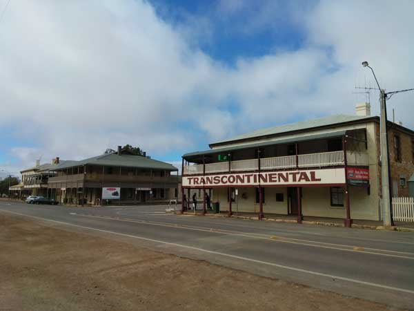 |
| The fettler cottage with the Flinders Ranges in the background | Quorn |
The picnic area has tables, undercover tables and barbecues, it is really good. While here we witness what we think was an attempted drug buy. Just after we come to the park, a woman walks is dropped off by a bloke in an SS Commodore. She sits under one of the covers and continually plays with her phone. Soon after a bloke comes in and ignores her but goes and sits at another table. Here they stay for at least 40 minutes. We assume that after we left at 1:10 pm they did the deal.
We turn at Quorn and head towards Wilmington on the Main North Road. At Wilmington there is a toy museum and outside there are parked more than eight Land Rovers of various vintages, as well as an old Jeep and a Valiant. We only stop to take a photograph. Since just after Quorn the countryside has changed dramatically, the desert replaced by very green hills and paddocks. At Wilmington we are only about 20 kilometres from the top of Spencer Gulf.
We travel via Booleroo, Appila, Jonestown and then to Hallett. This is really good farming land. There are also hundreds of wind turbines on the hills just before Hallett. The road is also all tar except for one small five kilometre section which was great anyway. We get there at 3:15 pm, 460 kilometres travelled today.
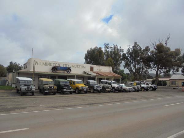 | 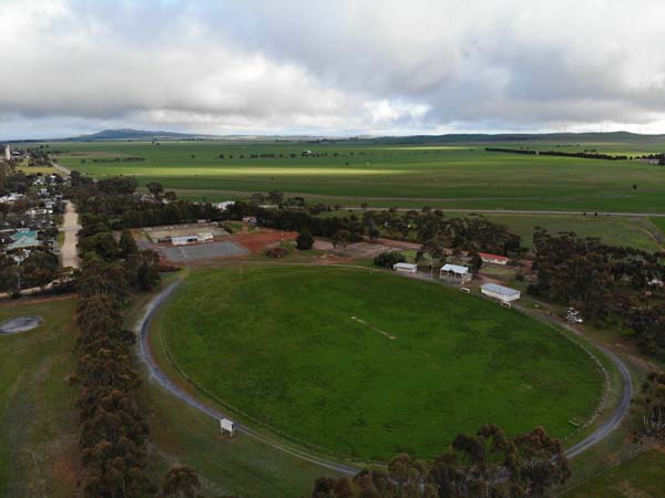 |
| The Land Rovers outside the Wilmington Toy Museum | A drone photo looking towards the hotel |
At Hallett we plan to stay at the sports ground which is shown in WikiCamps as a camping spot. They are doing work on part of the grounds (putting in basketball or netball courts) so the entrance has been moved. There must have been some rain here in the past few hours as the gravel road is a very sticky mud. We go in and find a spot to camp.
Unfortunately, despite what WikiCamps says, the toilets and showers are closed, with very conflicting information about how to get a key with phone numbers crossed out and a claim that if the above do not work, you can get from pub after 6:00 pm. The publican later tells us he knows nothing about this. It is not too bad, but the grass needs cutting.
On the other side of the oval (which does not look like it has been used for a long time and the grandstand is falling down) is the Barrier Highway. This runs from south of here over 1,000 kilometres to Broken Hill, Cobar and Nyngan in New South Wales. There is a bit of truck traffic but during the night we do not really hear much.
 |
| Wildongoleechie Hotel at Hallett |
Anyway, it does not look like many people camp here. We set up and start a fire in my firepit as it is cold and rain is possible (we had a few drops on the way). At 5:15 pm we have drinks and at 6:10 pm we have dinner, I cook lamb steaks with fired rice. After this we walk to the Wildongoleechie Hotel.
This old pub is not open everyday, but it is tonight. There are three blokes in there and it is nice and warm with a log fire going. The publican tells us he is leaving and someone new is taking over in the coming months. At the moment he does not offer accommodation due to "cost of insurance". We talk to the blokes, they work on local properties. Later one leaves and another bloke comes in, he owns a couple of nearby farms as well as one further south. We have a good time talking to them.
I have a few Coopers Pale Ale bottles, $6 I think. We leave about 10:00 pm I think (I forgot to write that down) and go back to the camp where Veto is asleep in my rooftop tent.
Weather: Overcast, maximum of 16ÂșC
Arrived: Hallett Sportsground, Hallett Time: 3:15 pm Distance: 460 kilometres
Day 17 â Thursday 25 July 2019 â Hallett to Waikerie
Weather: minimum of 4.3ÂșC and overcast
I get up at 8:00 am and after breakfast, we go for a walk through town. We notice that the petrol station is closed (it is also the general store) and then remember that at the pub last night they said power was going off this morning. We try to use the toilets behind the day use area but they are inexplicably (to us) closed. We then try to use ones behind the library and after John goes in, a bloke comes and shuts them due to the power outage. Seems the water to the town relies on pumps. Bugger, I need to go!
We go back to the camping area and after packing up we leave at 10:00 am. We saw a sign advertising an historic woolscouring dam when out walking so we go to have a look. A disappointment as all that remains is a small rock wall. We then drive to the railway station as I had seen on the internet references to camping here. There is a very nice toilet (which I of course have to use) and it would be a nice spot to camp except it is only metres from the Barrier Highway.
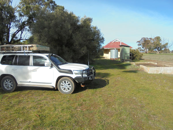 | 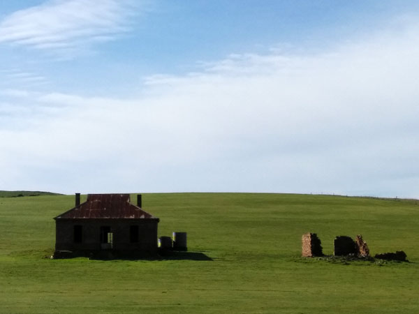 |
| The camping spot at Hallett Railway Station | Midnight Oil House just north of Burra, featured on the cover of Diesel and Dust |
We leave at 10:20 am and ten minutes later stop at the "Midnight Oil" house. This is an old ruin that was on the cover of Diesel and Dust. It is just over seven kilometres before Burra. You can tell a lot of people stop here as there are bare patches on the side of the road and a track to the fence. We take some photos.
At 10:50 am we arrive in Burra. This is a very historic old town, famous for its mine and old buildings. It is also famous in Australian historic heritage management circles for the "Burra Charter" which was adopted in 1992 and defines the basic principles and procedures to be followed in the conservation of Australian heritage places.
 |
| A panoramic photograph of the quarry of the Monster Mine at Burra |
We first go to the huge mine which is just on the outskirts of the main centre of the town. It was called the Monster Mine. We go to the Town Lookout and then the Mine Lookout. After this we go to the mine itself. You can "purchase" a key which gives you access into a lot of buildings, including ones here. We are not stopping long enough to make use of this, but next time I come I will.
 |
| A panoramic photograph of the Monster Mine at Burra |
The open cut quarry is huge, mined from 1848 to 1877 and then later in the early 20th century and lastly from 1970 to 1981. It was a copper mine and at one stage produced 5% of the world's copper. We walk around the section of the mine you can visit without a key, interesting and well preserved and interpreted. While here we have morning tea. We leave at 11:35 am and drive into town and park there.
We walk back the way we came in and look at all the beautiful old buildings. Some of the outstanding ones are the Town Hall, the Catholic Church and the Anglican Church. The last one is open and we go in and have a look (with Veto as the parishioners outside told us we could).
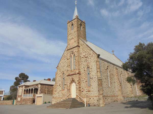 |  |
| The Burra Catholica Church | The Burra Anglican Church (right) and hall (left) |
From here we walk back into town. We see a very nice building on the other side of the river and attempt to drive there but cannot figure it out. We go back to the park near the river and have lunch. Another nice spot. Near here there are dozens of old miners' houses that are being done up for tourist accommodation.
 |  |
| The Burra Town Hall | The Burra Railway Station |
We leave at 1:00 pm and go to the railway station and then head off towards the Murray River. We go to Morgan via the Goyder Highway and then cross the Murray River at Cadell via a small car ferry. We then go to Wailkerie which is on the river. At 2:45 pm we pull into the shopping centre. While John goes to the supermarket (Woolies), I go to BWS and buy a carton of beer, TED ($52).
 | 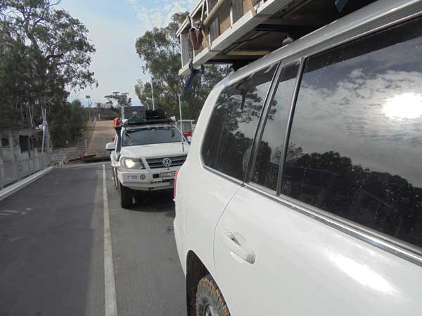 |
| The ramp down to the ferry | Crossing the Murray River on the ferry |
We then go to the huge silos which have been painted with art. We stop there for a while and take some photos. Really nice and one of many such installations now in Australia. We leave at 3:10 pm.
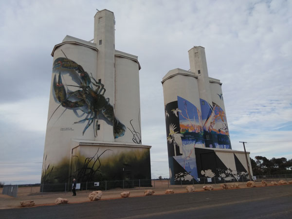 | 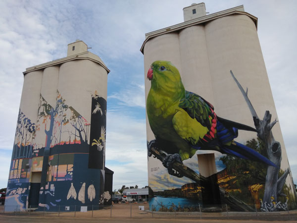 |
| The Waikerie silos | The Waikerie silos |
It is only a few kilometres to Holder Reserve which is on the Murray River on the eastern side of Waikerie. Thiis consists of a lot of different spots, there are hundred of campsites along quite a few kilometres of the river. This one is the closest to town. There are a few caravans here, but plenty of large spots. We pick out a site and set up camp.
We are right on the river, with great views. The river winds around a bit here so there are plenty of bends. The river on the outside bends has huge cliffs. I set up the shower and heat 10 litres of water for my shower. Brilliant! I then heat 10 litres for John.
 |
| A panoramic photograph of the site at Waikerie |
After showers we have nibblies and drinks and I also start a fire. I am having pork ribs with a smoky seasoning rub. I am cooking them in the camp oven so once I have some coals, I put them on as I plan to cook slowly. After 50 minutes they are done, I have with leftover fried rice from last night. Brilliant!
 |  |
| Our campsite at Waikerie | The Murrary River at Waikerie |
After this I watch the rugby league on my phone, Cronulla are playing North Queensland but I cannot recall who won! We go to bed at 10:10 pm and it is cloudy and a warm 11ÂșC.
Weather: Mostly overcast, maximum of 19ÂșC
Arrived: Lower Holder Bend Reserve, Waikerie Time: 3:15 pm Distance: 180 kilometres
Day 18 â Friday 26 July 2019 â Waikerie to Balranald
Weather: minimum of 9.4ÂșC and overcast
There is a very slight drizzle, not sure when it started, but it is still going at 8:00 am when I get up. I have been awake since 6:30 am, reading. After breakfast we pack up and the rain gets a little heavier about 8:30 am. We leave at 9:20 am.
It rains most of the way to Renmark (we go via Barmera). There are huge numbers of vineyards along here, as well as some olive and walnut farms. After Renmark we stop at the fruit fly inspection station (only checks going the other way) for morning tea. It is 10:40 am and it is still slightly raining.
We are back underway at 11:00 am (SA times before now) and soon pass into Victoria. At 11:45 am (Vic/NSW time) we stop and cut some timber. We leave 10 minutes later. At 12:10 pm John gets pulled over by a Police car which was going in the opposite direction. I stop a bit further on and wait for him. The reason he was stopped was because one of his headlights is out. We found this out a few days ago but we have not seen anywhere to get a new bulb. The Police let him go with a warning.
The road across this part of Victoria is very straight and pretty flat. It is desert really. At 12:50 pm we arrive in Mildura in Victoria. This is also on the Murray River. We go to get fuel (103 litres at $1.459, 13.0 litres per hundred kilometres for the 791 kilometres since Leigh Creek. I also buy a roast chicken from Woolworths and some rolls and we then go to an automotive parts store where John gets a headlight globe.
We go to a park on the river and have lunch there. This is where I came almost four years ago when I was looking for a new dive boat. I drove here from Sydney and back home in two days, but did not buy the boat but I bought an identical model later. It is a nice park.
We leave at 2:30 pm and cross the river into New South Wales. We take the Sturt Highway which we have been on since Renmark. Just before Balranald we turn off the highway and drive south to the Murrumubidgee River. At 4:15 pm we arrive at the Balranald Weir.
 |
| Our campsite at Balranald Weir |
This is a very nice spot, some grass areas, suitable for caravans and tents. The water is flowing over the weir and the river red gums are beautiful. We set up camp and start a fire. I also collect some more timber as it looks like being cold and possibly wet this evening.
Later two LandCruiser 200s with caravans come in, we passed them earlier. They set up camp closer to the river. I give them some timber I cut and John and I go over and have sundowners with them. They are from Victoria (Lee and Chris, Silvio and Rita - Lee and Rita are brother and sister).
 | 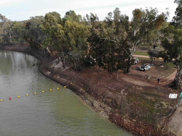 |
| Looking down the Murrumbidgee River | The campsite and river |
After this John and I cook dinner, I have chicken breast and fried rice. It rains a little on and off during the evening. We sit around the fire and I watch South Sydney play St George. Souths were leading till two minutes before full-time when Saints score and go ahead. With two seconds to go, Souths score a miraculous try and win!!
Weather: Raining, maximum of 18ÂșC
Arrived: Balranald Weir, Balranald Time: 4:15 pm Distance: 379 kilometres
Day 19 â Saturday 27 July 2019 â Balranald to Wagga Wagga
Weather: minimum of 7.7ÂșC and fine (high overcast)
I get up at 8:00 am and have breakfast and take some drone photos. We pack up and at 9:22 am we leave.
We continue on the Sturt Highway through Balranald and at 10:55 am we arrive at Hay. We head off the highway towards town and stop at a nice picnic area near the river as you enter town. There are nice clean toilets and some tables. Best thing, there is the best grass we have seen since leaving home and Veto spends a lot of her time rolling on her back, scratching herself.
Even funnier, if I pull on her lead, she lefts me drag her along upsidedown across the grasss. She makes no attempt to stop me doing this or getting to her feet, she is loving the grass.
At 11:23 am we leave and return to the highway. We stop at Narrandera at 1:20 pm (316 kilometres) for lunch at a park just inside the town. Again, nice toilets and undercover tables. We leave at 1:52 pm and return to the highway. We continue towards the east.
We go via Wagga Wagga, turning off the highway here and going around the northern side of the town and then to Oura. We are camping at a spot called Oura Beach which is on the Murrumbidgee River. As for the past four campsites, this is on WikiCamps. I have been here before, a few years back, but I did not stay.
We arrive at 3:10 pm. The site is quite large, fronting the northern side of the river for about 1.5 kilometres. There are spots all the way along, but the best ones I think are near the main area where you drive in. There are also two sets of toilets here and some tables. We have a look around and decide to camp on the southern most section which has a table, firepit and is near one of the toilets.
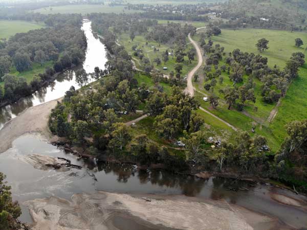 |  |
| The Murrumbidgee River at Oura Beach, we camped one third from right above river | The campsite at Oura Beach |
We set up camp and I have a hot shower. I then start a fire as it is a bit cool. We have nibblies and drinks and then I cook sausages with potatoes. I go to bed at 10:15 pm.
Weather: Mostly fine, maximum of 18ÂșC
Arrived: Oura Beach Reserve, Wagga Wagga Time: 3:10 pm Distance: 435 kilometres
Day 20 â Sunday 28 July 2019 â Wagga Wagga to Kareela
Weather: Minimum of 3.7ÂșC and foggy
I get up at 7:10 am and have a quick breakfast and then pack up. It is very foggy and cold. There is a very heavy dew as well and every part of the car and rooftop tent is freezing cold. By the time I have finished packing up, my fingers are hurting me a lot, a bit like frostbite I imagine.
I leave at 8:10 am but John stays, he will leave later at a more reasonable time. I have to leave so early as I have to meet up with my soon to be ex-wife, Kelly, at Goulburn at 11:30 am. This is so she can see Veto as she is going to the snow for a week.
It is slow going till I get to the Hume Highway as the fog is very thick in places and I have to travel slowly at times. Once on the highway I can sit on 110 km/h.
I get to Goulburn at 10:45 am and go to a service station to refuel as I do not have enough to get to Sydney. Guess what, Kelly is at the same one also refuelling. I fill up, 114 litres at $1.399 for an average of 13.5 l/100 km for the 842 kilometres since Mildura.
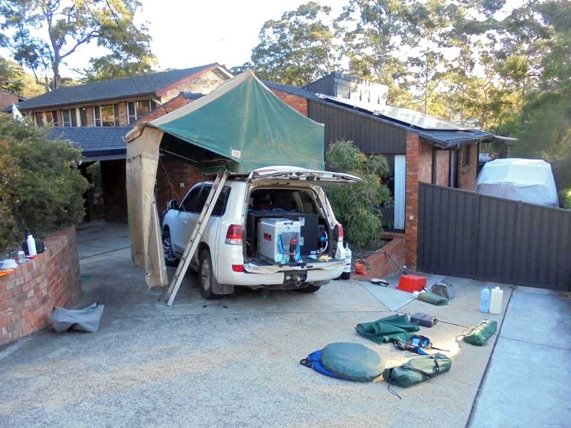 |
| Back home and unpacking |
We go to a nearby dog park and Kelly plays with Veto and I have morning tea. At 11:50 am we both leave, I am really sad as I drive off back home. At 1:52 pm Veto and I arrive back home at Kareela. I have some lunch and then unpack the car and start putting things away.
Over the next three days I take off the rooftop tent and roof racks, remove the drawer system from the rear of the car, clean the inside and wash and polish the outside of the car. A huge job. The car still smells of dust, so I buy an air freshener to try to get rid of it (or at least cover it up). It works to a certain extent, but when the air conditioner blows hard, I get the smell again!
This was a great holiday, almost three weeks away. Apart from a couple of days staying on properties and council camping areas (which only cost $5 to $15 a person), all the camping was free. The Big Red Bash concert cost $539 for one person (including camping) and an extra day per vehicle was $75. I would recommend that if you go, you get in at least one day early.
Weather: Foggy then fine, maximum of 18ÂșC
Arrived: Home, Kareela (Sydney)Time: 1:52 pm Distance: 432 kilometres
SUMMARY
Distance: 5,377 kilometres
Litres: 720.4
Cost: $1,169
Litres/100 km: 13.4
Maximum cost: $1.97
Concert: $614
Camping: $25 approx
Repairs: $170 (tyre and aerial)
Total: $1974 (plus meals out and drinks) | 
 v6.00.307 © 2003-2005