|
After well over a year without us going on a four wheel drive trip (due to our sailing), we decided to spend the post Christmas 2015 period camping in the Victorian High Country. As with most of our trips, we were accompanied by our diving buddies Ron and Donna in their Toyota Prado 120 series. They left on Christmas Day (in the afternoon) and drove to Gundagai where they spent the night. We left early Boxing Day.
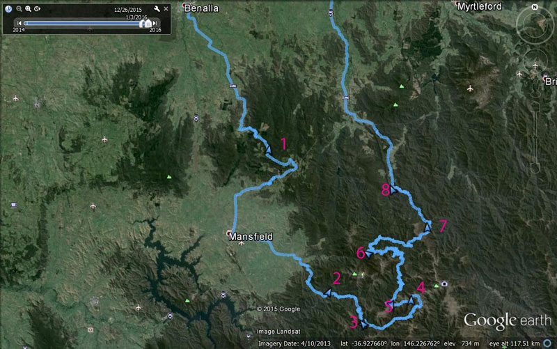 |
Our route as recorded by our tablet using OziExplorer and uploaded to Google Earth
The night camps are where the blue triangle is located next to each number:
1 = Stringybark Creek, 2 = Pickerings Flat, 3 = Upper Jamieson Hut, 4 = Lovicks Hut, 5 = Bluff Hut, 6 = Razorback Hut, 7 - Cobbler Lake, 8 = Bennies |
Day 1 - Saturday 26 December 2015 (Boxing Day) - Sydney to Stringybark Creek
Weather: 16ºC and fine with some high overcast
We leave home at 6:50 am and head via the Princes Highway to Bulli Tops and then across to the Hume Highway via Appin Road. This is much shorter than going via the M5, but only saves about five minutes or so. We have a great run as there is little traffic on any of the roads.
Our plan for this trip is to visit a few places we have never been to in the first few days of the trip and then visit places we all have been to before. For these, we will camp at huts that we stopped at on these trips, but never camped at. We will then go to some spots Kelly and I have been to but Ron and Donna have not. Our first night will be spent at Stringybark Creek in Toombullup State Forest. This is a camping reserve.
Stringybark Creek is where Ned Kelly and the Kelly Gang ambushed four Victorian policemen and killed three of them in a shootout. This is what made Kelly a real outlaw in the eyes of the police. We have visited most of the iconic Kelly locations in New South Wales and Victoria, and this is the last one we need to go to. Kelly is named after Ned Kelly as when she was born, the room her Mum was in had a painting of Ned Kelly on the wall, and as she was expected to be a boy, her parents had not picked out any girl names.
We arrive at the Mundanon Rest Area at 9:35 am. This is where we usually stop when heading south as it is the pefect distance from Sydney. We have covered the 247 kilometres in 2:45 hours at an average of 90 km/h. We have a cup of tea from the free Driver Reviver before leaving at 9:55 am with Kelly driving.
As we leave, the rain clouds start forming. From around Jugiong the rain starts and does not ease till near the Adelong turn off. At times it is quite heavy and this slows us down a bit. At 12:30 pm we stop at the Blue Metal Rest Area, 257 kilometres along the highway, averaging 100 km/h. This is quite nice and we have lunch here.
We head off again at 12:50 pm and I am driving once again. As we pass Albury and cross the Murray River into Victoria, the rain finally stops, but it becomes very windy. At 2:30 pm we stop for fuel in Benalla. To get to Stringybark Creek, we have to leave the highway before the town and travel via Benalla anyway, so we are not going out of our way. We refuel, taking just over 100 litres of petrol for the 662 kilometres at an average of 15 litres per 100 kilometres.
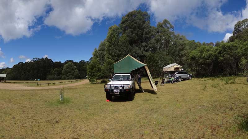 |
| Our Prado with Ron's behind us at the Stringybark Creek Camping Area |
We leave at 2:37 pm and take the road to Tatong. It is a good tar road for most of the trip, but becomes dirt and quite windy towards the end. We arrive at the camping area at 3:25 pm. Ron and Donna have arrived about 90 minutes ago and picked out a spot. This is a very good and large camping area with nice grass cover. There are two lots of toilets, many firepits and tables and two undercover tables. It is quite cold, 12ºC.
We are in a spot with a firepit and table. We also put out our rear awning as the sky looks like we might get some more rain.
 |
| This is the Stringybark Creek site where the Kelly Gang ambushed the four Victorian policemen |
Once we have got everything set up, we go for a walk to Stringybark Creek itself. This is only a short walk away. We first go to the spot where Ned Kelly ambushed the police. There are some great interpretation signs here and at other spots nearby. Kelly attacked the police in October 1878 as he thought they were searching for him with the aim of killing him (rather than arresting him) after he injured a policeman (possibly for making sexual approaches to his sister). He was charged with attempted murder for this, but it is still unclear really what happened or even if Ned was present.
After this the Kelly Gang were chased across Victoria and New South Wales till they were taken into custody in the infamous shootout at the Glenrowan Hotel in June 1880. He was hanged in Melbourne on 11 November 1880, uttering the famous last words "such is life".
 |  |
Kelly with the Kelly Tree, notice
the metal armour inside the tree | A plaque commemorating the Victorian policemen |
We visit the shooting site and then walk to the Kelly Tree. This tree has a carving and metal Kelly outfit on its trunk. This is now very overgrown by the tree bark. This tree is relatively new, this was done in 1985, but there have been commemoration trees here for over 100 years.
We then walk back to the camping area. Ron tried to have a shower using his hot water shower in the Prado, but the pump does not work. We cannot find what is the problem so he and Donna use our hot shower. After this we have sundowners. As soon as the sun drops low in the sky (it does not set till after 8:30 pm) the temperature drops to 6ºC. We have the fire going already.
 | 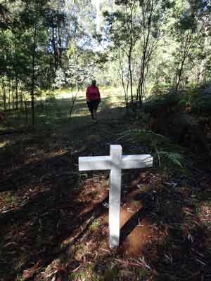 |
| Our campsite at Stringybark Creek | Not sure if this is a grave, there
is nothing to indicate what it is |
Kelly and I have a dinner of reheated veal schnitzels (from Christmas Eve dinner) with salads. After this we again sit around the fire and talk. We end up going to bed at 10:00 pm.
Once in bed, we discover that we have had a leak. Last week I had to replace the bungy cord that holds the cover down when we are driving. Unfortunately, I got a size a little too small (it was hard to tell what we had before as it had lost its elasticity and was much thinner than before). The new stuff has not held the cover totally closed and water has worked its way under and into the rear passenger side of the bed. This means I have to sleep with my feet well over Kelly's side.
Weather: Raining for a lot, max of 20ºC Arrived: Stringybark Creek Camping Area Time: 3:25 pm Distance: 774 kilometres
Day 2 - Sunday 27 December 2016 - Stringybark Creek to Pickerings Camping Area, Howqua Hills Historic Site
Weather: minimum of 3.1ºC and fine
It was very cold last night, the cool southerly wind really got the temperature down. It was only 3.1ºC but we were warm (so long as I did not put my feet near the wet part of the bed). After listening to the ABC Radio News at 7:45 am, I got up at 8:15 am but Kelly was a bit later. It is a nice sunny morning as we have breakfast. Even at 9:30 am it is only 8ºC.
We pack up camp and at 10:00 am we leave and drive back a short distance on the road we came in on to find a sign-posted historic grave. It is only a couple of minutes drive to the location. The grave is of Emma Heller who died here in 1889 aged 42 and was buried near her homestead. She is said to be the only white person buried in the area outside a cemetery. Her story is told in an accompanying sign, very sad really, two of her husbands died and the third one was left with 12 children, some were his and the rest from previous husbands.
 |  |
| Emma Heller's grave near Stringybark Creek | Parked in the main street of Mansfield |
We leave at 10:30 am and drive via Tolmie to Mansfield where we arrive at 11:10 am (42 kilometres). The town is very busy for a Sunday, probably lots of people on day trips from Melbourne as well as many campers like us. The main street is full of four wheel drives loaded to the hilt. We stop and get some fresh bread and a few other things. We head off at 11:50 am.
We drive out of Mansfield towards Mount Buller skifield. This is a tar road and about 20 kilometres out we turn right onto the dirt Howqua Track. This is a good two wheel drive road, but care needs to be taken if you are in a normal car as there are a couple of rougher spots and also it is steep and winding in parts.
It is another 17 or so kilometres to the first of the many camping areas along the Howqua River. As you drop over 440 metres from the 870 metre high Timbertop Saddle to the river, it is a beautiful drive. On the approach to the river there are a lot of huts, it looks like they are owned by various clubs. The river is crossed at Sheepyard Flats where there is a huge camping area. There are numerous camping areas along the river here, some to the right and most to the left.
 |  |
| Pickerings Flat Camping Area | Pickerings Flat Camping Area, the river is behind us |
Sheepyard Flat is pretty crowded, but we drive into two sections to have a look. There are dozens of four wheel drives as well as lots of two wheel drives. There are also many large caravans. We decide to head to the next camping area, Davons Flat. This is smaller but even more crowded. We go onto Pickerings Flat which is only just over a kilometre up the river from Sheepyard.
We head in and go towards Pickerings Hut (which despite being in an historic site - public land - is privately owned) and just past it we see a couple in a Pajero in a really nice camping spot. I think that they may be packing up so Kelly asks if they are going. Yes!
We pull in nearby and chat with them as they finish packing away their rooftop tent. Once they have left, we pick out spots for ourselves. This is a nice spot, the nearest campers are the other side of some trees and bushes. We are right on the river, although it is very shallow here.
 | 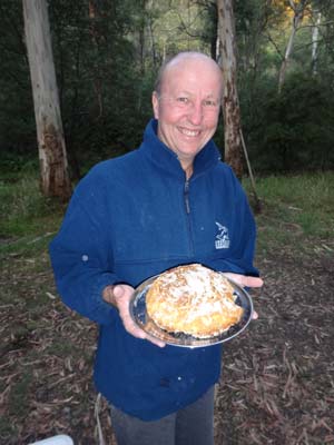 |
| The Howqua River at Pickerings Flat | Ron with his apple damper |
It is 1:10 pm by the time we can move into our camping spots and we then have lunch. We have a firepit and there is a toilet close by. It is nice and sunny and after lunch I sit and read for a while. A huge bull ant bites me on the bottom of my foot, damn, it hurts for about 10 minutes. I have a swim in the river, well really a lie down in the shallows. The water is quite warm, about 22ºC according to my thermometer.
Later Kelly and I go for a walk around the camping area. There is a group with an old wood stove cooking something inside. It rests on two old chairs! Despite the number of people here, it is not too crowded overall. After we come back, Kelly, Ron and Donna go for a swim. After another read, I set up the shower and have a nice hot shower using a full 10 litres of water. Great! The others then have a shower as well.
Kelly cooks a dinner of creamy garlic prawns and I cook rice to go with it. Ron cooks an apple damper which we have for dessert. After dinner we sit around the fire and look for satellites and shooting stars. We see 10 satellites and 3 shooting stars, not bad considering we can only see a small section of the sky. We go to bed at 10:20 pm.
Weather: Sunny, max of 20ºC Arrived: Pickerings Flat Camping Area Time: 12:45 pm Distance: 83 kilometres
Day 3 - Monday 28 December 2016 - Pickerings Camping Area to Upper Jamieson Hut, Jamieson State Forest
Weather: minimum of 7.9ºC and fine
Last night was a lot warmer than the night before. We get up at 8:00 am and have breakfast, using some left over Turkish bread to make a really nice toast. It is sunny and 9ºC. We pack up and leave at 9:55 am. For most days of this trip (apart from the first and last), we only have short distances to travel, so we are having very relaxed starting times.
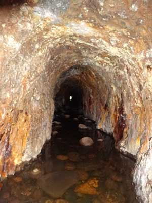
We continue along Howqua Track and pass two more camping areas, Noonans Flat and Tunnel Spur Flat. They are much more crowded per square metre than the three we have passed already. We stop at Tunnel Bend which is 2.2 kilometres along. There is a parking area on the bend and down a short set of stairs to the river where there is a 100 metre long tunnel.
 |  |
| Looking down at where the tunnel starts | The long section of the tunnel, you can see the exit |
The tunnel was built through solid rock in 1884 as a link between the Howqua River and a four kilometre hand cut water race to a waterwheel at Sheepyard Flat. Apparently the remains of the water race can be seen above the road between Tunnel Bend and Sheepyard Flat. The water was used to power the "Hanney" waterwheel which was 63 feet (18 metres) in diameter and drove the crushers which broke gold ore into a suitable size for smelting in a furnace.
The tunnel comes off the side of the river and goes in a few metres before turning 90º to the left and running under the road. If you go inside, you can see the other end. You probably could walk through it with suitable shoes and a torch. This is the best gold mining river diversion I have seen (there are plenty around NSW and Victoria.
 | 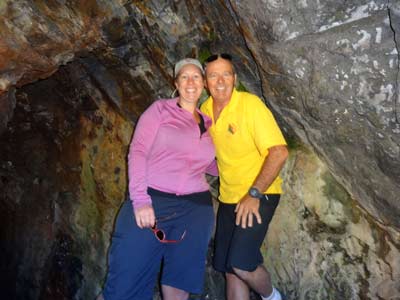 |
| Ron outside the entrance to the tunnel | Kelly and me inside the tunnel |
We are back on the road after a 20 minute stop. A bit further on we go into 8 Mile Camping Area for a look, very nice and less crowded from memory. At 11:20 am we stop to cut some timber for tonight. This takes 10 minutes.
Jamieson Hut is on the Jamieson River in Jamison State Forest. The descent down from Brocks Road is very steep and the 350 metre section requires low range. Here we have to cross the Jamieson River. It is quite shallow as the river is not running strongly. I have seen a video on Youtube where someone tried to drive across in a raging current. They only just made it to the other side after a lot of effort. Very silly!
 |  |
| Ron crossing the Jamieson River | Our campsite at Upper Jamieson Hut |
It is another 500 metres to the hut and the camping area. This is a very nice spot, with four separate spots to camp, all near the hut. Unfortunately there is no toilet, a pity as it means there is probably a lot of shit all over the place. Anyway, we end up getting a spot between the hut and the river. We have a firepit and a table. Surely a toilet should be a higher priority than a table.
We have a cup of tea and then set up camp. We also put up our small fly-proof cabana as there are lots of flies around, including huge March flies. We sit inside and read for a while and then have lunch. After lunch we have a few swims in the river, there are a couple of spots where you can lie down, sort of like in a spa. The water is again not too cold, 20ºC.
 |  |
| Upper Jamieson Hut | Kelly inside Upper Jamieson Hut |
We spend the rest of the afternoon in the cabana, reading books and some 4WD magazines Ron has brought along. At 4:00 pm we take a beer down to the river and sit on rocks with our feet in the water. Very nice. We put the fire on at 4:30 pm as we are cooking pork spare ribs with smoky barbecue sauce in the camp oven. We have never cooked this before on a trip, so it is all experimental. We plan to cook it very slowly.
We have some nibblies and more drinks as dinner cooks. We put it on at 5:30 pm and cook for about 70 minutes. It is very tender and the meat falls off the bones as we eat it. A success! After this I make some scones (using Lauckes Scone Mix which requires only water to be added). Very easy and one pack (two in the carton) made 13 scones. I added some sultanas to the mix. We have a hot one each with butter for dessert. Another success.
 | 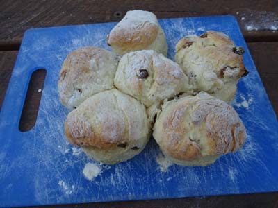 |
| The Jamieson River next to our camp site | Some of the scones I made |
We spend the rest of the evening around the fire and spot 22 satellites and 4 shooting stars. One of the satellites was probably the European Space Station as it was extremely bright, much brighter than any we have seen before. We go to bed at 10:45 pm.
Weather: Sunny, max of 24ºC Arrived: Upper Jamieson Hut Time: 11:40 am Distance: 28 kilometres
Day 4 - Tuesday 29 December 2016 - Upper Jamieson Hut to Lovicks Hut, Alpine National Park
Weather: minimum of 6.1ºC and fine
It was cool again overnight but nice and sunny when I get up at 8:15 am. We have breakfast and pack up. Once again we do not have far to travel, only 35 or so kilometres, most of it on reasonably good tracks. We leave at 9:45 am and cross the Jamieson River again and climb steeply back towards Brocks Road.
Once on the road we turn right and follow this to the east and north. This is still a good two wheel drive dirt road. Only 10 minutes along we see the first of a few nice camping areas. I have not been able to find much information at all about them, but they appear to be in state forest and specifically for fishers. We only see people at the first camping area.
 |  |
Ron inching his way through the gap
in the fallen tree at the Jamieson River crossing | The camping area at the intersection of Brocks Road,
King Billy Track and Bluff Track |
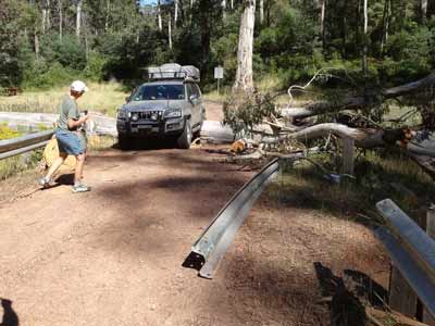
Five kilometres from Upper Jamieson Hut we come to a large two part camping area at a spot where the road crosses the Jamieson River. These are great spots. A huge tree has fallen and gone right across the road and damaged part of the Armco railing on the sides of the road approaching the bridge. Whoever has cut the tree has only left a gap just wider than a normal 4WD, so it is a tight squeeze to get through.
Our guidebook as well as our tablet based maps show Brocks Road continuing on the western side of the river, but in reality it is on the eastern side. I later looked up GoogleMaps and can see no trace of an old road on the western side, so it must have been a long time ago if it was actually ever there. The road is first and second
gear high range all the way from here.
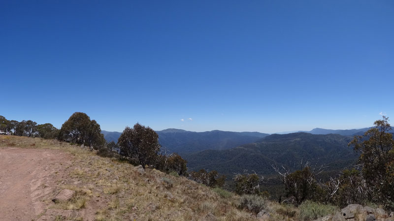 |
| A panoramic photograph of the valley to the north of Bluff Track, taken just to the west of Picture Point |
At 10:30 am we stop for a while and cut some timber for tonight's fire. We fill a big bag in our car as well as two smaller ones on Ron's roof. We are back underway 20 minutes later. At 11:30 am we arrive at the intersection of Brocks Road, King Billy Track and Bluff Track. This has a nice wooded area and would make a good camping area if needed. The King Billy Track leads to the Macalister Valley and then to Howitt Plain. We went that way last time we were here on Christmas Day 2012.
We stop here for morning tea and soon a few other 4WDs stop as well. They have come along Bluff Road. After a morning tea of the scones I made last night, at 11:55 am we head down Bluff Track. Straight away we notice that it is a lot rougher than three years ago. This is nearly all low range second and third gear, with some first gear as well. The view along here is extremely nice, not necessarily of the mountains, but the trees overhanging the road. Kelly says this is her most favourite 4WD track in Australia.
 |  |
| Having lunch at Picture Point | Lovicks Hut Camping Area |
We pass the Picture Point lookout as there is little space to park. There are lots of other 4WDs coming towards us as well as from behind. I stop at one place to let a few go pass as they are travelling quicker than us. At 12:30 pm we stop to the west of Picture Point at a much better spot. This is quite large and you can even camp here (there are some cars and tents but no people - must be out walking). We take a few photos, the view is excellent (see above) across to Mount Buller and Mount Stirling. We decide to have lunch here.
We leave at 1:10 pm and continue to Lovicks Hut, arriving there at 1:20 pm. It has taken us 45 minutes (actual driving time) to travel the 5 kilometres from Brocks Road, an average of 7 km/h. As we come in, a large group is about to head the way we have come. They ask us what it is like (they have a few camper trailers) and I tell them how long it has taken us. They take a long time to decide what to do, but eventually continue on.
 |  |
| Lovicks Hut | Inside Lovicks Hut |
We go to our preferred spot which is on the other side of the road from Lovicks Hut under some nice gum trees. This is next to the old horseyards, but there is little evidence of recent use. This spot has a very nice grassy base and is close to the toilets which are behind the hut. We set up camp and unload our timber. Ron and I both have to sharpen and refuel our chainsaws which we do during the afternoon.
It is quite high here, 1476 metres according to my GPS. Over the course of the afternoon, dozens of cars come in. Most leave, even ones who get there well after 5:00 pm. Not sure where they were heading to, but it would take at least three hours to get to any recognised camping site (there are of course others as mentioned before). We end up with three close neighbours in one group (who I borrow an iPhone cable from as I left mine at home), a car below us, another near the hut and three more behind the hut. These last idiots later cut down a tree, what there was not enough fallen timber for them to use!
 |  |
Me and Ron with our chainsaws and the timber we cut this morning
(and no, Ron did not cut the pile in front of him!) | One of the old fences of the horseyard at Lovicks Hut |
There are lots of flies here as well so we put the fly cabanas up and sit in them reading. We later go over and look at the hut again. When we first came here in 2007, there was only few vertical poles and cross members. This was because the owner (again, how can someone own it?) pulled it down some years before as it was falling down. In 2012 it was almost complete. We start the fire at 3:40 pm as we need coals as we are cooking a roast rack of lamb and vegies. I set up the shower which we all use and then have sundowners.
The vegies go in the camp oven first and 40 minutes later Kelly puts in the rack of lamb. Another 30 minutes sees it all cooked. The lamb was excellent, the first time we have cooked this sort of meat.
After dinner we again watch the stars as we sit around the fire. We see 14 satellites and 2 shooting stars in the very small section of sky visible to us. We go to bed at 10:40 pm.
Weather: Sunny, max of 22ºC Arrived: Lovicks Hut Time: 1:20 pm Distance: 30 kilometres
Day 5 - Wednesday 30 December 2016 - Lovicks Hut to Bluff Hut, Alpine National Park
Weather: minimum of 13.4ºC and fine
Well, it was very warm overnight considering we are at almost 1500 metres. Amazing. There is no wind at all when we get up but it picks up a bit later during the day. There is a total fire ban today in almost all of Victoria due to the high temperature and strong winds, but in this area there is none. We have breakfast and leave at 9:40 am. We are only going to Bluff Hut which is 7 kilometres down the track.
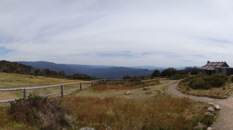
Again, the track is very rough apart from the last kilometre which has been recently graded. This is from the lookout area above the hut. We stop at the highest point which is just past Mount Lovick at 1650 metres. This has a large clear area and there are excellent views, almost 360º. Back a few hundred metres is a relatively protected camping area down a short track.
 |
| A panoramic photograph looking west and north from Bluff Track near Mount Lovick. Mount Buller to left and Mount Stirling in middle |
We stop here for 15 minutes taking photographs. Again you can see out to Mount Buller and Mount Stirling. As with Bluff and Lovicks Huts, you get full mobile phone and data coverage from the towers on Mount Buller (for the skifield). Once back on our way, it is only five minutes down to Bluff Hut.
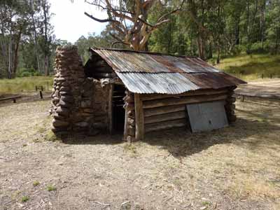
We arrive at Bluff Hut at 10:35 am, taking 40 minutes (driving) to cover the almost 7 kilometres, an average of 10 km/h. There is no-one there when we arrive, so we park on the eastern side of the hut (away from the road) and pick out our camping spots. There is not much room for rooftop tents to camp, only space here for perhaps three cars. You could also set up near the road but you may get a lot of dust from the cars that pass through without stopping.
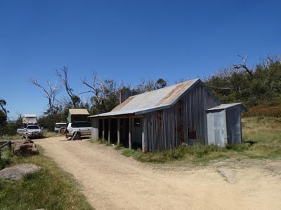 |  |
| Bluff Hut from Bluff Track | Three baby swallows in a nest under the verandah |
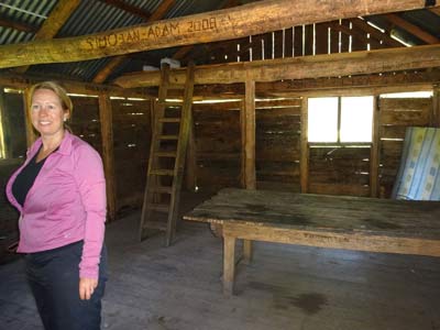
We set up our chairs on the dirt verandah as there are not that many flies here. We set up some things inside the hut for lunch and dinner and have morning tea. We sit and read and many cars stop over the next six hours. Some stay for lunch, others have a cuppa. We chat to a lot (some are not that friendly) and learn some things we did not know (eg about Lovicks Hut being pulled down rather than burning down like we thought).
After lunch, Ron and I go for a walk while Kelly and Donna have nanna-naps. You would think we were getting up very early each morning! It is an easy walk to a spot between Bluff Hut and The Bluff. This has a vertical drop of 100 metres or so but gives great views to the north and west. Later we walk to the small dam below and behind the hut (probably for helicopter use in fires).
This whole area was burnt in a huge bushfire in 2006-7. Bluff Hut was burnt to the ground and the majority of the trees killed by the fire. In the nine years since then it has recovered quite well. The dead trees are actually quite beautiful in their own way.
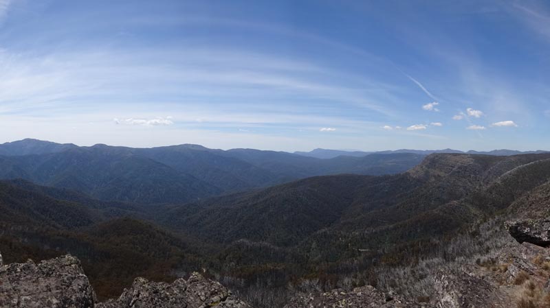 |
| A panoramic photograph looking west and north from below The Bluff. Mount Buller and Mount Stirling in middle, Square Head Jinny is the feature to the right. |
We have been seeing a couple of swallows coming into the hut and also into the corner of the verandah. When I look, I find three baby swallows in the nest. The parents have been collecting insects and feeding them. The babies are very quiet, no squarking at all.
We have decided to stay mostly inside tonight, cooking and eating there (a very nice table with long seats) and sitting in front of the fireplace. We take enought timber inside for a small fire. Ron and Donna have showers and then we have sundowners outside.
 | 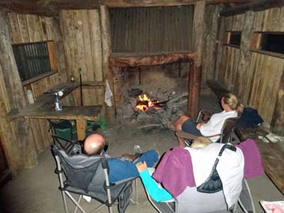 |
| Sunset and dead trees above Bluff Hut | Inside Bluff Hut at night with a nice fire going |
When the temperature drops a bit (it has been 26ºC or so for most of the day), we move inside and later Kelly cooks a choritzo pasta. It is now quite cloudy so there is no point going outside to look for satellites and shooting stars (if clear it would have been perfect with almost 100% of the sky visible).
After dinner we sit in front of the fire and have a few wines and beers. I am really glad we stopped here tonight, it has been very enjoyable.
Weather: Sunny, max of 26ºC Arrived: Bluff Hut Time: 10:35 am Distance: 7 kilometres
Day 6 - Thursday 31 December 2016 - Bluff Hut, Alpine National Park to Razorback Hut, Mount Stirling Ski Area
Weather: minimum of 12.0ºC and fine
Last night was again quite warm considering we were at 1475 metres. By the time I get up at 8:15 am it is 18ºC and rising. Today is again forecast to be very warm across a lot of Victoria, but thankfully there is no fire ban today here (and most of the state). We have breakfast and leave at 9:35 am.
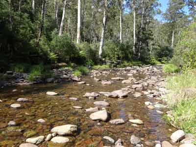
We were originally going to go straight to our destination, Razorback Hut, but Ron and Donna want to visit Craigs Hut again. We arrive at Upper Howqua at 10:20 am where we fill our water containers which are empty (used for showers). It only takes five minutes to fill them out of the Howqua River at the causeway. We go to Bindaree Hut which is only two kilometres away so not too far out of the way.
There is only one other car here and we have had reports over the past few days that it has been pretty empty all the time. I have no idea why as it is a very good camping area right on the river. We leave after 10 minutes and start the climb to the Circuit Road which goes around the Mount Stirling skifield. We arrive at Craigs Hut at 11:25 am, having taken 95 minutes to cover the 40 kilometres (25 km/h). It is a good dirt road from Bindaree Hut area apart from the short section up Clear Hills Trail from Circuit Road. This section requires a minimum of an all wheel drive.
 |  |
| Bindaree Hut | Razorback Hut at left and the accommodation at right |
Craigs Hut was originally built for the 1983 movie "The Man from Snowy River". It was then just a film set, but later was built as a complete hut. This burnt down in the 2006/7 bushfires and rebuilt later in 2007/8. There is a huge crowd here, including a tag-along 4WD tour as well as people setting up tables and chairs for lunch for people on a horse riding tour.
We stop and have morning tea and then look around Craigs Hut. We also notice that there is now an established camping area below the hut off the track we came up. This has a firepit and there is a toilet near the hut. Kelly and I leave at 11:55 am and go back down Clear Hills Trail and follow Circuit Road to the west till we come to the track to Razorback Hut. We arrive there at 12:30 pm, 19 kilometres at an average of 33 km/h.
Razorback Hut is used as a base for horseriding treks around Mount Stirling. We check the door of the hut and find that luckily the trek operators are not using the hut and area tonight. They were here last night and will be again tomorrow. These were the people we saw at Craigs Hut this morning. The only person here is a bloke called Paul from near Horsham and his two kids Wade and Olivia. They have a horse truck with three horses and 11 dogs. Paul is a farmer and most of the dogs are his working dogs.
 |
| A panoramic photograph looking north near Craigs Hut. |
We set up the Prado between the hut and the accommodation building, leaving Ron and Donna to pick from a couple of other spots. They arrive about 30 minutes later, having spent more time examining Craigs Hut. Once set up, we take a lot of stuff into the hut as we plan to eat in here tonight. We have lunch and then unload all our timber for our fire (for cooking dinner).
Quite a few cars come in during the afternoon, but most stay more than no more than a few minutes. A couple have lunch or afternoon tea, but overall it is quiet.
At 4:30 pm we start the fire as we need lots of coals for our camp ovens. Just after this I notice that Paul is shouting out for his kids. It is obvious they are not with him and have gone off. I walk over and he tells me that he gave them permission to walk up to the horse yards which are only 75 or 100 metres away. I tell him they did not come our way. Paul heads off on his quad bike but despite running out to the Circuit Road, down the walking track (also to the Circuit Road) and down to a dam, he cannot find them. He is very worried as am I.
 |  |
| Kelly, Donna and Ron with our New Year's Eve dinner | Sparklers for New Year's Eve! |
I go back and get Ron, Donna and Kelly as well as some of our handheld UHF radios. Donna goes up past the horseyard, Kelly and Ron go down the walking track and I head back along the road towards Circuit Road. Paul heads across country, again checking the dam. I am almost back at the road when I see Wade and Olivia. They tell me they walked down the walking track to the Circuit Road and then walked all the way back via it. It is now about 45 minutes since they went missing and probably 30 minutes since I first noticed Paul looking for them.
Paul arrives a minute or two later, having come the way the kids came. He is extremely relieved and the kids are certainly told they have done a bad thing wandering off like they did. I radio Kelly and Ron and they come back and soon after Donna comes back as well. By now it is well after 5:00 pm so I set up the shower and we all have hot showers. The fire died down a bit while we were out searching, so we have to build that back up as well.
After showers, we have sundowners around the fire. Earlier, Kelly started preparing her sticky date puddings and she now does a bit more preparation. We will have these after dinner. Ron is cooking pork and we have a turkey roll. The pork is bigger, so it goes on first. We are eating later, so it does not really matter that we are a bit behind time due to the search.
 | 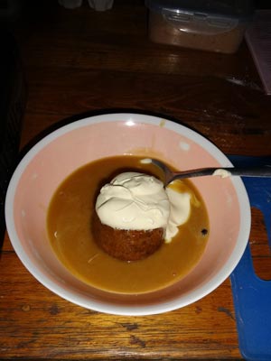 |
The camp oven in front of the fire inside the hut.
It has our sticky date puddings inside cooking. | My sticky date pudding! |
We cook the dinners with roast vegetables in the camp ovens around the outside fire. We have also taken some timber inside so we can have a fire in there later. We set the table inside (there are a couple of large tables with benches) and about 8:00 pm we have dinner. This is washed down with Chandon sparkling wine. Excellent as always. After washing up, we start the fire inside. It is overcast outside, so decide to sit around the fire. Anyway, we later need to play the World Uno Championships which we will do inside.
Kelly later puts the sticky date puddings on to cook. They go inside the camp oven. We have them about 10:30 pm with double thick cream. Once again, perfect. As midnight approaches, we play Uno. We have done this every New Year's Eve for the past 10 or so years. We also drink good Australian sparkling wine and even a bottle of French champagne. This time Donna is the winner.
We go to bed about 1:00 am or so.
Weather: Sunny, max of 24ºC Arrived: Razorback Hut Time: 12:30 pm Distance: 59 kilometres
Day 7 - Friday 1 January 2016 - Razorback Hut, Mount Stirling Ski Area to Cobbler Lake, Alpine National Park
Weather: minimum of 17.9ºC and cloudy
Well, it was very warm overnight considering we are at almost 1400 metres. We get up at 9:00 am, relatively early considering the time we went to bed. Kelly cooks bacon and eggs for breakfast. We also discover that the second lot of sticky date puddings that Kelly made last night and inadvertantly left on the table in the hut are missing. We at first think some rats must have taken them but later conclude that Paul's dogs might have got them.
We tidy up the hut and leave at 10:55 am. We need to be gone soon as we suspect that the horse rider operator will arrive soon and want access to the hut. We are proved correct in this as we pass them as we head back down the first section of the Circuit Road. We go to Pineapple Flat which is on the King River. We have been there before but Ron and Donna have not. We cross the river into the camping area. There are not many people there considering the size of the area. It has taken 40 minutes to travel the 14 kilometres (we were stuck behind two slow cars for a while).
 |  |
| A section of the camping area on the King River | The King River near this camping area |
After looking around, especially at the excellent waterhole near the river crossing, we go back across the river and then head along King Track. We cross a creek and a bit later on, come to a track off to the left. Despite Kelly and I coming along here a few times before, we have never noticed this. We go down and have a look. This is a nice camping area, in three or four sections right on the river. The western (left) section is the best. We stop and have a swim. This spot is 5 kilometres from Pineapple Flat and 6 kilometres from King Hut.
We are here for about 25 minutes. As we leave we see some great cut timber, so we collect a lot of it. Thanks to whoever left it behind. We cross the King River multiple times and arrive at King Hut at 1:00 pm. There are a couple of other camping areas along the river.
 |  |
| King Hut | Another photo of King Hut |
We again stop at the hut so Ron and Donna can check it out. The grass is a lot shorter than three years ago and there is less cow shit. We leave at 1:20 pm.
 |
| Coming down the staircase in 2007 |
We are heading for Cobbler Lake. There are two ways to get there from here, one goes via the harder Speculation Road and Cobbler Lake Track and the other via Little Cobbler Track and Cobble Lake Road. We go the first way. This is not too hard, but there is one section called "The Staircase" which is about 50 to 75 metres long and involves a few rock steps.
We found this easier than when we last did it in 2007. This time we were going up "The Staircase". The whole track is fairly rough, but we average a reasonable speed. We arrive at Cobbler Lake at 2:15 pm, having taken 55 minutes to cover the 14 kilometres, 15.3 km/h.
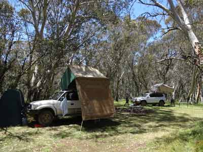
There are not a great deal of good spots to camp here. The best one is right up past the hut, but there is already a family setting up here. The next best is down on the lake's edge just south of the hut. We pick out two spots and set up our rooftop tents.
There are quite a few people here, none of whom appear to be staying. They are mostly in the lake swimming. We have lunch and set up our fly-proof cabanas. We sit and read for the rest of the afternoon. Lots of cars come in, but most go. Only a few stay the night, three cars near the hut and two back down the road a little.
Ron, Donna and I go for a walk to the waterfall. There is very little water in the creeks, so the waterfall only has a trickle going over it. We are, of course, at the top of the waterfall. Once back at the camp, we read some more. I later go for a swim in the lake. There is a nice little beach and access through the reeds. The water is very tea coloured. It is not too cold, but I would imagine out a bit it is a lot colder down deeper.
We decide to have dinner later tonight since we had a late breakfast and a late lunch. There is the hint of rain around tonight, so we put away the fly cabana as the flies have seemingly lessened. Kelly and I are having T-bone steaks and sausages with a pasta dish. I pull out the barbecue and collect some small pieces of timber for it.
The barbecue is a Bidjii which runs better with small twigs and leaves. We have also started a fire to sit around. After sundowners, I get the fire going for the Bidjii. I soon cook our steaks and sausages.
 |
| Camped by the edge of Cobbbler Lake |
We sit around the fire and have dinner. The flies that disappeared earlier have come back with a vengence. We should have kept the cabana up! After dinner we sit around the fire and go to bed early at 9:30 pm.
Weather: Overcast, max of 28ºC Arrived: Cobbler Lake Time: 2:15 pm Distance: 39 kilometres
Day 8 - Saturday 2 January 2016 - Cobbler Lake to Bennies Camping Area, Alpine National Park
Weather: minimum of 14.0ºC and fine
We get up at 9:00 am and it is windy and overcast. Again, fairly warm considering we are at 1100 metres. We have breakfast and leave at 9:55 am.
We do not have far to go today and it is a good road, really 2WD with care. We quickly stop to look back at the three waterfalls, but there is little water to see. We turn off Cobbler Lake Track onto Cobbler Lake Road. We arrive at Bennies Camping Area at 10:45 am, 23 kilometres (28 km/h).
 |
| Bennies Camping Area - Rose River is behind our cars |
There are three separate sections to the Bennies Camping Area. We look at them all and decide to stop at the middle section. This is sort of in two parts. We set up camp next to the Rose River. However, there is no water running in it at all, unlike when Kelly and I were here last time.
Ron goes for a walk along the river and later reports that the only spot with any water is back near the first section (where we camped last time). We read and relax. After lunch, we walk down to the waterhole and go for a swim, very nice. There is actually a little bit of flowing water here, there is either a creek coming in somewhere or the water is running under the rocky base where we are camped.
From about 2:00 pm there are very dark clouds to the south and south-west. Later there is a lot of thunder. At 3:30 pm it starts to rain, very heavily. We have to shelter under our roof-top tents. It rains solidly for about 35 minutes before easing off. It drizzles a bit for another two hours.
 | 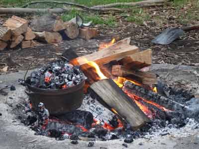 |
| Me stoking the fire at Bennies | A closeup of the camp oven heating on the fire |
Once the rain stops, we light the fire as we need coals for our dinner. We are making pizzas, so need heat and coals. I make the pizza dough (use my search facility - "Pizza in the Bush" to find how) and let it rise a little.
I also set up the shower for hot showers, it is now quite cool due to the rain. Once we have all had a shower, I have a beer as I split the dough into five pieces and roll out with a Coke can. We will have a cheesy garlic pizza to share and one each. I make my pizza and the garlic one.
Once the fire is going good, I put the camp oven onto heat up. I should have left for 30 minutes to get it ready, but I did not leave it long enough. As such, the first ones took a bit longer than normal. After cooking the garlic one, I do Donna's, Ron's and then Kelly's before doing my own. Mine only takes five minutes compared to Donna's ten minutes.
 |  |
| Kelly's pizza | Me and the remains of my pizza |
These pizzas are the best you will ever eat, far better than the most expensive pizza you will find in a big city. We make pizzas now on nearly every trip.
After dinner we sit around the fire and go to bed at 10:30 pm.
Weather: Overcast, max of 22ºC Arrived: Bennies Camping Area Time: 10:45 am Distance: 39 kilometres
Day 9 - Sunday 3 January 2016 - Bennies Camping Area, Alpine National Park to Sydney
Weather: minimum of 16.0ºC and overcast
We get up at 6:30 am and quickly pack up. After a cup of tea, we depart at 7:30 am and head towards Wangaratta. We get there at 8:40 am and go to a petrol station as I cannot get back to Sydney without refuelling. We also get some breakfast from the petrol station and Maccas. We leave at 9:05 am and almost 150 kilometres on stop at 10:35 at Milton Reef Rest Area.
After a tea break, Kelly takes over driving. We stop next at Jugiong at 12:15 pm (150 kilometres) for lunch. We leave 25 minutes later and make one more stop for a toilet break. We arrive back home at Kareela (Sydney) at 4:20 pm. This is another 331 kilometres.
Weather: Sunny, max of 26ºC Arrived: Kareela Time: 4:20 pm Distance: 711 kilometres
SUMMARY:
Once again we had a fantastic trip which cost us only the food we ate, the grog we drank and the fuel we used. We still have some more of the Victorian High Country to do, we are not sure when we might be able to do those sections, but hopefully in the next few years we will find the time. |  v6.00.307 © 2003-2005

